Near Plains in Sanders County, Montana — The American West (Mountains)
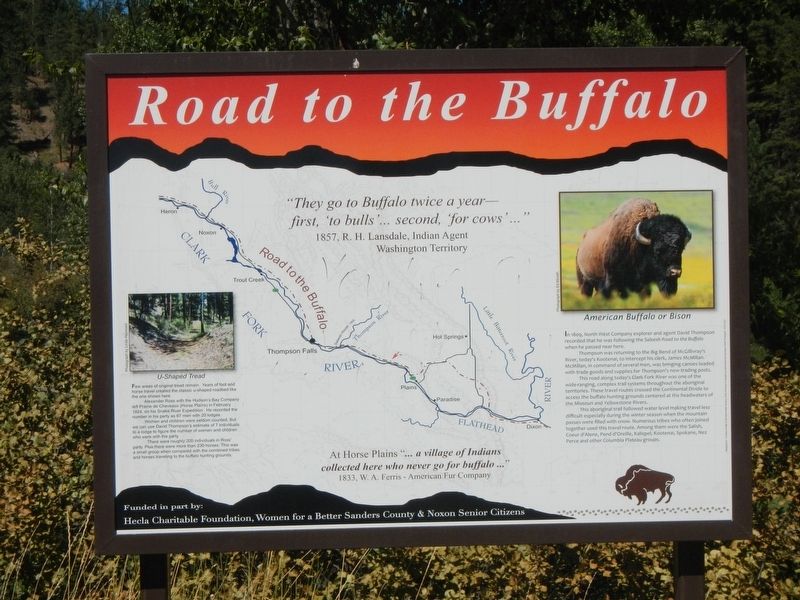
Road to the Buffalo
At Horse Plains "... a village of Indians collected here who never go for buffalo ..." 1833, W.A. Ferris - American Fur Company
U-Shaped Tread
Few areas of original tread remain. Years of foot and horse travel created the classic u-shaped roadbed like the one shown here.
Alexander Ross with the Hudson's Bay Company left Prairie de Cheveaux (Horse Plains) in February 1824, on his Snake River Expedition. He recorded the number in his party as 67 men with 20 lodges.
Women and children were seldom counted. But we can use David Thompson's estimate of 7 individuals to a lodge to figure the number of women and children who were with the party.
There were roughly 200 individuals in Ross' party. Plus there were more than 230 horses. This was a small group when compared with the combined tribes and hoses traveling to the buffalo hunting grounds.
(Photo on right)
American Buffalo or Bison
In 1809, North West Company explorer and agent David Thompson recorded that he was following the Saleesh Road to the Buffalo when he passed near here.
Thompson was returning to the Big Bend of McGillivray's River, today's Kootenai, to intercept his clerk, James McMillan. McMillan, in command of several men, was bring canoes loaded with trade goods and supplies for Thompson's new trading posts.
This road along today's Clark Fork River was one of the wide-ranging, complex trail systems throughout the aboriginal territories. These routes crossed the Continental Divide to access the buffalo hunting grounds centered at the headwaters of the Missouri and Yellowstone Rivers.
This aboriginal trail followed water level making travel less difficult especially during the winter season when the mountain passes were filled with snow. Numerous tribes who often joined together used this travel route. Among them were the Salish, Couer d'Alene, Pend d'Oreille, Kalispel, Kootenai, Spokane, Nez Perce and other Columbian Plateau groups.
Erected by Hecla Charitable Foundation, Noxon Senior Citizens.
Topics. This historical marker is listed in these topic lists: Native Americans • Roads & Vehicles. A significant historical month for this entry is February 1824.
Location. 47° 31.527′ N, 115° 0.252′ W. Marker is near Plains, Montana, in Sanders County. Marker is on State Highway 200 at milepost 67 near Old Hicks Road, on the right when traveling west. Touch for map. Marker is in this post office area: Plains MT 59859, United States of America. Touch for directions.
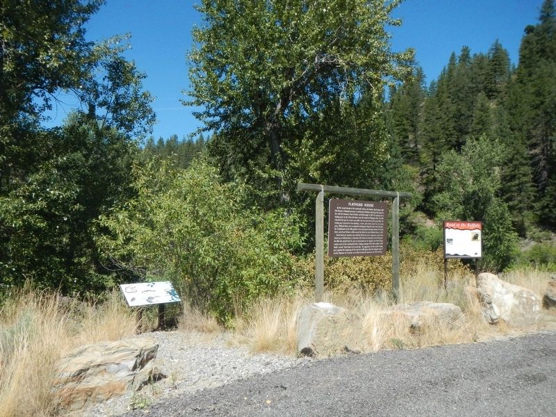
Other nearby markers. At least 6 other markers are within 9 miles of this marker, measured as the crow flies. Sanctuary for Wetland Wildlife (here, next to this marker); Flathead House (here, next to this marker); Wild Horse Plains (approx. 7.6 miles away); Pend d'Oreille Hunting Grounds (approx. 8.6 miles away); Mountain (Bighorn) Sheep (approx. 8.6 miles away); Bad Rock Trail (approx. 8.6 miles away).
Credits. This page was last revised on March 31, 2023. It was originally submitted on March 31, 2023, by Barry Swackhamer of Brentwood, California. This page has been viewed 76 times since then and 20 times this year. Photos: 1, 2. submitted on March 31, 2023, by Barry Swackhamer of Brentwood, California.

