Near Fredericksburg in Stafford County, Virginia — The American South (Mid-Atlantic)
Potomac Creek Bridge
"Beanpoles and Cornstalks"
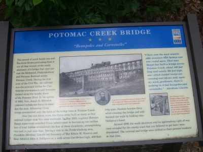
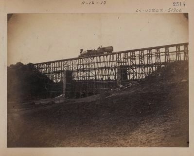
Over the next three years, the Union army built as many as four railroad bridges atop this same abutment. In May 1862, engineer Herman Haupt supervised unskilled Union infantrymen in harvesting two million feet of local lumber to construct the first of these structures, accomplishing this task in just nine days. During a visit to the Fredericksburg area, President Abraham Lincoln led Secretary of War Edwin M. Stanton and Rear Admiral John A. Dahlgren on a walk across the 80-foot-high, 400-foot-long span. Stanton became dizzy while crossing the bridge and only finished the walk by holding onto Dahlgren’s hand.
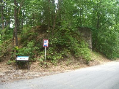
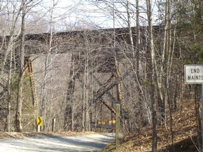
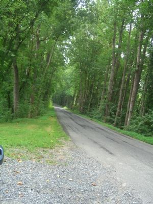
Around 1899, the south abutment and its approaching right-of-way (now occupied by the county road that you followed to get here) were abandoned. The railroad and bridge were shifted to their present locations at that time.
“I have seen the most remarkable structure that human eyes ever rested upon. That man Haupt has built a bridge across Potomac Creek, about 400 feet long and nearly 100 feet high, over which loaded trains are running every hour, and, upon my word, gentlemen, there is nothing in it but beanpoles and cornstalks.” —Abraham Lincoln
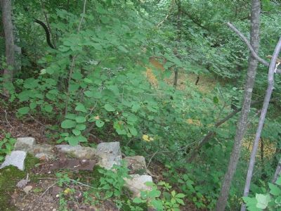
(caption under main picture) The Potomac Creek Bridge (under Union control), ca. February 1863, looking across the creek from a viewpoint located just down the slope in front of you.
(caption to the right of the portrait of Herman Haupt) A genius of innovation, Herman Haupt rebuilt the bridge over Potomac Creek in just nine days utilizing mostly local materials.
(caption to the right of the small bridge picture) The Potomac Creek Bridge in May or June 1863, looking across the creek from a viewpoint atop the abutment beside
you. Note the wartime blockhouse in the center background and the prewar buildings in the right background.
Erected by Virginia Civil War Trails.
Topics and series. This historical marker is listed in these topic lists: Bridges & Viaducts • Man-Made Features • Military • Railroads & Streetcars • War, US Civil. In addition, it is included in the Former U.S. Presidents: #16 Abraham Lincoln, and the Virginia Civil War Trails series lists. A significant historical month for this entry is February 1863.
Location. 38° 21.401′ N, 77° 24.533′ W. Marker is near Fredericksburg, Virginia, in Stafford County. Marker is on Leeland Road, on the left when traveling north. Touch for map. Marker is at or near this postal address: 892 Leeland Rd, Fredericksburg VA 22405, United States of America. Touch for directions.
Other nearby markers. At least 8 other markers are within 3 miles of this marker, measured as the crow flies. Cavalry Review (approx. 1.6 miles away); Lincoln Review (approx. 1.9 miles away); Camp Pitcher (approx. 1.9 miles away); History at Leeland Station (approx. 2.3 miles away); Mt. Hope Baptist Church (approx.
2.3 miles away); Union Battery (approx. 2.4 miles away); German-Americans and the Eleventh Corps (approx. 2.4 miles away); 11th Corps Road (approx. 2.4 miles away). Touch for a list and map of all markers in Fredericksburg.
More about this marker. This marker is subject to periodic removal and replacement. It has been reported missing at least twice in the last six years. The marker was last replaced in early 2008.
Photographed By Andrew J. Russell, circa 1862
7. United States Military Railroad Department. Construction and Transportation.
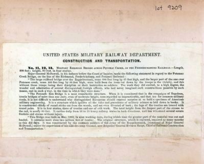
No. 11, 12, 13. Miltary Railroad Bridge Across Potomac Creek, on the Fredericksburg Railroad — Length, 400 feet; height, 80 feet, in four stories.
Major-General McDowell, in his defence before the Court of Inquiry, made the following statement in regard to the Potomac Creek Bridge, on the line of the Richmond, Fredericksburg, and Potomac Railroad: “The large railroad bridge over the Rappahannock, some 600 feet long by 65 feet high, and the larger part of the one over Potomac creek, some 400 feet long by 80 feet high, were built from the trees cut down by the troops in the vicinity, and this without those troops losing their discipline or their instruction as soldiers. The work they did excited, to a high degree, the wonder and admiration of several distinguished foreign officers, who had never imagined such constructions possible by such means, and in such a way, in the time in which they were done.”
“The Potomac Run Bridge is a most remarkable structure. When it is considered that in the campaigns of Napoleon, trestle bridges of more than one story, even of moderate height, were regarded as impracticable, and that, too for common military roads, it is not difficult to understand why distinguished Europeans should express surprise at so bold a specimen of American military engineering. It is a structure which ignores all the rules and precedents of military science as laid down in books. It is constructed chiefly of round sticks cut from the woods, and not even divested of bark; the legs of the trestles are braced with round poles. It is in four stories, three of trestles and one of crib work. The total height from the deepest part of the stream to the rail, is nearly 80 feet. It carries daily from 10 to 20 heavy railway trains in both directions, and has withstood several severe freshets and storms without injury.
“This bridge was built in May, 1862, in nine working days during which time the greater part of the material was cut and hauled. It contains more than two million feet of lumber. The original structure, which it replaced, required as many months as this did days. It was constructed by the common soldiers of the Army of the Rappahannock, (command of Major General McDowell,) under the supervision of his aide-de-camp Colonel, now Brigadier General Herman Haupt, Chief Railroad Construction and Transportation.”
Library of Congress [LC-DIG-ppmsca-10326, LOT 9209, no.13]
Credits. This page was last revised on February 2, 2023. It was originally submitted on August 28, 2007, by Kevin W. of Stafford, Virginia. This page has been viewed 6,182 times since then and 75 times this year. Photos: 1, 2, 3, 4, 5. submitted on August 28, 2007, by Kevin W. of Stafford, Virginia. 6, 7. submitted on July 22, 2010, by Bernard Fisher of Richmond, Virginia. • J. J. Prats was the editor who published this page.
