Guilford Hills in Greensboro in Guilford County, North Carolina — The American South (South Atlantic)
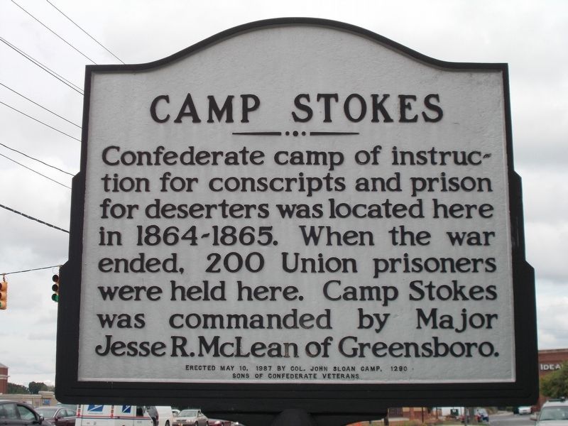
Camp Stokes

Photographed by Michael C. Wilcox, August 20, 2013
1. Camp Stokes Marker
Erected 1987 by Col. John Sloan Camp, 1290, Sons of Confederate Veterans.
Topics. This historical marker is listed in this topic list: War, US Civil. A significant historical year for this entry is 1864.
Location. 36° 5.56′ N, 79° 48.883′ W. Marker is in Greensboro, North Carolina, in Guilford County. It is in Guilford Hills. It is at the intersection of Green Valley Road and Battleground Avenue, on the right when traveling west on Green Valley Road. Touch for map. Marker is at or near this postal address: 1801 Battleground Ave, Greensboro NC 27408, United States of America. Touch for directions.

Regionally, this marker is in the Piedmont and specifically in Piedmont Triad. It is also in the American South and specifically in the Upper South. Globally, it is in North America, the Western Hemisphere, the Western World, and the Anglosphere. Historically, it finds itself in what was once
this page online
Other nearby markers. At least 8 other markers are within 2 miles of this marker, measured as the crow flies: David Schenck (approx. 1.3 miles away); T. Gilbert Pearson (approx. 1.3 miles away); University of N.C. at Greensboro (approx. 1.3 miles away); David Caldwell (approx. 1.4 miles away); The Harden Thomas Martin House (approx. 1.4 miles away); Simkins v. Cone (approx. 1½ miles away); a different marker also named David Caldwell (approx. 1½ miles away); Irving Park (approx. 1½ miles away). Touch for a list and map of all markers in Greensboro.
Another marker is no longer nearby. Our Confederate Dead (was approx. 1.2 miles away but has been permanently removed).
Photographed by Michael C. Wilcox, August 20, 2013
2. Camp Stokes Marker

Photographed by Michael C. Wilcox, August 20, 2013
3. Camp Stokes Marker

Photographed by Michael C. Wilcox, August 20, 2013
4. Camp Stokes Marker

Photographed by Michael C. Wilcox, August 20, 2013
5. Camp Stokes Marker
Credits. This page was last revised on April 2, 2023. It was originally submitted on October 12, 2016, by Michael C. Wilcox of Winston-Salem, North Carolina. This page has been viewed 2,203 times since then and 113 times this year. Last updated on April 1, 2023, by Michael Buckner of Durham, North Carolina. Photos: 1, 2, 3, 4, 5. submitted on October 12, 2016, by Michael C. Wilcox of Winston-Salem, North Carolina. • Bernard Fisher was the editor who published this page.
