Near Thompson Falls in Sanders County, Montana — The American West (Mountains)
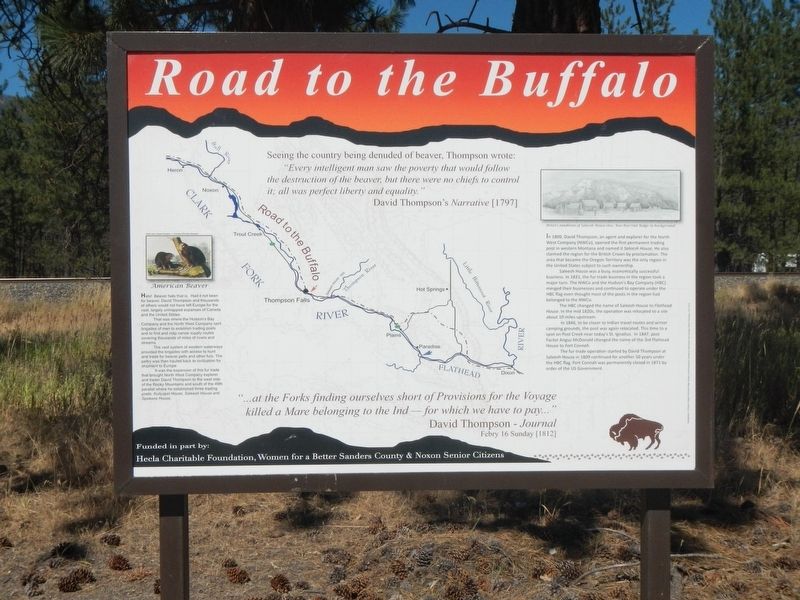
Road to the Buffalo
"... at the Forks finding ourselves short of Provisions for the Voyage killed a Mare belonging to the Ind-for which we have to pay..." David Thompson - Journal, Feb 16 Sunday [1812]
(image on left:)
American Beaver
Hats! Beaver hats that is. Had it not been for beaver, David Thompson and thousands of others would not have left Europe for the vast and largely unmapped expanses of Canada and the United States.
That was where the Hudson's Bay Company and the North West Company sent brigades of men to establish trading posts and to find and map canoe supply routes covering thousands of miles of rivers and streams.
The vast system of western waterways provided the brigades with access to hunt and trade for beaver pelts and other furs. The peltry was then hauled back to civilization for shipment to Europe.
It was the expansion of this fur trade that brought North West explorer and trader David Thompson to the west side of the Rocky Mountains and south of the 49th parallel where he established three trading posts: Kullyspel House, Saleesh House and Spokane House.
(image on right:)
Artist's rendition of Saleesh House 1810. Koo-Koo-Sint Ridge in the background.
In 1809, David Thompson, an agent and explorer for the North West Company (NWCo), opened the first permanent trading post in western Montana and named it Saleesh House. He also claimed the region for the British Crown by proclamation. The area that became the Oregon Territory was the only region in the United States subject to such ownership.
Saleesh House was a busy, economically successful business. In 1821, the fur trade business in the region took a major turn. The NWCo and the Hudson's Bay Company (HBC) merged their businesses and continued to operate under the HBC flag even thought (sic) most of the posts in the region had belonged to the NWCo.
The HBC changed the name of Saleesh House to Flathead House. In the mid-1820s, the operation was relocated to a site about 10 miles upstream.
In 1846, to be closer to Indian travel routes and winter camping grounds, the post was again relocated. This time to a spot on Post Creek near today's St. Ignatius. In 1847, post Factor Angus McDonald changed the name of the 3rd Flathead House to Fort Connah.
The fur trade operation started by David Thompson at Saleesh House
in 1809 continued for another 50 years under the HBC flag. Fort Connah was permanently closed in 1871 by order of the US Government.
Erected by Hecla Charitable Foundation, Noxon Senior Citizens.
Topics. This historical marker is listed in these topic lists: Native Americans • Roads & Vehicles. A significant historical date for this entry is February 16, 1810.
Location. 47° 35.479′ N, 115° 19.514′ W. Marker is near Thompson Falls, Montana, in Sanders County. Marker is on State Highway 200 at milepost 52 near Golf Street, on the right when traveling west. Touch for map. Marker is in this post office area: Thompson Falls MT 59873, United States of America. Touch for directions.
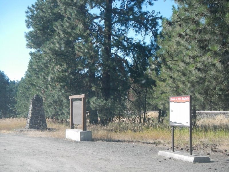
Other nearby markers. At least 8 other markers are within 2 miles of this marker, measured as the crow flies. David Thompson (here, next to this marker); Saleesh House (within shouting distance of this marker); Fort Thompson Playground (approx. 0.9 miles away); Weber's Store (approx. 0.9 miles away); Bedard House (approx. 1.1 miles away); Ward Hotel (approx. 1.1 miles away); Ainsworth House (approx. 1.2 miles away); Sanders County Jail (approx. 1.2 miles away). Touch for a list and map of all markers in Thompson Falls.
Credits. This page was last revised on April 1, 2023. It was originally submitted on April 1, 2023, by Barry Swackhamer of Brentwood, California. This page has been viewed 73 times since then and 19 times this year. Photos: 1, 2. submitted on April 1, 2023, by Barry Swackhamer of Brentwood, California.

