Inner Harbor in Baltimore, Maryland — The American Northeast (Mid-Atlantic)
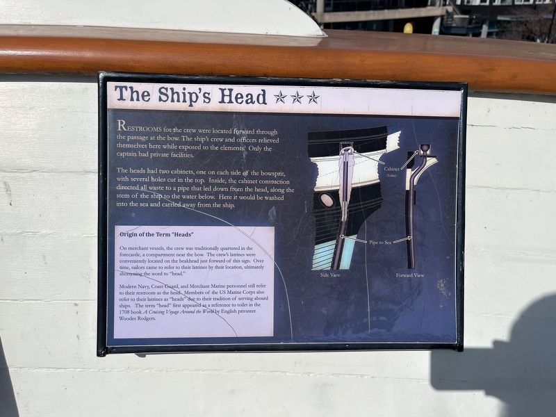
The Ship's Head
Restrooms for the crew were located forward through the passage at the bow. The ship's crew and officers relieved themselves here while exposed to the elements. Only the captain had private facilities.
The heads had two cabinets, one on each side of the bowsprit, with several holes cut in the top. Inside the cabinet construction directed all waste to a pipe that led down from the head, along the stem of the ship to the water below. Here it would be washed into the sea and carried away from the ship.
Origin of the Term "Heads"
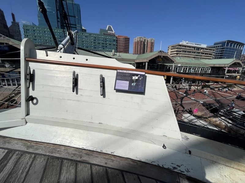
On merchant vessels, the crew was traditionally quartered in the forecastle, a compartment near the bow. The crew's latrines were conventionally located on the beakhead just forward of this sign. Over time, sailors came to refer to their latrines by their location, ultimately shortening the word to "head."
Modern Navy, Coast Guard, and Merchant Marine personnel still refer to their restroom as the head. Members of the US Marine corps also refer to their latrines as "heads" due to their tradition of serving aboard ships. The term "head" first appeared as a reference to toilet in the 1708 book A Cruising Voyage Around the World by English privateer Woodes Roger.
Erected by Historic Ships in Baltimore.
Topics. This historical marker is listed in these topic lists: Anthropology & Archaeology • Arts, Letters, Music • Waterways & Vessels. A significant historical year for this entry is 1708.
Location. 39° 17.149′ N, 76° 36.674′ W. Marker is in Baltimore, Maryland. It is in the Inner Harbor. Marker can be reached from East Pratt Street east of Light Street (Maryland Route 2), on the right when traveling east. The marker stands on board the USS Constellation display. Touch for map. Marker is at or near this postal address: 301 E Pratt St, Baltimore MD 21202, United States of America. Touch for directions.
Other nearby markers. At least 8 other markers are within walking distance of this marker. Hammock Rails (within shouting distance of this marker); USS Constellation (within shouting distance of this marker); The Port of Baltimore (within shouting distance of this marker); The Ship's Helm (within shouting distance of this marker); Spar Deck Guns (within shouting distance of this marker); Living Classrooms (about 300 feet away, measured in a direct line); Welcome (about 400 feet away); Top of the World Observation Level World Trade Center (about 400 feet away). Touch for a list and map of all markers in Baltimore.
Credits. This page was last revised on April 3, 2023. It was originally submitted on April 3, 2023, by Devry Becker Jones of Washington, District of Columbia. This page has been viewed 61 times since then and 9 times this year. Photos: 1, 2. submitted on April 3, 2023, by Devry Becker Jones of Washington, District of Columbia.

