Near Ovando in Powell County, Montana — The American West (Mountains)
The Blackfoot River Corridor
Inscription.
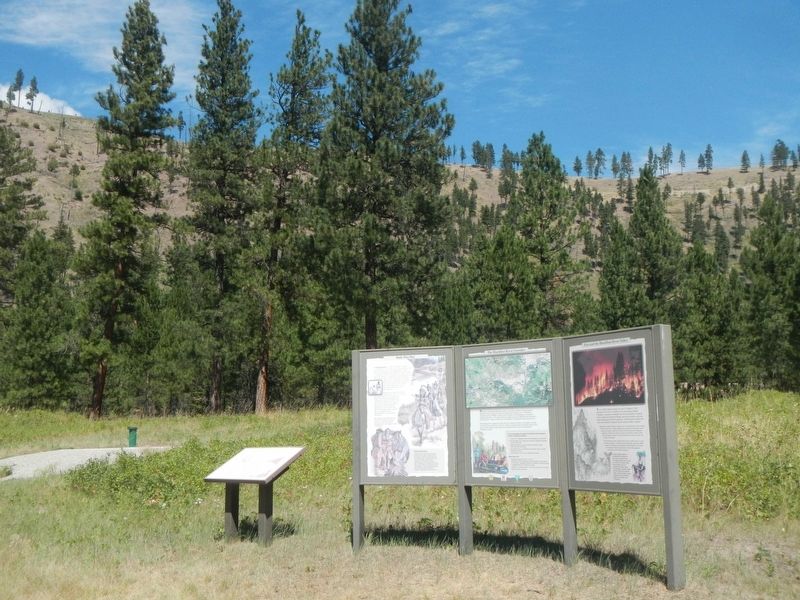
(This marker is constructed of three attached panels:)
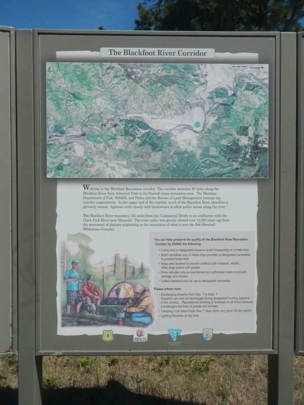
The Blackfoot River Corridor
Welcome to the Blackfoot Recreation corridor. The corridor stretches 26 mile along the Blackfoot River from Johnsrud Park to the Russel Gates recreation area. The Montana Department of Fish, Wildlife and Parks and the Bureau of Land Management manage the corridor cooperatively. In the upper half of the corridor, much of the Blackfoot River shoreline is privately owned. Agencies work closely with land owners to allow public access along the river.
The Blackfoot River meanders 132 miles from the Continental Divide to its confluence with the Clark Fork River near Missoula. The river valley was greatly altered over 12,000 years ago from the movement of glaciers originating in the mountains of what is now the Bob Marshal Wilderness Complex.
(The rest is a list of do and don't.)
Walk This Way
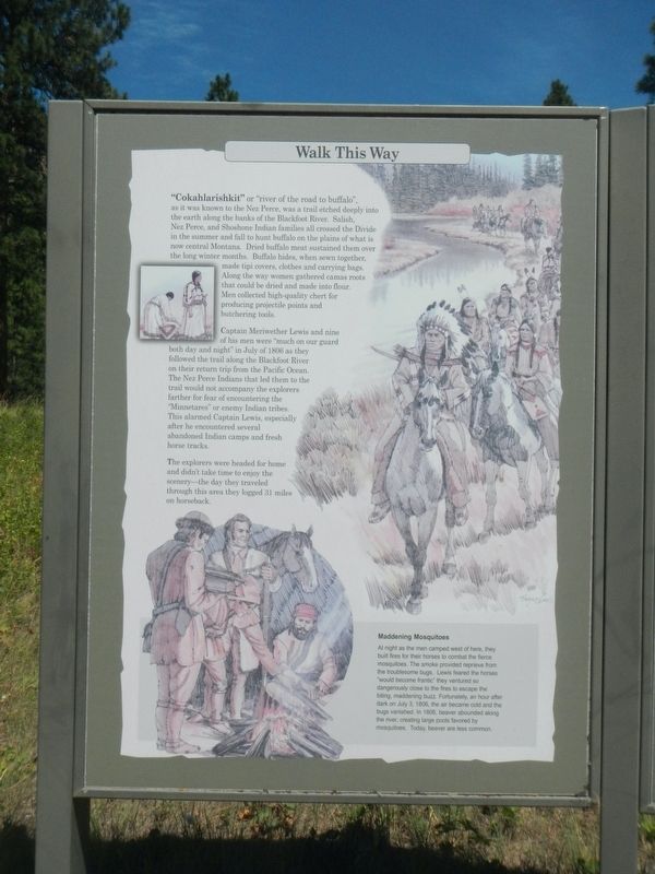
"Cokahlarishkit" or "river of the road to buffalo", as it was known to the Nez Perce, was a trail etched deeply into the earth along the banks of the Blackfoot River. Salish, Nez Perce, and Shoshone Indian families all crossed the Divide in the summer and fall to hunt buffalo on the plains of what is now central Montana. Dried buffalo meat sustained them over the long winter months. Buffalo hides, when sewn together, made tipi covers, clothes and carrying bags. Along the way women gathered camas roots that could be dried and made into flour. Men collected high-quality chert for producing projectile points and butchering tools.
Captain Meriwether Lewis and nine of his men were "much on our guard both day and night" in July of 1806 as they followed the trail along the Blackfoot River on their return trip from the Pacific Ocean. The Nez Perce Indians that led them to the trail would not accompany the explores farther for fear of encountering the "Minnetares" or enemy Indian tribes. This alarmed Captain Lewis, especially after he encountered several abandoned Indian camps and fresh horse tracks.
The explorers were headed for home and didn't take time to enjoy the scenery - the day they traveled through this area they logged 31 miles on horseback.
Fire and the Blackfoot River Valley
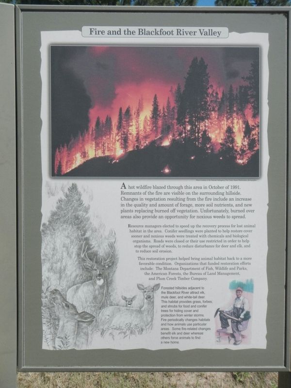
A hot wildfire blazed through this area in October of 1991. Remnants of the fire are visible on the surrounding hillside. Changes in vegetation resulting from the fire include an increase in the quality and amount of forage, more soil nutrients, and new plants replacing burned off vegetation. Unfortunately, burned over areas also provide an opportunity for noxious weeds to spread.
Resource managers elected to speed up the recovery process for lost

Photographed By Barry Swackhamer, August 11, 2022
2. The Blackfoot River Corridor Marker, Walk This Way panel
Caption:(lower right) Maddening Mosquitoes,
At night as the men camped west of here, they built fires for their horses to combat the fierce mosquitos. The smoke provided reprieve from the troublesome bugs. Lewis feared the horses "would become frantic" they ventured so dangerously close to the fires to escape the biting maddening buzz. Fortunately, an hours after dark on July 3, 1806, the air became cold and the bugs vanished. In 1806, beaver abounded along the river, creating large pools favored by mosquitos. Today, beaver are less common.
This restoration project helped bring animal habitat back to a more favorable condition. Organizations that funded restoration efforts include: The Montana Department of Fish, Wildlife and Parks, the American Forests, the Bureau of Land Management, and Plum Creek Timber Company.
Forested hills adjacent to the Blackfoot River attract elk, mule deer, and white-tail deer. This habitat provides grass, forbes, and shrubs for food and conifer trees for hiding cover and protection from winter storms. Fire periodically changes habitats and how animals use particular areas. Some fire-related changes benefit elk and deer whereas others force animals to find a new home.
Erected by The Montana Department of Fish, Wildlife and Parks and the Bureau of Land Management.
Topics and series. This historical marker is listed in these topic lists: Exploration • Native Americans • Natural Features. In addition, it is included in the Lewis & Clark Expedition series list.
Location.
47° 1.386′ N, 113° 18.513′ W. Marker is near Ovando, Montana, in Powell County. Marker is on Russel Gates Fishing Access near State Highway 200. The marker is in the Russel Gates Campground, just off of Montana 200 near Mile Post 36. Touch for map. Marker is in this post office area: Ovando MT 59854, United States of America. Touch for directions.
Other nearby markers. At least 8 other markers are within 12 miles of this marker, measured as the crow flies. Big Blackfoot Railroad (approx. 2.7 miles away); Souvenirs of the Ice Age (approx. 3.2 miles away); Big Blackfoot Milling Company (approx. 3.2 miles away); A Vast Network of Indigenous Trails. (approx. 3.2 miles away); Seaman (approx. 4.3 miles away); The Lewis Minus Clark Expedition (approx. 8.3 miles away); Early Ovando Years (approx. 8.3 miles away); Ghost Town Byway (approx. 11.9 miles away). Touch for a list and map of all markers in Ovando.
Credits. This page was last revised on April 7, 2023. It was originally submitted on April 7, 2023, by Barry Swackhamer of Brentwood, California. This page has been viewed 129 times since then and 15 times this year. Photos: 1, 2, 3, 4. submitted on April 7, 2023, by Barry Swackhamer of Brentwood, California.


