Lincoln in Lewis and Clark County, Montana — The American West (Mountains)
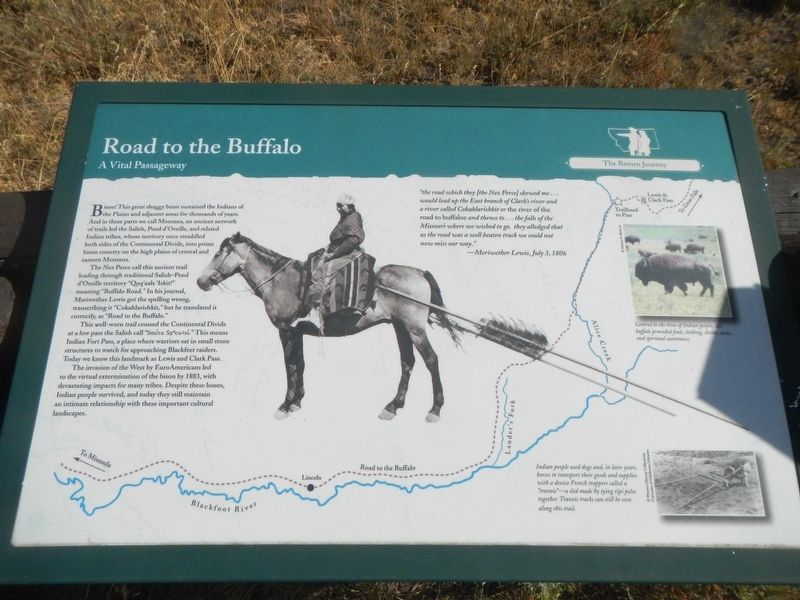
Road to the Buffalo
A Vital Passageway
— The Return Journey —

Photographed By Barry Swackhamer, August 12, 2022
1. Road to the Buffalo Marker
Captions: (upper right) Central to the lives of Indian people, the buffalo provided food, clothing, shelter, tools and spiritual sustenance.; (bottom right) Indian people use dogs and, in later years, horses to transport their goods and supplies with a device French trappers call a "travois" - s sled made by tying tipi poles together. Travois tracks can still be seen along the trail.
The Nez Perce called this ancient trail leading through traditional Salish-Pend d'Oreille territory "Qoq'aalx 'Iskit!" meaning "Buffalo Road.
This well-worn trail crossed the Continental Divide at a low pass the Salish called "Smitu Sxcucs.i" This means Indian Fort Pass, a place where warriors sat in small stone structures to watch for approaching Blackfeet raiders. Today we know to watch we know this landmark as Lewis and Clark Pass.
The invasion of the West by EuroAmerican led to the virtual extermination of the bison by 1883, with the devastating impacts for many tribes. Despite there losses, Indian people survived, and today they still maintain an intimate relationship with these important cultural landscapes.
"the road which they [the Nez Perce] shewed men ... would lead up the East branch of Clark's river and a river called Cokahlarishkit or the river of the road to buffaloe and thence to ... the falls of the Missouri where we wished to go. they alleged that as the road was a well beaten track we could not now miss our way." -- Meriwether Lewis, July 3, 1806
Erected by Lewis & Clark National Historic Trail.
Topics and series. This historical marker is listed in these topic lists: Exploration • Native Americans • Roads & Vehicles. In addition, it is included in the Lewis & Clark Expedition series list. A significant historical date for this entry is July 3, 1806.
Location. 47° 8.34′ N, 112° 27.384′ W. Marker is in Lincoln, Montana, in Lewis and Clark County. Marker is on Alice Creek Road near State Highway 200. The marker is a far north end of Alice Creek Road (gravel/dirt), about 10 miles from the intersection with Montana Highway. Touch for map. Marker is in this post office area: Lincoln MT 59639, United States of America. Touch for directions.
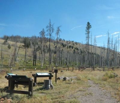
Other nearby markers. At least 8 other markers are within 12 miles of this marker, measured as the crow flies. Reaching Familiar Territory (here, next to this marker); Crossing Lewis and Clark Pass (here, next to this marker); Lewis and Clark Pass (approx. 1.3 miles away); Coldest Temperature in Contiguous United States (approx. 6.1 miles away); Record Cold Spot (approx. 6.1 miles away); Return to the United States (approx. 8 miles away); Eagle Watch (approx. 8 miles away); A Fine Passageway (approx. 11.7 miles away). Touch for a list and map of all markers in Lincoln.
Credits. This page was last revised on April 8, 2023. It was originally submitted on April 8, 2023, by Barry Swackhamer of Brentwood, California. This page has been viewed 75 times since then and 19 times this year. Photos: 1, 2. submitted on April 8, 2023, by Barry Swackhamer of Brentwood, California.
