Anastasia in St. Augustine in St. Johns County, Florida — The American South (South Atlantic)
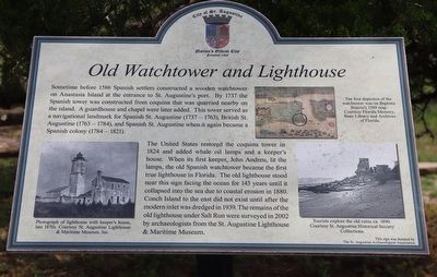
Old Watchtower and Lighthouse
Sometime before 1586 Spanish settlers constructed a wooden watchtower on Anastasia Island at the entrance to St. Augustine's port. By 1737 the Spanish tower was constructed from coquina that was quarried nearby on the island. A guardhouse and chapel were later added. This tower served as a navigational landmark for Spanish St. Augustine (1737-1763), British St. Augustine (1763-1784), and Spanish St. Augustine when it again became a Spanish colony (1784-1821).
The United States restored the coquina tower in 1824 and added whale oil lamps and a keeper's house. When its first keeper, John Andreu, lit the lamps, the old Spanish watchtower became the first true lighthouse in Florida. The old lighthouse stood near this sign facing the ocean for 143 years until it collapsed into the sea due to coastal erosion in 1880. Conch Island to the east did not exist until after the modern inlet was dredged in 1939. The remains of the old lighthouse under Salt Run were surveyed in 2002 by archaeologists from the St. Augustine Lighthouse & Maritime Museum.
Erected by The St. Augustine Archaeological Association.
Topics. This historical marker is listed in these topic lists: Colonial Era • Communications • Waterways & Vessels. A significant historical year for this entry is 1586.
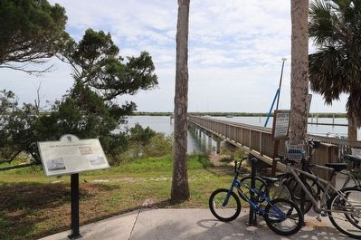
Location. 29° 53.176′ N, 81° 17.185′ W. Marker is in St. Augustine, Florida, in St. Johns County. It is in Anastasia. Marker can be reached from Ocean Vista Avenue east of Red Cox Drive, on the left when traveling east. Touch for map. Marker is at or near this postal address: 446 Ocean Vista Ave, Saint Augustine FL 32080, United States of America. Touch for directions.
Other nearby markers. At least 8 other markers are within walking distance of this marker. Sentinels of the Coast (about 300 feet away, measured in a direct line); Lighthouse and Keepers House (about 600 feet away); World War II (about 600 feet away); 1888 Outdoor Kitchens (about 700 feet away); 1886 Well (about 700 feet away); 1872 North Privy (about 700 feet away); 1872 South Privy (about 800 feet away); St. Augustine on Anastasia Island (approx. ¼ mile away). Touch for a list and map of all markers in St. Augustine.
Credits. This page was last revised on April 11, 2023. It was originally submitted on April 10, 2023, by Dave W of Co, Colorado. This page has been viewed 250 times since then and 95 times this year. Photos: 1, 2, 3. submitted on April 10, 2023, by Dave W of Co, Colorado. • Bernard Fisher was the editor who published this page.


