Terlingua in Brewster County, Texas — The American South (West South Central)
Chisos Mine and Terlingua
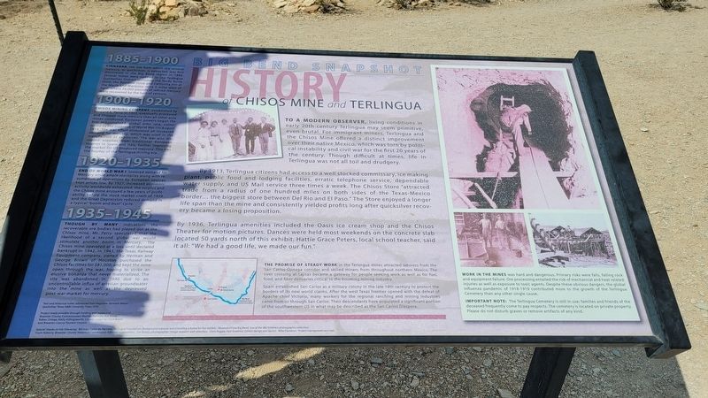
Big Bend Snapshot History
By 1913, Terlingua citizens had access to a well stocked commissary, ice making plant, public food and lodging facilities, erratic telephone service, dependable water supply, and US Mail service three times a week. The Chisos Store "attracted trade from a radius of one hundred miles on both sides of the Texas-Mexico border... the biggest store between Del Rio and El Paso." The Store enjoyed a longer life span than the mine and consistently yielded profits long after quicksilver recovery became a losing proposition.
By 1936, Terlingua amenities included the Oasis ice cream shop and the Chisos Theater for motion pictures. Dances were held most weekends on the concrete slab located 50 yards north of this exhibit. Hattie Grace Peters, local school teacher, said it all: "We had a good life, we made our fun."
1885-1900
Cinnabar, the ore from which the mineral mercury, or quicksilver, is extracted, was first discovered in the Big Bend region in 1884. Several mines were opened in the Terlingua Quicksilver District including the Study Butte mine, the Rainbow mine and California Hill at the Marfa and Mariposa mine 5 miles west of here, where 76,000 pounds of refined mercury were recovered by the turn of century.
1900-1920
Chisos Mining Company, established by Howard E. Perry in 1903, eventually processed and shipped more mercury than all other area mines combined. European powers began the first industrialized, global arms race, culminated by the outbreak of World War I in August 1914. The war effort stimulated an increased demand for mercury, which was used in the manufacture of explosives. The war also disrupted supplies from traditional European sources in Spain and Italy, further improving the market for US produced mercury. This was the heyday of the Terlingua mining era.
1920-1935
End of World War I lowered demand for Mercury while ample stockpiles along with resumption of operations by European sources kept prices low. By 1927, increased economic activity worldwide exhausted the surplus and the Chisos mine enjoyed a few years of profitability before the stock market crash of 1929 and the Great Depression reduced demand in a typical "boom and bust" cycle.
1935-1945
Though
by Many indications the recoverable ore bodies had played out at the Chisos mine, Mr. Perry speculated that the likelihood of a second global war would stimulate another boom in Mercury. The Chisos mine operated at a loss until declared bankrupt in 1942. In 1943, the Texas Railway Equipment company, owned by Herman and George Brown of Houston purchased the Chisos facilities for $81,000, and kept the mine open through the war, hoping to strike an elusive bonanza that never materialized. The site was abandoned in 1946 due to an uncontrollable influx of artesian groundwater into the mine as well as the depressed post-war market for mercury.
Text and historical notes referenced from Ragsdale, Kenneth Baxter Quicksilver, Texas A&M University Press 1976
Project made possible through funding and support of Brewster County Commissioners Matilde Pallanez, Asa Stone, Ruben Ortega, Kathy Killingsworth, County Judge Val Clark Beard and Brewster County Tourism Council.
Captions
The Promise of Steady Work in the Terlingua mines attracted laborers from the San Carlos-Ojinaga corridor and skilled miners from throughout northern Mexico. The river crossing at Lajitas became a gateway for people seeking work as well as for fuel, food, and fiber deliveries critical to the booming mining industry.
Spain
established San Carlos as a military colony in the late 18th century to protect the borders of its new world claims. After the west Texas frontier opened with the defeat of Apache chief Victorio, many workers for the regional ranching and mining industries came from or through San Carlos. Their descendants have populated a significant portion of the southwestern US in what may be described as the San Carlos Diaspora.
Work in the Mines was hard and dangerous. Primary risks were falls, falling rock and equipment failure. Ore processing entailed the risk of mechanical and heat related injuries as well as exposure to toxic agents. Despite these obvious dangers, the global influenza pandemic of 1918-1919 contributed more to the growth of the Terlingua Cemetery than any other single cause.
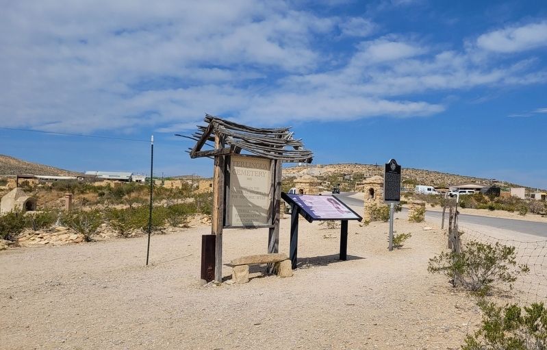
Important Note: The Terlingua Cemetery is still in use; families and friends of the deceased frequently come to pay respects. The cemetery is located on private property. Please do not disturb graves or remove artifacts of any kind.
Erected by Brewster County Historical Commission.
Topics. This historical marker is listed in these topic lists: Hispanic Americans • Industry & Commerce • Wars, US Indian. A significant historical year for this entry is 1913.
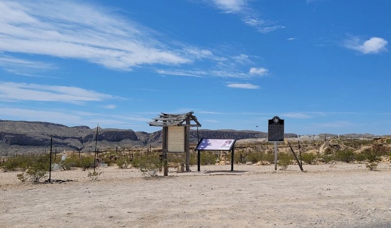
Location. 29° 19.184′ N, 103° 36.745′ W. Marker is in Terlingua, Texas, in Brewster County. Marker is at the intersection of Terlingua Ghost Town and Ivey Road, on the left when traveling north on Terlingua Ghost Town. The marker is located in the northeast section of the cemetery. Touch for map. Marker is at or near this postal address: 31 Terlingua Ghost Town, Terlingua TX 79852, United States of America. Touch for directions.
Other nearby markers. At least 8 other markers are within 9 miles of this marker, measured as the crow flies. Federico Villalba (here, next to this marker); Terlingua Cemetery (here, next to this marker); Terlingua (approx. 0.4 miles away); Quicksilver (approx. 0.8 miles away); Ranching in the Big Bend (approx. 4.7 miles away); Big Bend Ranching: South (approx. 4.7 miles away); E.E. Townsend (approx. 6.4 miles away); Terlingua Abaja (approx. 8.4 miles away). Touch for a list and map of all markers in Terlingua.
Credits. This page was last revised on April 15, 2023. It was originally submitted on April 13, 2023, by James Hulse of Medina, Texas. This page has been viewed 137 times since then and 45 times this year. Photos: 1, 2, 3. submitted on April 15, 2023, by James Hulse of Medina, Texas.


