University City in Philadelphia in Philadelphia County, Pennsylvania — The American Northeast (Mid-Atlantic)
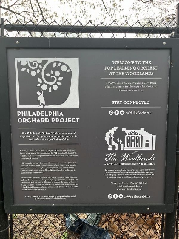
Philadelphia Orchard Project
The Woodlands
— A National Historic Landmark District —
In 2020, the Philadelphia Orchard Project (POP) and The Woodlands began a new partnership establishing the POP Learning Orchard at The Woodlands, a space designed for education, inspiration, and interaction with the environment.
POP planted a one-acre demonstration orchard, containing 90 fruit and nut trees, berry gardens, and pollinator gardens. The orchard contains both native and heirloom plants, serving to restore a small piece of the historic edible landscape of both William Hamilton and the earlier Lenni-Lenape land stewards.
In addition to providing valuable food resources, the orchard plantings enliven the streetscape and expanded joint programming will uplift The Woodlands' rich horticultural history. Leveraging the power of food-based programs will enhance cultural and recreational opportunities for West Philadelphia residents, and attract a wide cross-section of users to this extraordinary green space.
Erected by The Woodlands Foundation.
Topics and series. This historical marker is listed in these topic lists: Education • Horticulture & Forestry • Landmarks • Native Americans • Parks & Recreational Areas. In addition, it is included in the National Historic Landmarks series list. A significant historical year for this entry is 2020.
Location. 39° 56.882′ N, 75° 12.28′ W. Marker is in Philadelphia, Pennsylvania, in Philadelphia County. It is in University City. Marker can be reached from Woodland Avenue west of Chester Avenue, on the left when traveling west. Touch for map. Marker is at or near this postal address: 4100 Woodland Ave, Philadelphia PA 19104, United States of America. Touch for directions.
Other nearby markers. At least 8 other markers are within walking distance of this marker. Paul Philippe Cret (about 400 feet away, measured in a direct line); The Woodlands (about 500 feet away); William Hamilton's Schuylkill River Residence & Pleasure Gardens (about 500 feet away); Hamilton's Carriage House & Stable (about 600 feet away); Commodore David Porter (approx. 0.2 miles away); Hamilton's Greenhouses & Hothouses
Credits. This page was last revised on April 16, 2023. It was originally submitted on April 16, 2023, by Devry Becker Jones of Washington, District of Columbia. This page has been viewed 62 times since then and 10 times this year. Photos: 1, 2. submitted on April 16, 2023, by Devry Becker Jones of Washington, District of Columbia.

