Tombstone in Cochise County, Arizona — The American Mountains (Southwest)
Boothill Graveyard
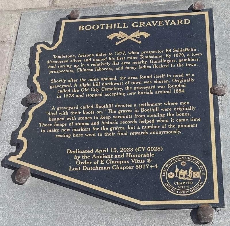
Tombstone, Arizona dates to 1877, when prospector Ed Schieffelin discovered silver and named his first mine Tombstone. By 1879, a town had sprung up in a relatively flat area nearby. Gunslingers, gamblers, prospectors, Chinese laborers, and fancy ladies flocked to the town.
Shortly after the mine opened, the area found itself in need of a graveyard. A slight hill northwest of town was chosen. Originally called the Old City Cemetery, the graveyard was founded in 1878 and stopped accepting new burials around 1884.
A graveyard called Boothill denotes a settlement where men "died with their boots on." The graves in Boothill were originally heaped with stones to keep varmints from stealing the bones. Those heaps of stones and historic records helped when it came time to make new markers for the graves, but a number of the pioneers resting here went to their final rewards anonymously.
Dedicated April 15, 2023 (CY 6028)
by the Ancient and Honorable Order of E Clampus Vitus Ⓡ
Lost Dutchman Chapter 5917+4
Erected 2023 by Lost Dutchman Chapter 5917+4 of The Ancient and Honorable Order of E Clampus Vitus.
Topics and series. This historical marker is listed in these topic lists: Cemeteries & Burial Sites • Settlements & Settlers. In addition, it is included in the E Clampus Vitus series list.
Location. 31° 43.192′ N, 110° 4.229′ W. Marker is in Tombstone, Arizona, in Cochise County. Touch for map. Marker is at or near this postal address: 408 AZ-80, Tombstone AZ 85638, United States of America. Touch for directions.
Other nearby markers. At least 8 other markers are within walking distance of this marker. Veterans Pioneers Settlers (here, next to this marker); a different marker also named Boothill Graveyard (here, next to this marker); Welcome to Boothill Graveyard (within shouting distance of this marker); St. Paul's Episcopal Church (approx. 0.4 miles away); Tombstone City Hall (approx. half a mile away); Schieffelin Hall (approx. half a mile away); Hoptown (approx. half a mile away); Grand Army of the Republic Memorial (approx. half a mile away). Touch for a list and map of all markers in Tombstone.
Credits. This page was last revised on December 20, 2023. It was originally submitted on April 16, 2023, by Frank Gunshow Sanchez of Hollister, California. This page has been viewed 311 times since then and 32 times this year. Photos: 1. submitted on April 16, 2023, by Frank Gunshow Sanchez of Hollister, California. 2. submitted on April 17, 2023. • J. Makali Bruton was the editor who published this page.

