Ormond Beach in Volusia County, Florida — The American South (South Atlantic)
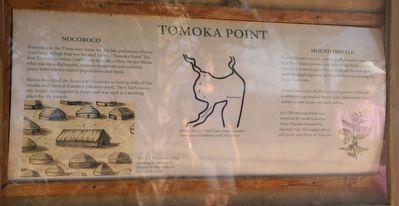
Tomoka Point
Nocoroco
Nocoroco is the Timucuan name for the late prehistoric Native American village that was located here on Tomoka Point. The first European visitor (1605) was Spanish soldier Alvaro Mexia who was on a diplomatic mission to explore and establish peace between the native populations and Spain.
Mexia described the houses of Nocoroco as having walls of tree trunks and conical thatched palmetto roofs. The Chief's house was larger, rectangular in shape and was used as a meeting place for the people.
Mound Oswald
Mount Oswald was a rice and indigo plantation built in 1766 by a West Indies investor and slave trader Richard Oswald. Oswald was searching for a way to invest the fortune he made by supplying bread to the British armies during the Seven Years war.
Oswald received a 20,000 acre land grant in 1764 and established a plantation house, barn, blacksmith shop, stables, a corn house and slave cabins.
In 1784 the plantation was removed to South Carolina when Florida returned to Spanish rule. The indigo plants still grow and thrive in Tomoka.
Topics. This historical marker is listed in these topic lists: African Americans • Agriculture • Exploration • Industry & Commerce • Native Americans. A significant historical year for this entry is 1605.
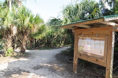
Location. 29° 21.345′ N, 81° 5.401′ W. Marker is in Ormond Beach, Florida, in Volusia County. Marker can be reached from North Beach Street east of Pine Tree Drive, on the right when traveling west. Touch for map. Marker is at or near this postal address: 2099 Unnamed Road, Ormond Beach FL 32174, United States of America. Touch for directions.
Other nearby markers. At least 8 other markers are within 5 miles of this marker, measured as the crow flies. The Timucua (about 400 feet away, measured in a direct line); Mount Oswald Plantation (about 500 feet away); Nocoroco (about 600 feet away); Dummitt Plantation Mill Ruins (approx. one mile away); World War II Coastal Watch Tower (approx. 1.6 miles away); Old King's Road (approx. 2.4 miles away); Ormond Tomb (approx. 3.3 miles away); First Christian Marriage In North America (approx. 4˝ miles away). Touch for a list and map of all markers in Ormond Beach.
Credits. This page was last revised on April 17, 2023. It was originally submitted on April 17, 2023, by Dave W of Co, Colorado. This page has been viewed 98 times since then and 37 times this year. Photos: 1, 2. submitted on April 17, 2023, by Dave W of Co, Colorado. • Devry Becker Jones was the editor who published this page.

