Salem in Essex County, Massachusetts — The American Northeast (New England)
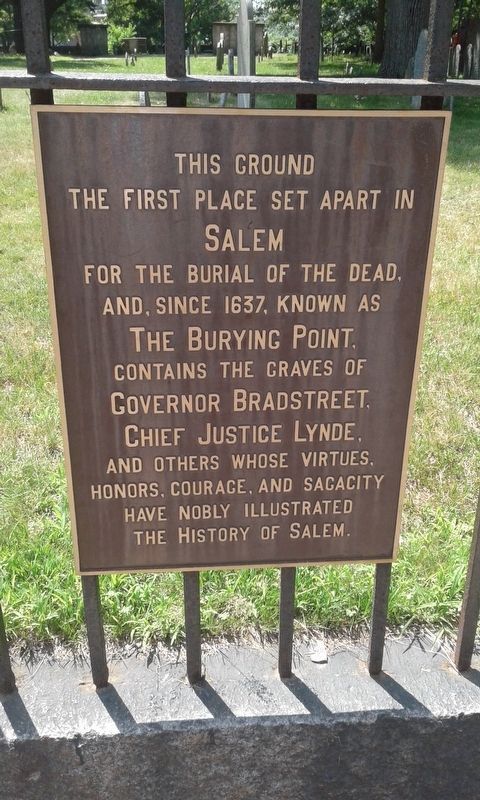
This Ground
the first place set apart in
Salem
for the burial of the dead,
and, since 1637, known as
The Burying Point.
Contains the graves of
Governor Bradstreet,
Chief Justice Lynde,
and others whose virtues,
honors, courage, and sagacity
have nobly illustrated
the history of Salem.
Topics. This historical marker is listed in these topic lists: Cemeteries & Burial Sites • Colonial Era. A significant historical year for this entry is 1637.
Location. Marker has been reported permanently removed. It was located near 42° 31.25′ N, 70° 53.533′ W. Marker was in Salem, Massachusetts, in Essex County. Marker was on Charter Street east of Central Street, on the right when traveling east. Touch for map. Marker was at or near this postal address: 51 Charter Street, Beverly MA 01915, United States of America.
We have been informed that this sign or monument is no longer there and will not be replaced. This page is an archival view of what was.
Other nearby markers. At least 8 other markers are within walking distance of this location. The Burying Point (a few steps from this marker); Charter Street Cemetery (a few steps from this marker); Graves of Greatest Historical Intrest (a few steps from this marker); Yin Yu Tang A Chinese Home (within shouting distance of this marker); The Salem Witch Trials Memorial (within shouting distance of this marker); a different marker also named The Salem Witch Trials Memorial (within shouting distance of this marker); The London Coffee House (about 400 feet away, measured in a direct line); East India Marine Hall (about 400 feet away). Touch for a list and map of all markers in Salem.
Credits. This page was last revised on April 25, 2023. It was originally submitted on December 9, 2020, by Craig Doda of Napoleon, Ohio. This page has been viewed 102 times since then and 2 times this year. Last updated on April 18, 2023, by Craig Doda of Napoleon, Ohio. Photos: 1, 2, 3, 4. submitted on December 9, 2020, by Craig Doda of Napoleon, Ohio. • Michael Herrick was the editor who published this page.


