Salem in Essex County, Massachusetts — The American Northeast (New England)
Salem Harbor
Photographed by J. Makali Bruton, July 1, 2015
1. Salem Harbor Marker
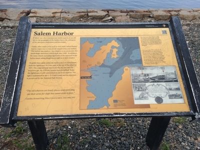
Unlike other major ports such as New York, Salem Harbor had no major river to link it with inland towns and markets. The harbor was shallow – too shallow to accommodate the much larger merchant vessels built after 1840. In addition, the many islands and submerged rocks at the approach to the harbor made sailing dangerous at night or in thick weather.
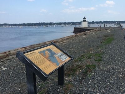
To guide ships safely within the harbor, the U.S. Government built the lighthouse on your right at the tip of the wharf in 1871. The original lamp was fueled by oil, and later by acetylene gas. By 1930 the lantern was electrified. Today the lighthouse is still considered an aid to navigation. The light is maintained by the U.S. Coast Guard, and the structure is preserved by the National Park Service.
The old wharves are lonely places now, stretching out their arms for ships that never come to port.” - Caroline Howard King, When I Lived in Salem, 1822-1866, 1937
Captions:
This chart shows Salem Harbor today. The numbers
this page online
The top of this 1797 certificate of membership in the Salem Marine Society bears an engraving of Salem Harbor in 1796. Derby Wharf and its three large warehouses are still visible, but the wharf extension on which you are standing was not built until 1808. In the background lies the harbor entrance and the original twin towers of Baker’s Island Light.
Erected by National Park Service.
Topics and series. This historical marker is listed in these topic lists: Industry & Commerce • Waterways & Vessels. In addition, it is included in the Lighthouses series list. A significant historical year for this entry is 1840.
Location. Marker has been reported permanently removed. It was located near 42° 31.029′ N, 70° 53.058′ W. Marker was in Salem, Massachusetts, in Essex County. It could be reached from Derby Street. The marker is along the Derby Wharf at the Salem Maritime National Historic Site. Touch for map. Marker was in this post office
Photographed by J. Makali Bruton, July 1, 2015
2. Salem Harbor Marker
We have been informed that this marker is no longer there and will not be replaced. This page is an archival view of what was.
Regionally, this marker was on Massachusetts’ North Shore, in Greater Boston, and in the Merrimack Valley. It was also in the American Northeast, in New England, and on the Eastern Seaboard. Globally, it was in the North Atlantic Region, North America, the Western Hemisphere, the Western World, and the Anglosphere. Historically, it found itself in what was once one of the original Thirteen Colonies.

Other nearby markers. At least 8 other markers are within walking distance of this location: Friendship of Salem (approx. ¼ mile away); a different marker also named Friendship of Salem (approx. ¼ mile away); Pedrick Store House, 1770 (approx. ¼ mile away); Wharves in the Early 1800s (approx. ¼ mile away); The Point Neighborhood (approx. 0.3 miles away); a different marker also named Derby Wharf (approx. 0.3 miles away); Wharves in the late 1800's (approx. 0.3 miles away); a different marker also named Central Wharf (approx. 0.3 miles away). Touch for a list and map
Photographed by J. Makali Bruton, July 1, 2015
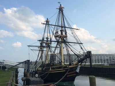
3. The Friendship replica at Derby Wharf.
Other markers no longer nearby. Salem Harbor (was here, next to this marker but has been confirmed missing); To the Farthest Port (was about 300 feet away, measured in a direct line but has been confirmed missing); a different marker also named The Pedrick Store House (was approx. ¼ mile away but has been permanently removed); Central Wharf (was approx. 0.3 miles away but has been confirmed missing); Wharves in the Late 1800s (was approx. 0.3 miles away but has been replaced with another marker now near it); Salem Maritime National Historic Site (was approx. 0.3 miles away but has been confirmed missing); Derby Wharf (was approx. 0.3 miles away but has been confirmed missing); The Custom House (was approx. 0.3 miles away but has been replaced with another marker now near it).
Credits. This page was last revised on April 21, 2023. It was originally submitted on July 31, 2015, by J. Makali Bruton of Washington, District of Columbia. This page has been viewed 642 times since then and 38 times this year. Last updated on April 18, 2023, by Craig Doda of Napoleon, Ohio. Photos: 1, 2, 3. submitted on July 31, 2015, by J. Makali Bruton of Washington, District of Columbia.
