Lebanon in Wilson County, Tennessee — The American South (East South Central)
Sellars Farm Site
Building Methods
Captions
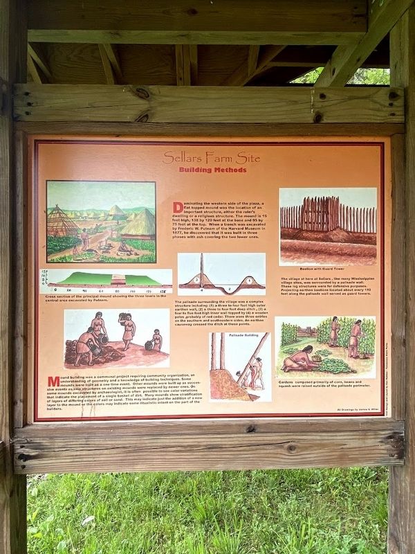
(top left): Cross section of the principal mound showing the three levels in the central area excavated by Putnam.
(bottom left): Mound building was a communal project requiring community organization, an understanding of geometry and a knowledge of building techniques. Some mounds were built as a one time event. Other mounds were built up as successive events as new structures on existing mounds were replaced by newer ones. On some mounds excavated by archaeologist, it is often possible to see color variations that indicate the placement of a single basket of dirt. Many mounds show stratification of layers of differing colors of dirt or sand. This may indicate just the addition of a new layer to the mound or the colors may indicate some ritualistic intent on the part of the builders.
(center): The palisade surrounding the village was a complex structure including (1) a three to four foot high outer earthen wall, (2) a three to four foot deep ditch, (3) a four to five foot high inner wall topped by (4) a wooden poles, probably of red cedar. There were three entries on the southern and southwestern sides. An earthen causeway crosses the ditch at these points.
(top right): Bastion with Guard Tower: The village here at Sellars, like many Mississippian village sites, were surrounded by a palisade wall. These log structures were for defensive purposes. Projecting earthen bastions located about every 110 feet along the palisade wall served as guard towers.
(lower right): Gardens composed primarily of corn, beans, and squash were raised outside of the palisade perimeter.
Erected by Tennessee State Parks.
Topics. This historical marker is listed in these topic lists: Anthropology & Archaeology • Native Americans.
Location. 36° 9.948′ N, 86° 14.572′ W. Marker is in Lebanon, Tennessee, in Wilson County. Marker can be reached from Poplar Hill Road, 0.4 miles east of Sparta Pike (U.S. 70), on the left when traveling east. Touch for map. Marker is at or near this postal address: 433 Poplar Hill Rd, Lebanon TN 37090, United States of America. Touch for directions.
Other nearby markers. At least 8 other markers are within 3 miles of this marker, measured as the crow flies. Welcome to Sellars Farm State Archaeological Area (here, next to this marker); Sellars Farm (within shouting distance of this marker); a different marker also named Sellars Farm (within shouting distance of this marker); Thompson-Partlow Cabin and Smokehouse (approx. 2.7 miles away); Cartmell Cabin (approx. 2.7 miles away); Livesay Mill (approx. 2.7 miles away); Forbes Cabin (approx. 2.7 miles away); Melrose Church (approx. 2.7 miles away). Touch for a list and map of all markers in Lebanon.
Credits. This page was last revised on May 17, 2023. It was originally submitted on April 18, 2023, by Darren Jefferson Clay of Duluth, Georgia. This page has been viewed 65 times since then and 12 times this year. Photos: 1, 2. submitted on April 18, 2023, by Darren Jefferson Clay of Duluth, Georgia. • James Hulse was the editor who published this page.

