Near Smith Hill in Westmoreland County, Virginia — The American South (Mid-Atlantic)
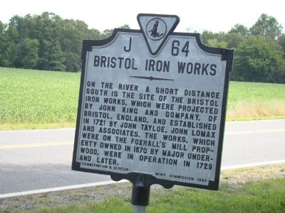
Bristol Iron Works
Erected 1935 by Conservation & Development Commission. (Marker Number J-64.)
Topics and series. This historical marker is listed in these topic lists: Colonial Era • Industry & Commerce. In addition, it is included in the Virginia Department of Historic Resources (DHR) series list. A significant historical year for this entry is 1721.
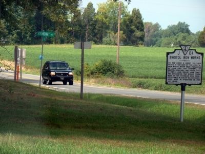
Location. 38° 10.949′ N, 77° 2.61′ W. Marker is near Smith Hill, Virginia, in Westmoreland County. Marker is at the intersection of Kings Highway (Virginia Route 3) and Claymont Road (County Route 634), on the right when traveling east on Kings Highway. Touch for map. Marker is in this post office area: Colonial Beach VA 22443, United States of America. Touch for directions.
Other nearby markers. At least 8 other markers are within 5 miles of this marker, measured as the crow flies. King George County / Westmoreland County (approx. 0.3 miles away); Charles B. Smith (approx. 2.3 miles away); History at Oak Grove (approx. 2.4 miles away); Westmoreland Association (approx. 2.4 miles away); Punishing the Nanzattico Indians (approx. 4.4 miles away); Monroe's Childhood Home (approx. 5 miles away); Birthright and Beginnings (approx. 5 miles away); Service to the Commonwealth (approx. 5 miles away).
More about this marker. The river referenced on the marker’s inscription is the Rappahannock River.
Credits. This page was last revised on June 16, 2016. It was originally submitted on September 1, 2009, by J. J. Prats of Powell, Ohio. This page has been viewed 1,313 times since then and 66 times this year. Photos: 1, 2. submitted on September 1, 2009, by J. J. Prats of Powell, Ohio.

