Near Jonesboro in Craighead County, Arkansas — The American South (West South Central)
Civil War Action in Western Craighead County
Photographed by Duane and Tracy Marsteller, April 22, 2023
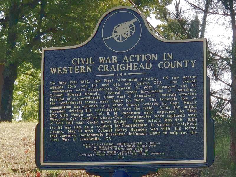
1. Civil War Action in Western Craighead County Marker
Inscription.
Civil War Action in Western Craighead County. . On June 17th 1862, the First Wisconsin Cavalry, US saw action against 30th Ark Inf. and 6th MO Militia CSA. The overall commanders were Confederate General M. Jeff Thompson and US Colonel Edward Daniels. Federal forces bivouacked at Jonesboro learned of a Confederate Camp west of Jonesboro. Federals attacked the Confederate forces were ready for them. The Federals low on ammunition was ordered to a sabre charge ordered by Capt. Henry Harnden driving the Confederates from the field. After the action LTC Alex Waugh and Col. R. H. Paramore were captured by First Wisconsin Cav. Scout Ed Abbey-Ten Confederates were captured west of Cole Hill near Cache River Bridge. Other action: May 5-9, 1864 the 1st Wis. Cav. on a scouting for Confederates in western Craighead County. May 10, 1865, Colonel Henry Harnden was with the forces that captured Confederate President Jefferson Davis to help end the Civil War in Irwinville, GA. ,
North East Arkansas Southern Heritage Foundation , Pres. W. Danny Honnoll-Sec/Treas. M. Ray Jones, Col. Robert G. Shaver Camp #1655, SCV , James W. Honnoll Chapter #2607 UDC , North East Arkansas Civil War Heritage Trails Committee , 2016
.
On June 17th 1862, the First Wisconsin Cavalry, US saw action against 30th Ark Inf. and 6th MO Militia CSA. The overall commanders were Confederate General M. Jeff Thompson and US Colonel Edward Daniels. Federal forces bivouacked at Jonesboro learned of a Confederate Camp west of Jonesboro. Federals attacked the Confederate forces were ready for them. The Federals low on ammunition was ordered to a sabre charge ordered by Capt. Henry Harnden driving the Confederates from the field. After the action LTC Alex Waugh and Col. R. H. Paramore were captured by First Wisconsin Cav. Scout Ed Abbey-Ten Confederates were captured west of Cole Hill near Cache River Bridge. Other action: May 5-9, 1864 the 1st Wis. Cav. on a scouting for Confederates in western Craighead County. May 10, 1865, Colonel Henry Harnden was with the forces that captured Confederate President Jefferson Davis to help end the Civil War in Irwinville, GA.
North East Arkansas Southern Heritage Foundation
Pres. W. Danny Honnoll-Sec/Treas. M. Ray Jones
Col. Robert G. Shaver Camp #1655, SCV
James W. Honnoll Chapter #2607 UDC
North East Arkansas Civil War Heritage Trails Committee
2016
Erected 2016
Click or scan to see this page online
by North East Arkansas Southern Heritage Foundation • Col. Robert G. Shaver Camp #1655, Sons of Confederate Veterans • James W. Honnoll Chapter #2607, United Daughters of the Confederacy • North East Arkansas Civil War Heritage Trails Committee.
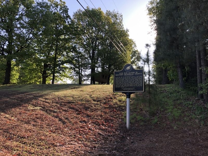
Location. 35° 51.041′ N, 90° 49.684′ W. Marker is near Jonesboro, Arkansas, in Craighead County. It is at the intersection of East Kings Highway (Arkansas Route 18/91) and Jacksonport Road (County Road 118), on the left when traveling east on East Kings Highway. Touch for map. Marker is in this post office area: Bono AR 72416, United States of America. Touch for directions.
Regionally, this marker is in Arkansas’ Crowley’s Ridge and in the Mississippi Alluvial Plain. It is also in the American South and specifically in the Upper South. Globally, it is in North America, the Western Hemisphere,
Photographed by Duane and Tracy Marsteller, April 22, 2023
2. Civil War Action in Western Craighead County Marker
the Western World, and the Anglosphere. Historically, it finds itself in what was once the territory of the Mississippian Culture, the Louisiana Purchase, one of the Confederate States of America, and the Antebellum South.
Unknown via HathiTrust Digital Library; Wikipedia; and Ohio State University (Public Domain), circa 1860/65
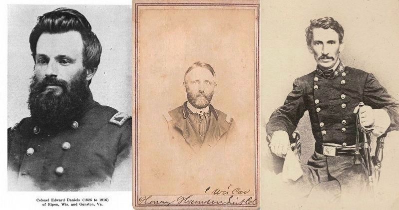
3. Officers in Western Craighead County Action
Composite of Union Col. Edward Daniels (left), Union Col. Henry Harden (center) and Confederate Gen. Meriwether Jeff Thompson (right).
Credits. This page was last revised on April 27, 2023. It was originally submitted on April 24, 2023, by Duane and Tracy Marsteller of Murfreesboro, Tennessee. This page has been viewed 629 times since then and 30 times this year. Photos:1, 2, 3. submitted on April 24, 2023, by Duane and Tracy Marsteller of Murfreesboro, Tennessee.