Near Baker in San Bernardino County, California — The American West (Pacific Coastal)
Zzyzx Mineral Springs Resort
Desert Studies Center
Photographed by Craig Baker, April 19, 2023
1. Zzyzx Mineral Springs Resort Marker
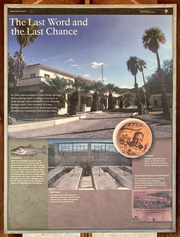
The Last Word and the Last Chance
In 1944, radio evangelist Curtis Howe Springer filed a mining claim on public lands here at Soda Springs and established Zzyzx Mineral Springs resort. Over the next 30 years, Springer transformed this desert oasis into the attractive landscape that you see today.
Last Word
Springer created the name Zzyzx as the last word in health, ensuring it would be the last listing in any directory.
Last Chance
When Curtis Springer stocked his new lake with fish from a nearby spring, he inadvertently took the first step in saving the endangered Mohave tui chub. The fish had once lived all along the Mojave River, but by the 1960s, they were found in only one small spring near here. Springer moved some into his lake, where their numbers increased. In recent years, biologists have moved chubs to other ponds, and plan to continue establishing new populations.
Bath House
The bath house at the end of the Boulevard of Dreams included a small pool as well as indoor and outdoor cement tubs for mineral soaks.
Zzyzx Mineral Springs and Health Resort
this page online
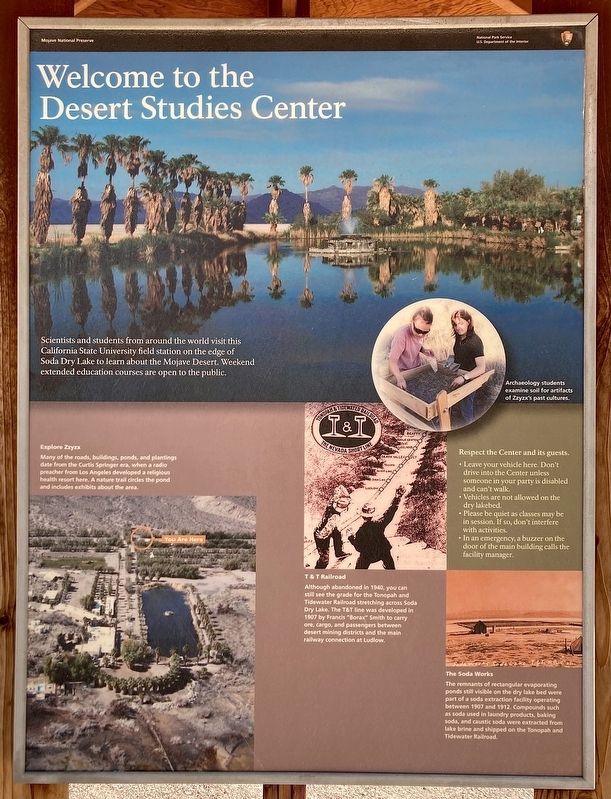
Welcome to the Desert Studies Center
Scientists and students from around the world visit this California State University field station on the edge of Soda Dry Lake to learn about the Mojave Desert. Weekend extended education courses are open to the public.
T&T Railroad
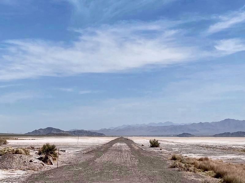
Although abandoned in 1940, you can still see the grade for the Tonopah and Tidewater Railroad stretching across Soda Dry Lake. The T&T line was developed in 1907 by Francis “Borax” Smith to carry ore, cargo, and passengers between desert mining districts and the main railway connection at Ludlow.
The Soda Works
The remnants of rectangular evaporating ponds still visible on the dry lake bed were part of a soda extraction facility operating between 1907 and 1912. Compounds such as sodas used in laundry products, baking soda, and caustic soda were extracted from lake brine and shipped on the Tonopah and Tidewater Railroad.
Explore Zzyzx
Many
Photographed by Craig Baker, April 19, 2023
2. Zzyzx Mineral Springs Resort Marker
Respect the Center and its guests
Leave your vehicle here. Don't drive into the Center unless someone in your party is disabled and can't walk. Vehicles are not allowed on the dry lakebed. Please be quiet as classes may be in session. If so, don't interfere with activities. In an emergency, a buzzer on the door of the main building calls the facility manager.
Topics. This historical marker is listed in these topic lists: Education • Industry & Commerce • Religion & Religious Structures • Science & Medicine. A significant historical year for this entry is 1944.
Location. 35° 8.618′ N, 116° 6.399′ W. Marker is near Baker, California, in San Bernardino County. It is on Zzyzx Road 5 miles south of Interstate 15, on the right when traveling south. Touch for map. Marker is at or near this postal address: 49441 Zzyzx Rd, Baker CA 92309, United States of America. Touch for directions.

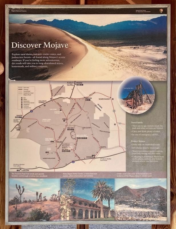
Regionally,
Photographed by Craig Baker, April 19, 2023
3. Zzyzx Mineral Springs Resort Marker
Things to do in the East Mojave area.
Other nearby markers. At least 8 other markers are within 10 miles of this marker, measured as the crow flies: Soda Springs - Zzyzx Mineral Springs (within shouting distance of this marker); The Desert Studies Center (approx. 0.2 miles away); A Traveler's Rest (approx. 0.2 miles away); A Lost Lake (approx. 0.2 miles away); Francis Marion "Borax" Smith (approx. 3.9 miles away); World’s Tallest Thermometer (approx. 8.7 miles away); Bun Boy Restaurant (approx. 8.7 miles away); Marl Springs / Seventeenmile Point (approx. 9.3 miles away). Touch for a list and map of all markers in Baker.
Also see . . . Zzyzx - with Huell Howser. In this half-hour video, produced for local PBS television stations in 2008, Huell
Photographed by Craig Baker, April 19, 2023
4. Zzyzx Mineral Springs Resort Marker
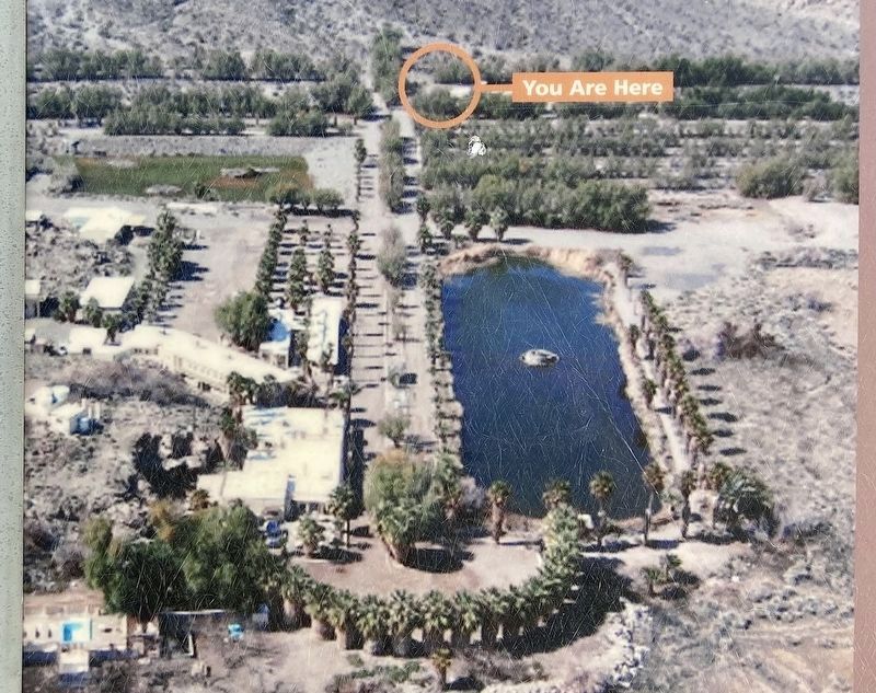
5. Zzyzx Marker Detail
Photographed by Craig Baker, April 19, 2023
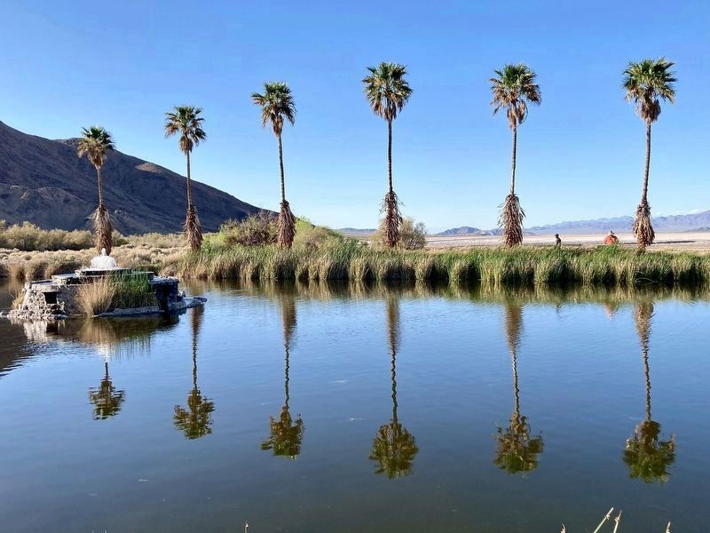
6. Zzyzx Pond and Fountain
This is the only area open to the public.
Photographed by Craig Baker, April 20, 2023
7. T&T Railroad Grade
Photographed by Denise Boose, May 19, 2015
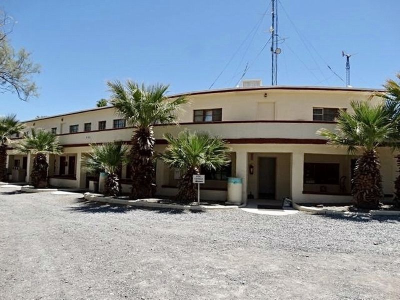
8. “The Castle” Dormitory Rooms
Photographed by Denise Boose, May 19, 2015
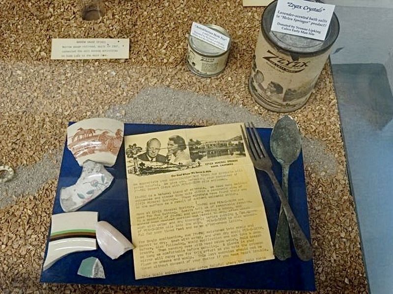
9. Mini Museum
Photographed by Craig Baker, April 20, 2023
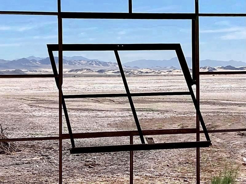
10. Zzyzx Mineral Springs Resort
View of the lake bed from the abandoned baths.
Credits. This page was last revised on May 16, 2024. It was originally submitted on April 25, 2023, by Craig Baker of Sylmar, California. This page has been viewed 1,795 times since then and 233 times this year. Photos: 1, 2, 3, 4, 5, 6, 7. submitted on April 25, 2023, by Craig Baker of Sylmar, California. 8, 9. submitted on July 11, 2023, by Denise Boose of Tehachapi, California. 10. submitted on April 25, 2023, by Craig Baker of Sylmar, California.
