Gore near Summerville in Chattooga County, Georgia — The American South (South Atlantic)
A Snapshot of Cherokee Life
Dirt Town
— Trail of Tears National Historic Trail —
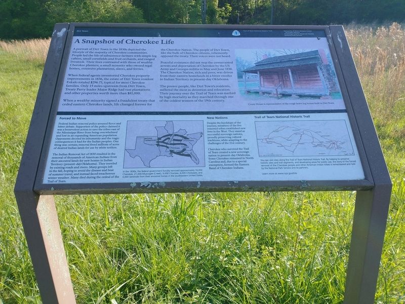
A portrait of Dirt Town in the 1830s depicted the lifestyle of the majority of Cherokee communities. People led the life of subsistence farmers with simple log cabins, small cornfields and fruit orchards, and ranged livestock. Their lives contrasted with those of wealthy Cherokee planters, a small minority who owned regal homes, extensive plantations, slaves, and ferries.
When federal agents inventoried Cherokee property improvements in 1836, the estate of Dirt Town resident Eskalo totaled $296.75, typical for most Cherokee families. Only 15 miles upstream from Dirt Town, Treaty Party leader Major Ridge had vast plantations and other properties worth more than $81,000.
When a wealthy minority signed a fraudulent treaty that ceded eastern Cherokee lands, life changed forever for the Cherokee Nation. The people of Dirt town, like the bulk of Cherokee citizens, vehemently opposed the treaty. Their voices were not heard.
Peaceful resistance did not stop the unwarranted arrests and deportation of Cherokee by the US Army and Georgia militia in May and June 1838. The Cherokee Nation, rich and poor, was driven from their eastern homelands in a bitter exodus to Indiana Territory in present-day Oklahoma.
The poorer people, like Dirt Town's residents, suffered the most in detention and relocation. Their journey over the Trail of Tears was marked by high mortality as they marched through on of the coldest winters of the 19th century.
Forced to Move
Federal Indian removal policy aroused fierce and bitter debate. Supporters of the policy claimed it was a benevolent action to save the tribes east of the Mississippi River from being overwhelmed and lost in an expanding American population. Opponents decried its inhumanity and the tragic consequences it had for the Indian peoples. One thing was certain; removal freed millions of acres of desired Indian lands for use by white settlers.
The Indian Removal Act of 1830 resulted in the removal of thousands of American Indians from their ancestral lands for new homes in Indian Territory (present-day Oklahoma). They traveled by existing roads and rivers. Many groups left in the fall, hoping to avoid the disease and heat of summer travel, and instead faced treacherous winter weather. Many died during the ordeal of Trail of Tears.
New Nations
Despite the hardships of the journey, members of the five removed tribes established new lives in the West. They stand as successful sovereign nations, proudly preserving cultural traditions, while adapting to the challenges of the 21st century.
Cherokee who survived the Trail of Tears created a new sovereign nation in present-day Oklahoma. Some Cherokee remained in North Carolina and, due to a special exemption, formed the Eastern Band of Cherokee Indians.
[Captions:]
Couey House is representative of the rough hewn log homes built in Dirt Town.
In the 1830s, the federal government forcibly removed approximately 16,000 Cherokee, 21,000 Muscogee (Creek), 9,000 Choctaw, 6,000 Chickasaw, and 4,000 Seminole from their ancestral homes in the southeastern United States.
Trail of Tears National Historic Trail
You can visit sites along the Trail of Tears National Historic Trail. By helping preserve historic sites and trail segments, and developing areas for public use, the story of the forced removal of the Cherokee people and other American Indian tribes is remembered and told by the National Park Service and its partners. Learn more at www.nps.gov/trte
Erected by University of West Georgia Center for Public History; Chattooga County Historical Society; National Park Service, U.S. Department of the Interior.
Topics and series. This historical marker is listed in these topic lists: Agriculture • Government & Politics • Native Americans • Settlements & Settlers. In addition, it is included in the Trail of Tears series list. A significant historical month for this entry is June 1838.
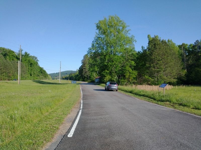
Location. 34° 27.604′ N, 85° 15.441′ W. Marker is near Summerville, Georgia, in Chattooga County. It is in Gore. Marker is at the intersection of Gore Fire Hall Road and Martha Berry Highway (U.S. 27), on the left when traveling east on Gore Fire Hall Road. Touch for map. Marker is at or near this postal address: 9 Gore Fire Hall Rd, Summerville GA 30747, United States of America. Touch for directions.
Other nearby markers. At least 8 other markers are within 7 miles of this marker, measured as the crow flies. The Couey House (approx. 5.2 miles away); Boyles Yard Turntable Named Summerville Railroad Turntable (approx. 5.2 miles away); Summerville, Georgia (approx. 5.2 miles away); Chattooga County (approx. 5.4 miles away); Trion Factory (approx. 5.9 miles away); Floyd Springs (approx. 6.3 miles away); a different marker also named Trion Factory (approx. 6˝ miles away); First Cotton Mill In Northwest Georgia (approx. 6.7 miles away). Touch for a list and map of all markers in Summerville.
Credits. This page was last revised on May 12, 2023. It was originally submitted on April 25, 2023, by Tom Bosse of Jefferson City, Tennessee. This page has been viewed 118 times since then and 28 times this year. Photos: 1, 2. submitted on April 25, 2023, by Tom Bosse of Jefferson City, Tennessee. • Devry Becker Jones was the editor who published this page.

