Columbus in Muscogee County, Georgia — The American South (South Atlantic)
Victory Drive
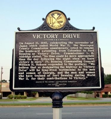
Photographed by David Seibert, August 24, 2009
1. Victory Drive Marker
Erected 2008 by Historic Chattahoochee Commission and the Victory Coalition.
Topics. This historical marker is listed in these topic lists: Government & Politics • Military • Roads & Vehicles • War, World II. A significant historical year for this entry is 1945.
Location. 32° 25.117′ N, 84° 56.7′ W. Marker is in Columbus, Georgia, in Muscogee County. It is at the intersection of Victory Drive (U.S. 27) and Marathon Drive, on the right
this page online

Regionally, this marker is in the Piedmont. It is also in the American South and specifically in the Deep South. Globally, it is in North America, the Western Hemisphere, the Western World, and the Anglosphere. Historically, it finds itself in what was once the territory of the Mississippian Culture, one of the original Thirteen Colonies, one of the Confederate States of America, and the Antebellum South.
Other nearby markers. At least 8 other markers are within 3 miles of this marker, measured as the crow flies: "Torch Hill" (approx. 0.4 miles away); Baker High School (approx. 0.4 miles away); POW ✯ MIA Monument (approx. 2.1 miles away); The Infantryman (approx. 2.1 miles away); Specialist Ross A. McGinnis (approx. 2.1 miles away); World Trade Center Beam Memorial (approx. 2.2 miles away); Dedicated to the American Revolutionary War Infantryman (approx. 2.2 miles away); The "Chattahoochee Choo Choo" (approx. 2.2 miles away). Touch for a list and map
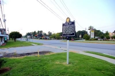
Photographed by David Seibert, August 24, 2009
2. Victory Drive Marker
Looking northwest on Victory Drive, toward downtown Columbus
Credits. This page was last revised on June 16, 2016. It was originally submitted on September 3, 2009, by David Seibert of Sandy Springs, Georgia. This page has been viewed 2,500 times since then and 98 times this year. Photos: 1, 2. submitted on September 3, 2009, by David Seibert of Sandy Springs, Georgia. • Bill Pfingsten was the editor who published this page.
