East Nashville in Davidson County, Tennessee — The American South (East South Central)
More Than Survival
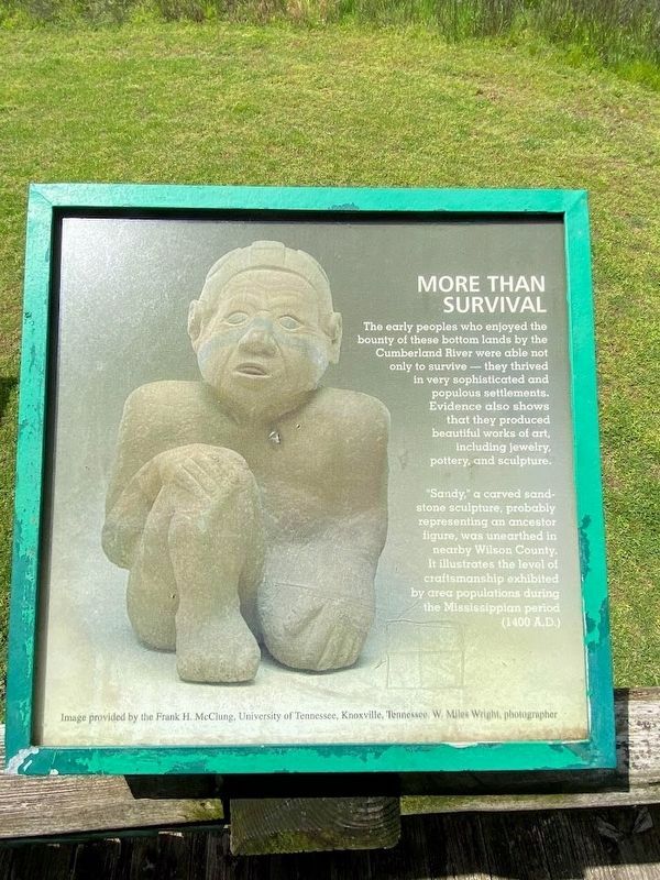
The early peoples who enjoyed the bounty of these bottom lands by the Cumberland River were able not only to survive - they thrived in very sophisticated and populous settlements. Evidence also shows that they produced beautiful works of art, including jewelry, pottery, and sculpture.
"Sandy," a carved sandstone sculpture, probably representing an ancestor figure, was unearthed in nearby Wilson County. It illustrates the level of craftsmanship exhibited by area populations during the Mississippian period (1400 A.D.)
Image provided by the Frank H. McClung, University of Tennessee, Knoxville, Tennessee. W. Miles Wright, photographer
Topics. This historical marker is listed in these topic lists: Anthropology & Archaeology • Native Americans. A significant historical year for this entry is 1400.
Location. 36° 10.13′ N, 86° 43.14′ W. Marker is in Nashville, Tennessee, in Davidson County. It is in East Nashville. Marker can be reached from Shelby Bottoms Greenway east of Through the Woods, on the right when traveling south. Touch for map. Marker is in this post office area: Nashville TN 37206, United States of America. Touch for directions.
Other nearby markers. At least 8 other markers are within 2 miles of this marker, measured as the crow flies. Shelby Bottoms (within shouting distance of this marker); a different marker also named Shelby Bottoms (approx. ¼ mile away); a different marker also named Shelby Bottoms (approx. 0.3 miles away); a different marker also named Shelby Bottoms (approx. 0.4 miles away); Shelby Park (approx. ¾ mile away); The VinnyLinks Golf Course (approx. 0.9 miles away); Lockeland Spring (approx. 1.3 miles away); Confederate Circle at Mount Olivet (approx. 1.3 miles away). Touch for a list and map of all markers in Nashville.
Credits. This page was last revised on April 29, 2023. It was originally submitted on April 28, 2023, by Darren Jefferson Clay of Duluth, Georgia. This page has been viewed 63 times since then and 15 times this year. Photos: 1, 2. submitted on April 28, 2023, by Darren Jefferson Clay of Duluth, Georgia. • Devry Becker Jones was the editor who published this page.

