Frankfort in Franklin County, Kentucky — The American South (East South Central)
Franklin County Hemp
⎯⎯⎯
Hemp in Kentucky
Photographed by Ginger Drenning, August 25, 2009
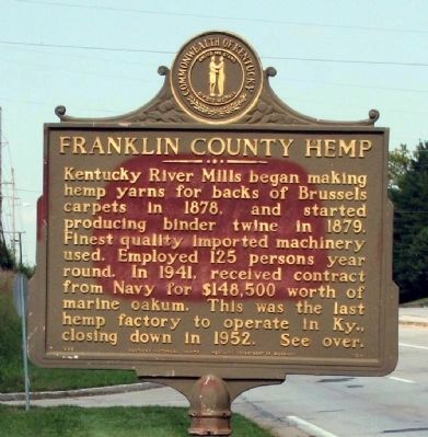
1. Side A - - Franklin County Hemp Marker
(Click any photo to see details...)
Side A
Kentucky River Mills began making hemp yarns for backs of Brussels carpets in 1878, and started producing binder twine in 1879. Finest quality imported machinery used. Employed 125 persons year round. In 1941, received contract from Navy for $148,500 worth of marine oakum. This was the last hemp factory to operate in Ky., closing down in 1952. See over.
Side B
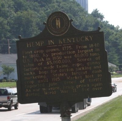
First crop grown, 1775. From 1840 to 1860, Ky.'s production largest in U.S. Peak in 1850 was 40,000 tons, with value of $5,000,000. Scores of factories made twine, rope, gunny sacks, bags for cotton picking and marketing. State's largest cash crop until 1915. Market lost to imported jute, freed of tariff. As war measure, hemp grown again during World War II. See over.
Erected by Kentucky Historical Society, Kentucky Department of Highways. (Marker Number 1164.)
Topics and series. This historical marker is listed in these topic lists: Horticulture & Forestry • Industry & Commerce • Notable Events • Notable Places • War, World II. In addition, it is included in the Kentucky Historical Society series list. A significant historical year for this entry is 1878.
Location. 38° 12.654′ N,
this page online

Regionally, this marker is in the Bluegrass Region. It is also in the American South and specifically in the Upper South. Globally, it is in North America, the Western Hemisphere, the Western World, and the Anglosphere. Historically, it finds itself in what was once the territory of the Mississippian Culture and also the Antebellum South.
Other nearby markers. At least 8 other markers are within walking distance of this marker: Glen Willis (about 400 feet away, measured in a direct line); Great Buffalo Trace (approx. 0.2 miles away); Leestown (approx. ¼ mile away); O.F.C.–Stagg Distillery (approx. ¼ mile away); Stony Point (approx. ¼ mile away); Buffalo Trace (approx. 0.3 miles away); Free House (approx. 0.4 miles away); Remembering The Soldiers Of The War Of 1812 On Both Sides (approx. 0.4 miles away). Touch for a list and map of all markers
Photographed by Ginger Drenning, August 25, 2009
2. Side B - - Franklin County Hemp Marker
Related marker. Click here for another marker that is related to this marker. Woodford County Hemp
Photographed by Ginger Drenning, August 25, 2009
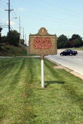
3. Long View Side A - - Franklin County Hemp Marker
Photographed by Ginger Drenning, August 25, 2009
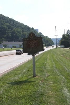
4. Long View Side B - - Franklin County Hemp Marker
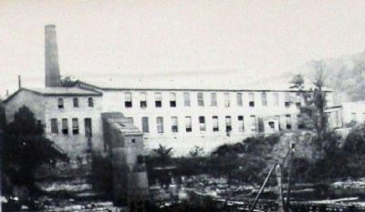
Photographed by Ginger Drenning, circa Unknown
5. The Original 1878 "Kentucky River Mills Company" Hemp Facility
The "Kentucky River Mills Company" was located at the dam a short walk to the north from the Marker. It sat about where "Jim's Restaurant" is now located.
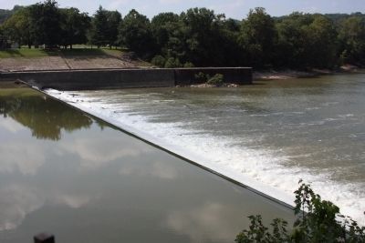
Photographed by Ginger Drenning, August 25, 2009
6. Mill Dam located on Kentucky River
Water from the Mill Dam was used by a water Trubine to power the Mill in its early days of production.
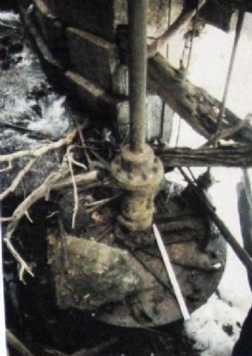
Photographed by Ginger Drenning, circa Unknown
7. The Upper Part - - of the Old Water Turbine at the Mill...
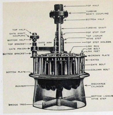
Photographed by Ginger Drenning, circa Unknown
8. "Diagram" of the Water Turbine
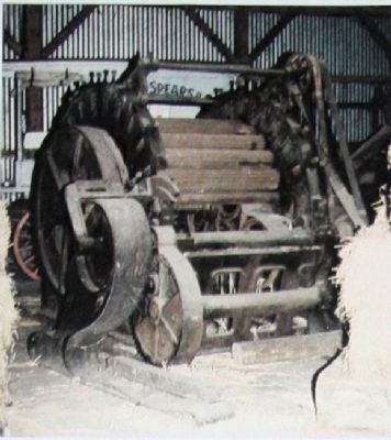
Photographed by Ginger Drenning, circa Unknown
9. Hemp Softening Machine
This machine is located at the "Woodford Spears and Sons" mill and is similar to the ones used at the "Kentucky River Mills Company".
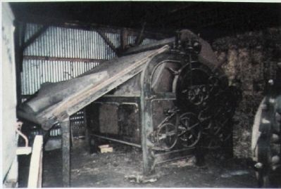
Photographed by Ginger Drenning, circa Unknown
10. Hemp Carding Machine
This machine is located at the "Woodford Spears and Sons" mill and is similar to the ones used at the "Kentucky River Mills Company".
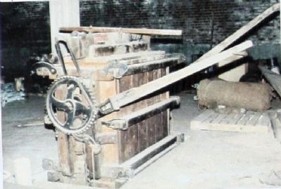
Photographed by Ginger Drenning, circa Unknown
11. Another Machine
This machine is located at the "Woodford Spears and Sons" mill and is similar to the ones used at the "Kentucky River Mills Company".
((These machines are circa 1912 imported from Belfast, Ireland.))
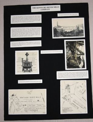
Photographed by Ginger Drenning, Unknown
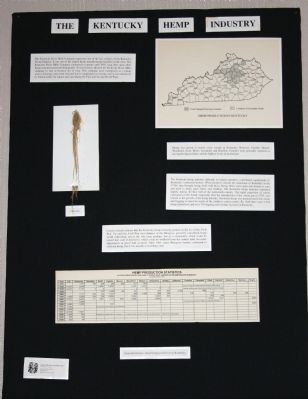
12. Display # 1 - - Items about the Hemp Mill
These display boards are located in " Jim's Restaurant " which is now sitting on the Mill Site...
Photographed by Ginger Drenning, circa Unknown
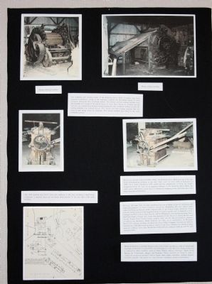
13. Display # 2 - - Items about the Hemp Mill
Photographed by Ginger Drenning, circa Unknown
14. Display # 3 - - Items about the Hemp Mill
Photographed by Ginger Drenning, August 25, 2009
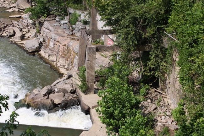
15. Last of the Timbers from the River Dock ....
The Kencucky River Dock was used to transport products in and out. Its location is just behind "Jim's Restaurant" - which is a short walk North from the Historic Marker.
Credits. This page was last revised on December 14, 2020. It was originally submitted on September 4, 2009, by Al Wolf of Veedersburg, Indiana. This page has been viewed 2,962 times since then and 61 times this year. Photos: 1, 2, 3, 4. submitted on September 4, 2009, by Al Wolf of Veedersburg, Indiana. 5, 6, 7, 8, 9, 10, 11, 12, 13, 14, 15. submitted on September 7, 2009, by Al Wolf of Veedersburg, Indiana. • Bill Pfingsten was the editor who published this page.
