Spirit Mound Township near Vermillion in Clay County, South Dakota — The American Midwest (Upper Plains)
Hill of Chalk
| — | Missouri National Recreational River | — |
April 15, 2023
1. Hill of Chalk Marker
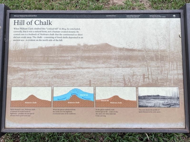
When William Clark climbed this "conical hill" in 1804, he concluded, correctly, that it was a natural form, not a human-created mound. Its central core is a bedrock of Niobrara chalk that the continental ice sheet did not erode away. The chalk—consisting of fossil shells deposited in an ancient sea—is evident on the north side of the hill.
Captions:
Spirit Mound's core, Niobrara chalk—a remnant of eroded bedrock highlands—predates the last glacial advance here 13,000 years ago.
When the glacier advanced from the north over the highland, it removed some of the sediment.
As the glacier melted, it left behind glacial till—a mix of clay, silt, sand, and other materials it was carrying.
This view shows the profile of Spirit Mound in the early 1900s.
Erected by Spirit Mound Trust, South Dakota Department of Game, Fish and Parks, and National Park Service U.S. Department of the Interior.
Topics and series. This historical marker is listed in these topic lists: Environment • Exploration. In addition, it is included in the Lewis & Clark Expedition series list. A significant historical year for this entry is 1804.
Location. 42° 52.334′ N,
this page online

Regionally, this marker is in East River. It is also in the American Lewis & Clark Corridor, on the prairies, and on the Northern Plains. Globally, it is in North America, the Western Hemisphere, the Western World, and the Anglosphere. Historically, it finds itself in what was once Rupert’s Land and also the Louisiana Purchase.
Other nearby markers. At least 8 other markers are within walking distance of this marker: Canotina Paha | Mountain of Little People (approx. 0.2 miles away); Daughters of the American Revolution Spirit Mound Monument (approx. ¼ mile away); Spirit Mound Monument (approx. ¼ mile away); Hill of Little Spirits (approx. ¼ mile away); Spirit Mound (approx. 0.3 miles away); From Lewis and Clark to the Future
April 15, 2023
2. Hill of Chalk Marker
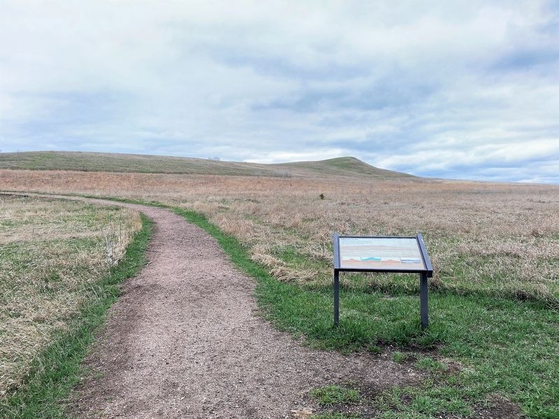
Spirit Mound can be seen in the background.
April 15, 2023
3. Hill of Chalk Marker
Credits. This page was last revised on May 5, 2023. It was originally submitted on May 4, 2023. This page has been viewed 337 times since then and 51 times this year. Photos: 1, 2, 3. submitted on May 4, 2023.
