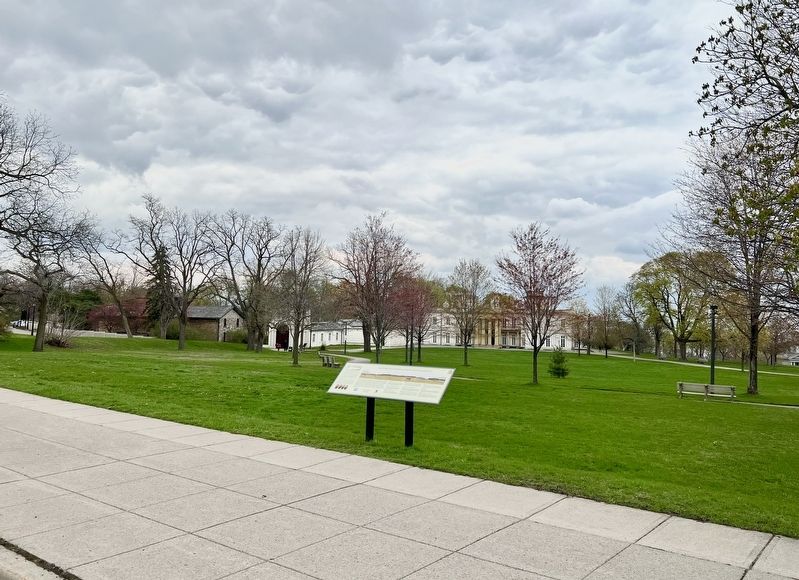
Burlington Heights in Hamilton, Ontario — Central Canada (North America)
Military Occupation of Burlington Heights
[text on left side]
BLOODY ASSIZE
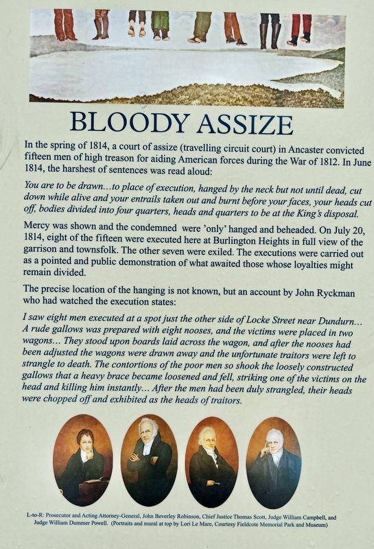
In the spring of 1814, a court of assize (travelling circuit court) in Ancaster convicted fifteen men of high treason for aiding American forces during the War of 1812. In June 1814, the harshest of sentences was read aloud:
You are to be drawn...to place of execution, hanged by the neck but not until dead, cut down while alive and your entrails taken out and burnt before your faces, your heads cut off, bodies divided into four quarters, heads and quarters to be at the King's disposal. Mercy was shown and the condemned were 'only' hanged and beheaded. On July 20, 1814, eight of the fifteen were executed here at Burlington Heights in full view of the garrison and townsfolk. The other seven were exiled. The executions were carried out as a pointed and public demonstration of what awaited those whose loyalties might remain divided.
The precise location of the hanging is not known, but an account by John Ryckman who had watched the execution states: I saw eight men executed at a spot just the other side of Locke Street near Dundurn... A rude gallows was prepared with eight nooses, and the victims were placed in two wagons... They stood upon boards laid across the wagon, and after the nooses had been adjusted the wagons were drawn away and the unfortunate traitors were left to strangle to death. The contortions of the poor men so shook the loosely constructed gallows that a heavy brace became loosened and fell, striking one of the victims on the head and killing him instantly... After the men had been duly strangled, their heads were chopped off and exhibited as the heads of traitors.
[text centre-left]
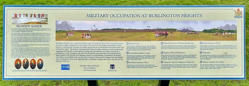
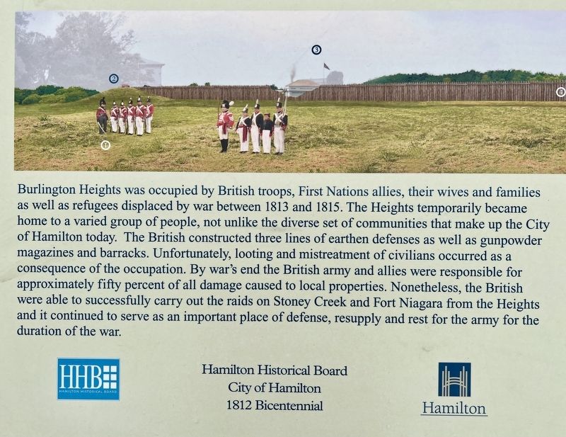
Burlington Heights was occupied by British troops, First Nations allies, their wives and families as well as refugees displaced by war between 1813 and 1815. The Heights temporarily became home to a varied group of people, not unlike the diverse set of communities that make up the City of Hamilton today. The British constructed three lines of earthen defenses as well as gunpowder magazines and barracks. Unfortunately, looting and mistreatment of civilians occurred as a consequence of the occupation. By war's end the British army and allies were responsible for approximately fifty percent of all damage caused to local properties. Nonetheless, the British were able to successfully carry out the raids on Stoney Creek and Fort Niagara from the Heights and it continued to serve as an important place of defense, resupply and rest for the army for the duration of the war.
Hamilton Historical Board
City of Hamilton
1812 Bicentennial
[text centre-right]
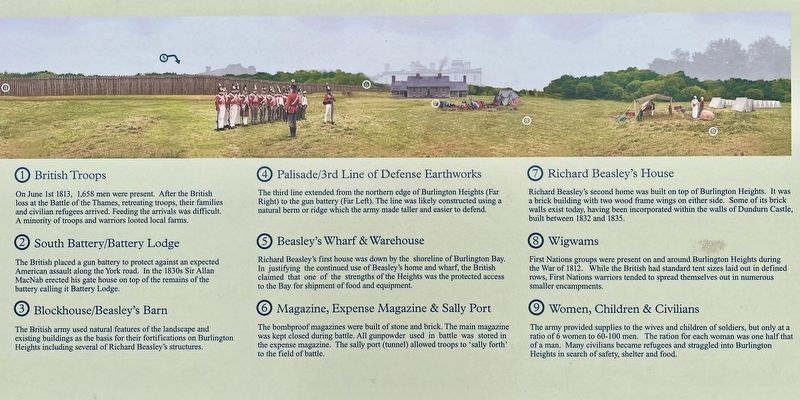
1.British Troops
On June 1st 1813, 1.658 men were present. After
the British loss at the Battle of the Thames, retreating troops, their families and civilian refugees arrived. Feeding the arrivals was difficult. A minority of troops and warriors looted local farms.
2. South Battery/Battery Lodge
The British placed a gun battery to protect against an expected American assault along the York road. In the 1830s Sir Allan MacNab erected his gate house on top of the remains of the battery calling it Battery Lodge.
3. Blockhouse/Beasley's Barn
The British army used natural features of the landscape and existing buildings as the basis for their fortifications on Burlington Heights including several of Richard Beasley's structures.
4. Palisade/3rd Line of Defense Earthworks
The third line extended from the northern edge of Burlington Heights (Far Right) to the gun battery (Far Left). The line was likely constructed using a natural berm or ridge which the army made taller and easier to defend.
5. Beasley's Wharf & Warehouse
Richard Beasley's first house was down by the shoreline of Burlington Bay. In justifying the continued use of Beasley's home and wharf, the British claimed that one of the strengths of the Heights was the protected access to the Bay for shipment of food and equipment.
6. Magazine, Expense Magazine & Sally Port
The bombproof magazines were built of stone and brick.
The main magazine was kept closed during battle. All gunpowder used in battle was stored in the expense magazine. The sally port (tunnel) allowed troops to 'sally forth to the field of battle.
7. Richard Beasley's House
Richard Beasley's second home was built on top of Burlington Heights. It was a brick building with two wood frame wings on either side. Some of its brick walls exist today, having been incorporated within the walls of Dundurn Castle, built between 1832 and 1835.
8. Wigwams
First Nations groups were present on and around Burlington Heights during the War of 1812. While the British had standard tent sizes laid out in defined rows, First Nations warriors tended to spread themselves out in numerous smaller encampments.
9. Women, Children & Civilians
The army provided supplies to the wives and children of soldiers, but only at a ratio of 6 women to 60-100 men. The ration for each woman was one half that of a man. Many civilians became refugees and straggled into Burlington Heights in search of safety, shelter and food.
Topics. This historical marker is listed in these topic lists: Forts and Castles • Law Enforcement • Native Americans • War of 1812. A significant historical date for this entry is July 20, 1814.
Location. 43° 16.104′ N, 79° 53.118′ W. Marker is in Hamilton
, Ontario. It is in Burlington Heights. Marker is at the intersection of York Boulevard and Dundurn Street North, on the right when traveling east on York Boulevard. Touch for map. Marker is in this post office area: Hamilton ON L8R 1Y3, Canada. Touch for directions.
Other nearby markers. At least 8 other markers are within walking distance of this marker. Dundurn Castle (about 90 meters away, measured in a direct line); Sir Allan Napier MacNab (about 90 meters away); a different marker also named Dundurn Castle (about 150 meters away); Sir John Harvey (about 150 meters away); United Empire Loyalists (about 150 meters away); Defensive Outwork (about 240 meters away); First Line of Defense (approx. 0.4 kilometers away); Burlington Heights 1813 - 1814 (approx. 0.4 kilometers away).
Also see . . . Canada’s Defenders Made Their Stand on Burlington heights. Hamilton Spectator article: As motorists zip along York Boulevard between Dundurn Castle and Hamilton Cemetery, they likely don’t appreciate that this high strip of land was the hinge on which Canada’s future swung 200 years ago. Burlington Heights was Britain’s line in the sand in the War of 1812, a key strategic site for its North American ambitions. If it had been lost or abandoned, we might now be saluting the Stars and Stripes in these parts. As well as a stronghold against marauding Americans, it was a refuge for harassed settlers and a vital gathering point for Native allies. (Submitted on May 4, 2023, by Tim Boyd of Hamilton, Ontario.)
Credits. This page was last revised on May 7, 2023. It was originally submitted on May 4, 2023, by Tim Boyd of Hamilton, Ontario. This page has been viewed 125 times since then and 43 times this year. Photos: 1, 2, 3, 4, 5, 6. submitted on May 4, 2023, by Tim Boyd of Hamilton, Ontario. • Andrew Ruppenstein was the editor who published this page.
