
Near Dahlgren in King George County, Virginia — The American South (Mid-Atlantic)
Civil War Action At Mathias Point
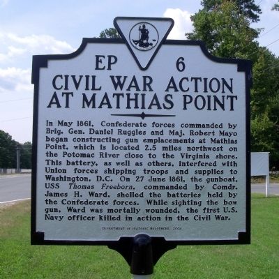
Photographed by Bernard Fisher, September 1, 2009
1. Civil War Action At Mathias Point Marker
Erected 2009 by Department of Historic Resources. (Marker Number EP-6.)
Topics and series. This historical marker is listed in this topic list: War, US Civil. In addition, it is included in the Virginia Department of Historic Resources (DHR) series list. A significant historical month for this entry is May 1861.
Location. 38° 21.552′ N, 77° 1.1′ W. Marker is near Dahlgren, Virginia, in King George County. It is on James Madison Parkway (U.S. 301) 0.3 miles north of Barnsfield Road, on the left when traveling north. Touch for map.
this page online

Regionally, this marker is in the American South, specifically in the Upper South, in the Mid-Atlantic, in the Tidewater, in the Chesapeake Bay Region, and on the Eastern Seaboard. Globally, it is in the North Atlantic Region, North America, the Western Hemisphere, the Western World, and the Anglosphere. Historically, it finds itself in what was once the territory of the Mississippian Culture, one of the original Thirteen Colonies, one of the Confederate States of America, and the Antebellum South.
Other nearby markers. At least 8 other markers are within 3 miles of this marker, measured as the crow flies: Mathias Point (within shouting distance of this marker); Historic Guns (approx. 2.3 miles away); 19 Inch Armor Plate (approx. 2½ miles away); Dahlgren's Naval Ordnance Testing (approx. 2½ miles away); Parade Field (approx. 2½ miles away); Serial Number 278L (approx. 2½ miles away); Laidler's Ferry (approx. 2.6 miles away in Maryland); Crossing the Potomac (approx. 3.1 miles away in Maryland).

Photographed by Bernard Fisher, September 1, 2009
2. Civil War Action At Mathias Point Marker
Original location.
Another marker is no longer nearby. "Cliffton" (was approx. 2.1 miles away in Maryland but has been confirmed missing).
More about this marker. The marker was relocated about 200' northwest of its original location as part of Route 301 expansion.

circa 2024
3. Civil War Action At Mathias Point Marker
Relocated 200 ft NW in 2024 following expansion of US-301 to four lanes.
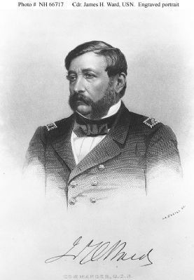
4. Commander James H. Ward, USN, (1806-1861)
The first U.S. Navy officer killed in action in the Civil War. Naval History & Heritage Command, Photo #: NH 66717
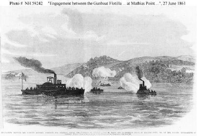
1861
5. Engagement at Mathias Point
"Engagement between the Gunboat Flotilla, Freeborn and Reliance, under the Command of Captain James H. Ward, and a Secession Force at Mathias Point, Va., on the Potomac River -- Death of Captain Ward.", 27 June 1861
Line engraving, based on a sketch by an "Officer of the Expedition", published in "Frank Leslie's Illustrated Newspaper", 1861. It depicts USS Thomas Freeborn, Ward's flagship, in the left foreground. The U.S. Tug Resolute is at right. Naval History & Heritage Command, Photo #: NH 59242
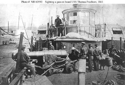
6. USS Thomas Freeborn (1861-1865)
Some of the ship's officers and men demonstrate how her late Commanding Officer, Commander James H. Ward, was sighting her bow gun when he was mortally wounded on 27 June 1861, during an action with Confederate forces at Mathias Point, Virginia.
The gun is a 32 pounder smoothbore, of 60 hundredweight, on a "Novelty Carriage". This mounting was developed by Commander Ward before the Civil War.
Location appears to be the Washington Navy Yard, D.C. Naval History & Heritage Command, Photo #: NH 60990
Photographed by Evan Dwyer
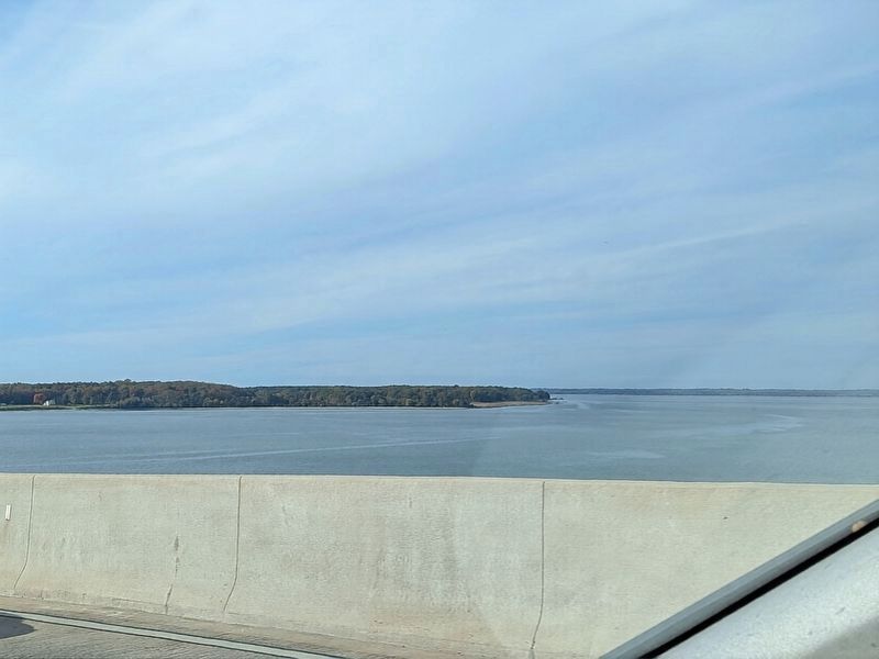
7. Persimmon & Mathias Points
Mathias Point is not accessible to the public - roads back to it are gated and private. This view of the shoreline looks north from the Harry W. Nice Memorial Bridge (US 301) over the Potomac River and shows the waters in which the described engagement took place (at distant center right); however, Mathias Point itself is not visible. The low strip of land with the cleared area by the water's edge at the photo's center is Persimmon Point, and heading north from that location the peninsula angles northwest before bending around rather sharply to the southwest at Mathias Point itself.
Credits. This page was last revised on November 1, 2026. It was originally submitted on September 6, 2009, by Bernard Fisher of Richmond, Virginia. This page has been viewed 4,413 times since then and 135 times this year. Last updated on October 29, 2024, by Evan Dwyer of Richmond, Virginia. Photos: 1, 2. submitted on September 6, 2009, by Bernard Fisher of Richmond, Virginia. 3. submitted on October 29, 2024, by Evan Dwyer of Richmond, Virginia. 4, 5, 6. submitted on September 6, 2009, by Bernard Fisher of Richmond, Virginia. 7. submitted on November 1, 2026, by Evan Dwyer of Richmond, Virginia.
