Vinings in Cobb County, Georgia — The American South (South Atlantic)
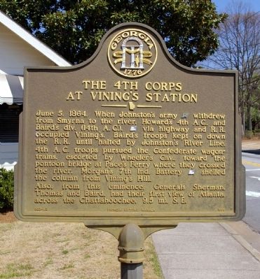
The 4th Corps at Vining’s Station
4th A.C. troops pursued the Confederate wagon trains, escorted by Wheeler’s Cav., toward the pontoon bridge at Pace’s Ferry where they crossed the river. Morgan’s 7th Ind. Battery [US] shelled the column from Vining’s Hill.
Also, from this eminence, Generals Sherman, Thomas and Baird, had their first view of Atlanta, across the Chattahoochee, 9.5 mi. S. E.
Erected 1988 by Georgia Department of Natural Resources. (Marker Number 033-83.)
Topics and series. This historical marker is listed in this topic list: War, US Civil. In addition, it is included in the Georgia Historical Society series list. A significant historical date for this entry is June 5, 1864.
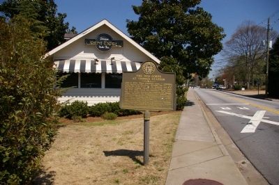
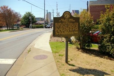
Location. 33° 51.95′ N, 84° 28.067′ W. Marker is in Vinings, Georgia, in Cobb County. Marker is on Paces Ferry Road NW, 0 miles west of New Paces Ferry Road SE, on the right when traveling west. The marker is located at the old Vinings railroad station, now a restaurant. Touch for map. Marker is in this post office area: Atlanta GA 30339, United States of America. Touch for directions.
Other nearby markers. At least 8 other markers are within 2 miles of this marker, measured as the crow flies. Site: Hardy Pace’s Res. Howard’s Headquarters (approx. 0.2 miles away); The 4th Corps Posted Along the River (approx. ¾ mile away); The 14th & 20th A.C. Cross at Pace’s Ferry (approx. 0.8 miles away); a different marker also named The 14th & 20th A.C. Cross at Pace's Ferry (approx. 0.8 miles away); The Errant Pontoon Bridge: Paces Ferry (approx. 0.8 miles away); Old Pace’s Ferry Road (approx. one mile away); Palmer’s & Hooker’s A.C. Cross the Chattahoochee (approx. 1.1 miles away); Union Defense Line (approx. 1.1 miles away). Touch for a list and map of all markers in Vinings.
More about this marker. This marker replaced an earlier marker of the same title and almost identical text at this location, erected by the Georgia Historical Commission.
Regarding The 4th Corps at Vining’s Station. There is a factual error on the marker: The events described occurred on July 5th 1864, not June 5th. The earlier marker had the correct date.
Additional commentary.
1. Marker missing?
It appears the marker is now missing. There has been remodeling of the nearby building and the marker was there at least in October, 2012.
— Submitted May 24, 2016, by Mark Hilton of Montgomery, Alabama.
Credits. This page was last revised on May 6, 2023. It was originally submitted on April 20, 2010, by David Seibert of Sandy Springs, Georgia. This page has been viewed 1,725 times since then and 18 times this year. Last updated on May 5, 2023, by Amanda Zimmer of Atlanta, Georgia. Photos: 1, 2, 3, 4. submitted on April 20, 2010, by David Seibert of Sandy Springs, Georgia. 5. submitted on May 24, 2016, by Mark Hilton of Montgomery, Alabama. • J. Makali Bruton was the editor who published this page.


