Near Wilson in Wilson County, North Carolina — The American South (South Atlantic)
Toisnot Church
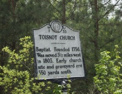
Photographed by Mike Stroud, April 18, 2013
1. Toisnot Church Marker
Erected 1959 by Archives and Highway Departments. (Marker Number F-33.)
Topics and series. This historical marker is listed in these topic lists: Cemeteries & Burial Sites • Religion & Religious Structures. In addition, it is included in the North Carolina Division of Archives and History series list. A significant historical year for this entry is 1756.
Location. 35° 43.907′ N, 77° 51.139′ W. Marker is near Wilson, North Carolina, in Wilson County. It is on North Carolina Route 42 0.3 miles west of Tarrt's Mill Raod, on the left when traveling west. Touch for map. Marker is at or near this postal address: 3042 NC-42, Wilson NC 27893, United States of America. Touch for directions.

Regionally, this marker is in North Carolina’s Piedmont. It is also in the American South and specifically in the Upper South. Globally, it is in North America, the Western Hemisphere, the Western World, and the Anglosphere. Historically, it finds itself in what was once the territory of the Mississippian Culture,
this page online
Other nearby markers. At least 8 other markers are within 3 miles of this marker, measured as the crow flies: Frank S. Hargrave, M.D. (approx. 2.9 miles away); Wilson Normal & Industrial Institute (approx. 2.9 miles away); Military Hospital (approx. 3 miles away); Samuel H. Vick (approx. 3 miles away); Wilson Hospital and Tubercular Home (approx. 3 miles away); Our Confederate Dead (approx. 3 miles away); Confederate Military Hospital No. 2 (approx. 3 miles away); Owen L. W. Smith (approx. 3.1 miles away). Touch for a list and map of all markers in Wilson.
Regarding Toisnot Church. Toisnot (also spelled Tosneot) Baptist Church was first established in 1756 as a General Baptist Church. Prior to September 24, 1759, a meetinghouse measuring sixteen by twenty-eight feet was built on a one-acre donated to the church for that purpose by John Thomas. On that date, Thomas registered in the Edgecombe County court a deed transferring a plantation to Jonathan Thomas except for “one acre hereon the meeting house now stands.” Shortly
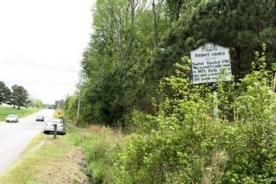
Photographed by Mike Stroud, April 18, 2013
2. Toisnot Church Marker looking east along NC 42
Toisnot Church belonged to the Charleston Association from 1760 to 1762, and joined as a charter member of the Kehukee Baptist Association associated with the Kehukee Primitive Baptist Church on November 6, 1769. When the first major split took place among North Carolina Baptists at the falls of Tar River in 1775, the next meeting of Regular and Particular churches was held at Toisnot on August 24, 1775. Several churches in the region originated as branches of Toisnot. The first, Flat Swamp became independent in 1776, later establishing several nearby churches including Skewarkey.
Rev. John Thomas, Sr., John Thomas, Jr. and Jonathan Thomas played major roles in the early years of Toisnot. Reuben Hayes became pastor in 1789, followed by John Sherrod in 1803, when the church moved to a more central location near Wilson. (North Carolina Office of Archives & History — Department of Cultural Resources)
Credits. This page was last revised on May 10, 2023. It was originally submitted on August 12, 2013, by Mike Stroud of Bluffton, South Carolina. This page has been viewed 1,519 times since then and 65 times this year. Last updated on May 7, 2023, by Michael Buckner of Durham, North Carolina. Photos: 1, 2. submitted on August 13, 2013, by Mike Stroud of Bluffton, South Carolina. • Bernard Fisher was the editor who published this page.
