Florence in Florence County, South Carolina — The American South (South Atlantic)
Mars Bluff Rice Growers
(side 1)
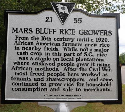
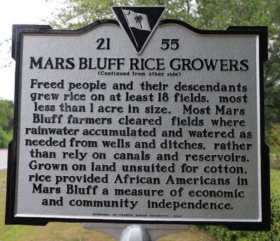
From the 18th century until c. 1920, African American farmers grew rice in nearby fields. While not a major cash crop in this part of S.C., rice was a staple on local plantations, where enslaved people grew it using African methods. After the Civil War, most freed people here worked as tenants and sharecroppers, and some continued to grow rice for household consumption and sale to merchants.
Erected 2022 by Francis Marion University. (Marker Number 21-55.)
Topics. This historical marker is listed in these topic lists: African Americans • Agriculture • Industry & Commerce.
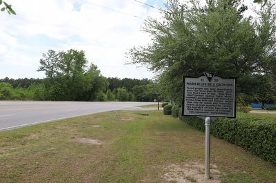
Location. 34° 11.258′ N, 79° 39.411′ W. Marker is in Florence, South Carolina, in Florence County. Marker is on Francis Marion Road north of Old Wallace Gregg Road, on the right when traveling north. Touch for map. Marker is at or near this postal address: 480 SC-327, Florence SC 29506, United States of America. Touch for directions.
Other nearby markers. At least 8 other markers are within 2 miles of this marker, measured as the crow flies. Francis Marion Memorial Highway (approx. 0.7 miles away); Hewn-Timber Cabins (approx. 0.7 miles away); Atomic Bomb Accident at Mars Bluff, March 11, 1958 (approx. 0.7 miles away); Mt. Zion Rosenwald School (approx. 0.9 miles away); Mt. Zion Methodist Church (approx. one mile away); Red Doe (approx. one mile away); Gregg-Wallace Farm Tenant House (approx. one mile away); Mars Bluff (approx. 1.2 miles away). Touch for a list and map of all markers in Florence.
Credits. This page was last revised on May 9, 2023. It was originally submitted on May 8, 2023, by Dave W of Co, Colorado. This page has been viewed 130 times since then and 51 times this year. Photos: 1, 2, 3. submitted on May 8, 2023, by Dave W of Co, Colorado. • Bernard Fisher was the editor who published this page.


