Thomasville in Davidson County, North Carolina — The American South (South Atlantic)
Thomasville City Cemetery
Union of Combatants
Photographed by Bill Coughlin, August 2, 2010
1. Thomasville City Cemetery Marker
===============
this page online
Erected by North Carolina Civil War Trails.
Topics and series. This historical marker is listed in this topic list: War, US Civil. In addition, it is included in the North Carolina Civil War Trails series list. A significant historical month for this entry is January 1865.
Location. 35° 53.221′ N, 80° 4.838′ W. Marker is in Thomasville, North Carolina, in Davidson County. It can be reached from Memorial Park Drive, on the right when traveling west. The marker is located in Thomasville City Cemetery.
Photographed by Bill Coughlin, August 2, 2010
2. Thomasville Marker

Regionally, this marker is in the Piedmont and specifically in Piedmont Triad. It is also in the American South and specifically in the Upper South. Globally, it is in North America, the Western Hemisphere, the Western World, and the Anglosphere. Historically, it finds itself in what was once the territory of the Mississippian Culture, one of the original Thirteen Colonies, one of the Confederate States of America, and the Antebellum South.
Other nearby markers. At least 8 other markers are within 5 miles of this marker, measured as the crow flies: Thomasville (approx. ¼ mile away); John W. Thomas (approx. 0.3 miles away); a different marker also named Thomasville (approx. 0.4 miles away); Smith Clinic (approx. 0.4 miles away); Mitchell House (approx. one mile away); a different marker also named John W. Thomas (approx. 3.1 miles away); John H. Mills (approx. 3½ miles away); Jeduthan Harper House (approx. 4.1 miles away). Touch for a list and map of all markers in Thomasville.
Another
Photographed by Bill Coughlin, August 2, 2010
3. Marker in the Thomasville City Cemetery
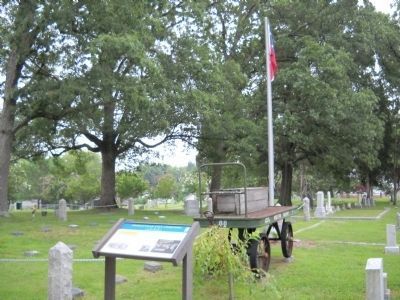
The common plot for both Northern and Southern soldiers is seen to the left in this photo.
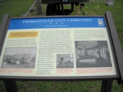
More about this marker. Three photos, Courtesy Library of Congress, appear at the lower part of the marker. The first is of a battlefield scene and has a caption of “Wounded soldiers often received their initial treatment on the battlefield. Union Surgeon Anson Hurd, 14th Indiana Volunteers, tends wounded Confederates in a field hospital after the Battle of Antietam, Sept. 1862.” The next one depicts “Wounded Union soldiers at the U.S. Sanitary Commission depot, Fredericksburg, Va., May 20, 1864.” The last photo is of the interior of a hospital and has the caption “Temporary hospitals were established in dwellings, churches, barns, warehouses and schools. This is a ward in a permanent facility, Harewood General Hospital, Washington, D.C., photographed during the war, showing mosquito netting for the patients’ beds.”
Photographed by Bill Coughlin, August 2, 2010
4. Thomasville City Cemetery Marker
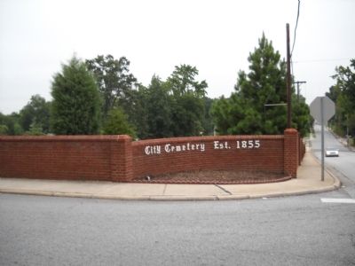
Photographed by Bill Coughlin, August 2, 2010
5. Thomasville City Cemetery
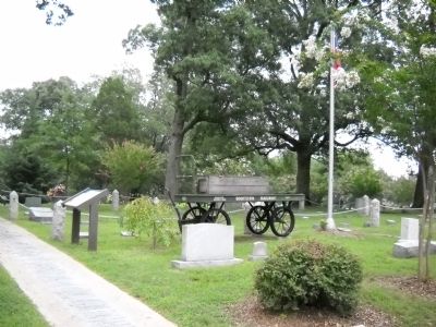
The marker is located inside of Thomasville's City Cemetery seen here.
Credits. This page was last revised on May 13, 2023. It was originally submitted on August 9, 2010, by Bill Coughlin of Woodland Park, New Jersey. This page has been viewed 1,669 times since then and 68 times this year. Last updated on May 8, 2023, by Michael Buckner of Durham, North Carolina. Photos: 1, 2, 3, 4, 5. submitted on August 9, 2010, by Bill Coughlin of Woodland Park, New Jersey. • J. Makali Bruton was the editor who published this page.
