Downtown Providence in Providence County, Rhode Island — The American Northeast (New England)
Central Wharf Shipping, Whaling, and Other Industries

By Devry Becker Jones (CC0), May 4, 2023
1. Central Wharf Shipping, Whaling, and Other Industries Marker
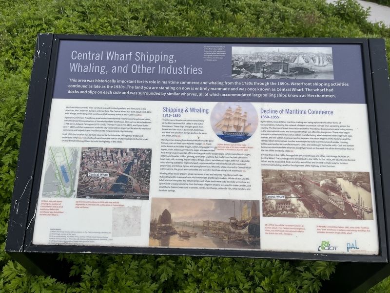
This area was historically important for its role in maritime commerce and whaling from the 1780s through the 1890s. Waterfront shipping activities continued as late as the 1930s. The land you are standing on now is entirely manmade and was once known as Central Wharf. The wharf had docks and slips on each side and was surrounded by similar wharves, all of which accommodated large sailing ships known as Merchantmen.
Merchant ships carried a wide variety of raw and finished goods to and from ports in the Americas, the Caribbean, Europe, and East Asia. The Central Wharf was built about 1815-1830 with a large, three-story brick warehouse that formerly stood at its southern end [1].
A group of prominent Providence-area businessmen formed The Dorrance Street Association, which financed the construction of the wharf and the warehouse. Men such as Nicholas Brown (1769-1841), Edward Carrington (1775-1843), Thomas P. Ives (1769-1835), and Cyrus Butler (1767-1849) and their successors made the city's west side an important location for maritime commerce and helped shape Providence into the prominent city it is today.
Until 2010 this location was partially covered by the Interstate 195 highway bridge and associated ramps [2]. The wharf and warehouse are now an archaeological site buried under several feet of fill brought here to build the highway in the 1950s.
Shipping & Whaling
1815 - 1850
The Dorrance Street Association owned many of the Merchantmen that sailed in and out of Providence. These ships brought goods from American cities such as Savannah, Baltimore, and New York and from foreign ports as far away as Canton, China [3].
Merchantment leaving from Central Wharf could be gone for two years on their trans-Atlantic voyages [4]. Trade in the Americas included dry gin, cotton, lime, potatoes, apples, cider, tobacco, prime pork, sugar, and rice. In East Asia, a ship's supercargo (an officer in charge of trade) bought capia (white maize flour), copper, rattans, gunpowder, coffee, ginseng, quercitron (a yellow dye made from the bark of eastern black oak), silk nutmeg, Indian cotton, Bengal opium, sandalwood, sugar, betel nut (a popular mind-altering substance that is chewed), sappanwood (an Indian redwood with medicinal properties), and bohea, hyson, and young hyson teas. When the ships returned to Central Wharf in Providence, the goods were unloaded and stored in the three-story brick warehouse [5].
Whaling ships would process whale carcasses at sea and return to Providence with

By Devry Becker Jones (CC0), May 4, 2023
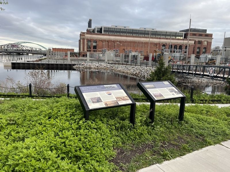
2. Central Wharf Shipping, Whaling, and Other Industries Marker
Decline of Maritime Commerce
1850-1955
By the 1850s, long-distance maritime trading was being replaced with other forms of transportation, including the network of steam locomotive railroad lines spreading across the country. The Dorrance Street Association and other Providence businessmen were losing money in the international trade, and transport by ships was often too dangerous. These men began to invest in other industries such as cotton manufacturing, which required vast supplies of coal, lumber, and raw cotton. Coal was needed to power the steam engines in the factories and the railroad steam locomotives. Lumber was needed to build warehouses and worker housing. Cotton was needed to manufacture yarn, cloth, and clothing in the textile mills. Coal and lumber businesses dominated the wharves along Dyer Street on the west side of the Providence River in the late 1800s and early 1900s [6].
Several fires in the 1920s damaged the brick warehouse and other coal storage facilities on Central Wharf. The buildings were demolished in the 1930s. In the 1950s, the abandoned Central Wharf and its associated docks and slips were filled and leveled to make way for modern commercial buildings and for the alignment of the highway across the river.
[Captions:]
[1] West side park layout showing the location of Central Wharf and its brick warehouse before the warehouse was demolished and the wharf filled in.
[2] Downtown Providence in 2010 with new and old alignments of Interstate 195 and location of Central Wharf, view northwest.
[3] Ann & Hope, typical China trade merchant ship of 551 tons, owned by Brown and Ives of Providence, RI, 1798-1816.
[4-Left] A View of the European Factories at Canton about 1785. Canton (now Guangzhou), China, was the hub of international trade for the British East India Company.
[5] View from the West Bank of The River about 1858. The three-story brick warehouse on Central Wharf was used to store goods traded between Providence and American and foreign ports.
[6-Above] Central Wharf about 1882, view north. The three-story brick warehouse is between coal storage buildings that extended the entire length of the wharf.
Erected by Rhode Island Department of Transportation (RIDOT); Public Archaeology Laboratory.
Topics. This historical marker is listed in these topic lists: Animals • Anthropology & Archaeology • Industry & Commerce • Waterways & Vessels. A significant historical year for this entry is 1815.
Location. 41° 49.203′ N, 71° 24.375′ W. Marker is in Providence, Rhode Island, in Providence County. It is in Downtown Providence. Marker can be reached from the intersection of Dyer Street and Ship Street, on the right when traveling north. Touch for map. Marker is at or near this postal address: 120 Peck St, Providence RI 02903, United States of America. Touch for directions.
Other nearby markers. At least 8 other markers are within walking distance of this marker. Early History and Archaeology of Central Wharf (here, next to this marker); Providence (about 700 feet away, measured in a direct line); Rise of the Gangways (1704-1844) / Fall of the Gangways (1844-1983) (about 700 feet away); The Changing Face of the West Bank / The West Bank (approx. 0.2 miles away); Fox Point Veterans Memorial (approx. 0.2 miles away); Revolutions: American and Industrial (approx. 0.2 miles away); Crawford Street Bridge Without Crawford Street (approx. 0.2 miles away); HMS Gaspee (approx. ¼ mile away). Touch for a list and map of all markers in Providence.
Credits. This page was last revised on May 9, 2023. It was originally submitted on May 8, 2023, by Devry Becker Jones of Washington, District of Columbia. This page has been viewed 63 times since then and 11 times this year. Last updated on May 8, 2023, by Bradley Owen of Morgantown, West Virginia. Photos: 1, 2. submitted on May 8, 2023, by Devry Becker Jones of Washington, District of Columbia. • J. Makali Bruton was the editor who published this page.