Lafayette in North Kingstown in Washington County, Rhode Island — The American Northeast (New England)
The Rail Connection
Lafayette
— A Southern Rhode Island Mill Village —
Robert Rodman had been making fabric here in Lafayette or more than two decades at the time that the most advantageous set of circumstances he might have imagined occurred. the nation's elite, led by the Vanderbilt, Berwind and Astor families and their compatriots, desired to have an easier way to get from the main rail line to their "Summer Cottages" in Newport. Departing their private railcars in a very industrial Providence for a long carriage ride to the "City by the Sea" was not pleasant in their minds.
In 1870, a group of investors spearheaded by Cornelius Vanderbilt II sought to fix this problem by setting up a short rail line run from Wickford Junction down to Poplar Point in Wickford Village, where an elegant ferryboat would whisk them all to Newport. The track infrastructure was designed and built to allow for the private railcars of these captains of industry to be shifted off the main line and hauled down to Poplar Point, where an additional siding track had been lain so that the railcars could remain there while their owners took advantage of the summer social life in Newport.
Vanderbilt and his investors wanted to be certain, though, that this rail line company, named the Newport & Wickford Rail and Steamship Line, would be financially viable. As such, they used their connections to secure the contracts for the U.S. Postal Service mail and freight going through to all of Aquidneck Island and southeastern Massachusetts. They also actively sought out other income-producing business contracts for the line; this is where Rodman Manufacturing and the Vanderbilt consortium running the Newport & Wickford line intersect. Prior to this, Rodman had to haul everything, coal, raw materials, finished fabric and the like, into and out of his Lafayette mill utilizing local teamsters and their draft horses and oxen. This was costly and inefficient. In his mind, the rail connection would be one more way that Rodman could be more competitive in the fabric markets of the late 19th century. Although negotiations took some time, this business arrangement was advantageous for all involved, and before long, Rodman Manufacturing had a dedicated spur line running from the Newport & Wickford tracks right into the mill property.
[Captions:]
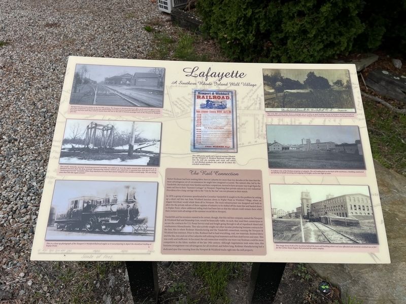
Wickford Junction train station in the late 19th century. The Newport & Wickford Railroad office can be seen just right of center. All of the construction materials for the new mill buildings were delivered here and later deliveries of coal, wool, and cotton would have been held here until they could be hauled down the line to the mill in between passenger runs on the Newport & Wickford spur line.
This small, manually operated

Photographed By Devry Becker Jones (CC0), May 5, 2023
2. The Rail Connection Marker
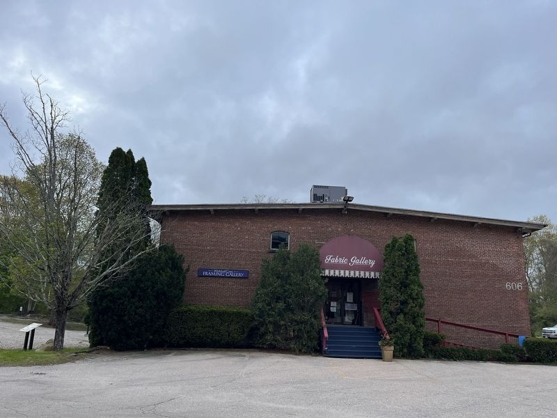
The marker stands to the left of the Fabric Gallery.
This is a close-up photograph of the Newport & Wickford Railroad engine as it was preparing to depart the steamboat landing at Poplar Point.
This 1895 poster spells out a typical summer schedule for the Newport & Wickford Railroad. Freight runs into the mill site carrying coal, wool, and cotton in and finished products out, were fit in where the schedule would allow.
This early 20th century image shows a passenger run as it picks up speed heading east out of Wickford Junction towards its ultimate destination at the ferry terminal at Poplar Point. Along the way it would stop at Belleville Station and Wickford Junction.
A southern view of the Rodman property in Lafayette. The rail loading dock on the back of the warehouse, a building constructed specifically to handle incoming and outgoing rail freight, can be seen right of center.
This image shows both of the locations behind the main mill building where coal was offloaded and stored for eventual use as fuel for the Corliss Steam Engine that powered the entire complex.
Erected by Town of North Kingstown; RI Historical Preservation & Heritage Commission.
Topics and series. This historical marker is listed in these topic lists: Communications • Industry & Commerce • Roads & Vehicles • Waterways & Vessels. In addition, it is included in the Postal Mail and Philately series list. A significant historical year for this entry is 1870.
Location. 41° 34.32′ N, 71° 29.105′ W. Marker is in North Kingstown, Rhode Island, in Washington County. It is in Lafayette. Marker is on Ten Rod Road (Rhode Island Route 102) east of Advent Street, on the right when traveling east. Touch for map. Marker is at or near this postal address: 606 Ten Rod Rd, North Kingstown RI 02852, United States of America. Touch for directions.
Other nearby markers. At least 8 other markers are within 2 miles of this marker, measured as the crow flies. The New Mill & New Beginnings (about 300 feet away, measured in a direct line); Robert Rodman's Village (about 300 feet away); Centerpiece of the Rodman Empire (about 400 feet away); A Millworker's Life (about 400 feet away); The Shewatuck & The Beginnings of Industry (about 500 feet away); Hortense Rodman Allen House (approx. 0.3 miles away); Roger Williams (approx. 1˝ miles away); North Kingstown G.A.R. Monument (approx. 1.8 miles away). Touch for a list and map of all markers in North Kingstown.
Credits. This page was last revised on May 9, 2023. It was originally submitted on May 8, 2023, by Devry Becker Jones of Washington, District of Columbia. This page has been viewed 59 times since then and 12 times this year. Photos: 1, 2. submitted on May 8, 2023, by Devry Becker Jones of Washington, District of Columbia.
