Downtown Providence in Providence County, Rhode Island — The American Northeast (New England)
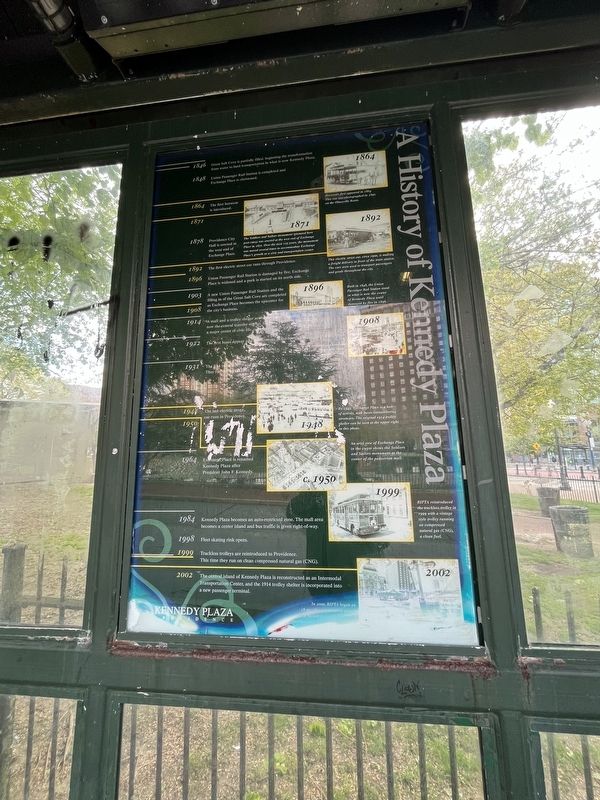
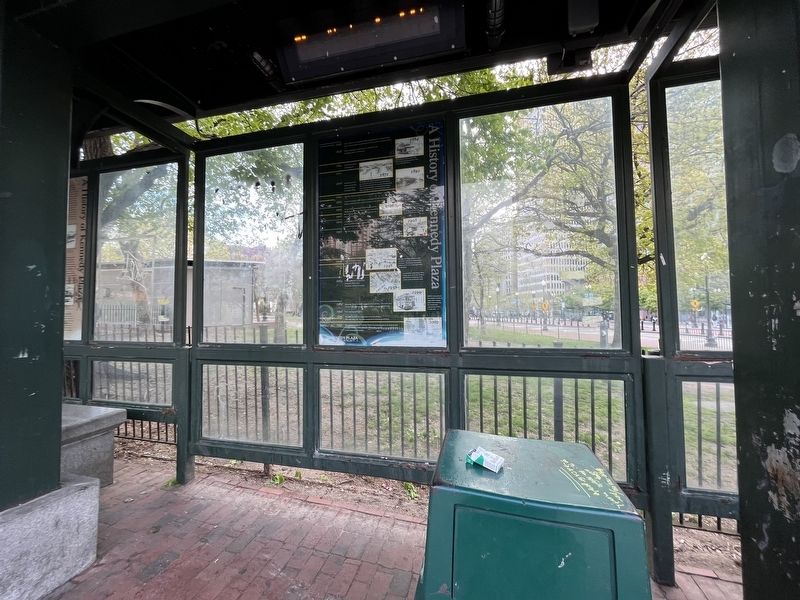
A History of Kennedy Plaza
Kennedy Plaza
— Providence —
1846 Great Salt Cove is partially filled, beginning the transformation from water to land transportation in what is now Kennedy Plaza.
1848 Union Passenger Rail Station is completed and Exchange Place is christened.
1864 Horsecars first appeared in 1864. This one was photographed in 1890 on the Olneyville Route.
1864 The first horse car is introduced.
1871 The Soldiers and Sailors monument (pictured here post-1903) was erected at the west end of Exchange Place in 1871. Over the next 125 years, the monument was moved several times to accommodate Exchange Place's growth as a civic and transportation center.
1878 Providence City Hall is erected at the west end of Exchange Place.
1892 This electric street car, circa 1900, is making a freight delivery in front of the train station. The cars were used to transport passengers and goods throughout the city.
1892 The first electric street car runs through Providence.
1896 Union Passenger Rail is damaged by fire; Exchange Plac;e is widened and a park is started on its north side.
1896 Built in 1848, the Union Passenger Rail Station stood in what is now the center of Kennedy Plaza until damaged by fire in 1896.
1908 A new Union Passenger Rail Station and the filling in of the Great Salt Cove are completed as Exchange Place becomes the epicenter for the city's business.
1908 People gathered in Exchange Place to celebrate Old Home Week on September 8, 1908.
1914 A mall and a trolley shelter are based at Exchange Place, now the central transfer station. Exchange Place becomes a major center of civic life, commercial activity and mass transit.
1922 The first buses appear and the Biltmore Hotel opens.
1931 The first trackless trolleys appear. They run until 1955.
1948 The last electric street car runs in Providence.
1948 By 1945, Exchange Place is a hub of activity, with buses outnumbering streetcars. The original 1914 trolley shelter can be seen at the upper right in this photo.
c. 1950 An aerial view of Exchange Place in the 1950s shows the Soldiers and Sailors monument at the center of the pedestrian mall.
1964 Exchange Place is renamed Kennedy Plaza after President John F. Kennedy.
1984 Kennedy Plaza becomes an auto-restricted zone. The mall area becomes a
1998 Fleet skating rink opens.
1999 Trackless trolleys are reintroduced to Providence. This time they run on clean compressed natural gas (CNG).
1999 RIPTA reintroduced the trackless trolley in 1999 with a vintage style trolley running on compressed natural gas (CNG), a clean fuel.
2002 The central island of Kennedy Plaza is reconstructed as an Intermodal Transportation Center, and the 1914 trolley shelter is incorporated into a new passenger terminal.
2002 In 2000, RIPTA began an 18-month re-construction project that included a passenger station incorporating the 1914 shelter.
Erected by Rhode Island Public Transit Authority (RIPTA); The City of Providence; State of Rhode Island.
Topics. This historical marker is listed in these topic lists: Arts, Letters, Music • Industry & Commerce • Parks & Recreational Areas • Railroads & Streetcars • Roads & Vehicles. A significant historical date for this entry is September 8, 1908.
Location. 41° 49.51′ N, 71° 24.746′ W. Marker is in Providence, Rhode Island, in Providence County. It is in Downtown Providence. Marker can be reached from Washington Street east of Dorrance Street, on the left when traveling east. Touch for map. Marker is at or near this postal address: 31 Washington St, Providence RI 02903, United States of America. Touch for directions.
Other nearby markers. At least 8 other markers are within walking distance of this marker. A different marker also named A History of Kennedy Plaza (here, next to this marker); a different marker also named A History of Kennedy Plaza (here, next to this marker); Providence Harbor History (within shouting distance of this marker); Rhode Island Soldiers and Sailors Memorial (about 300 feet away, measured in a direct line); Civil War Monument (about 300 feet away); Union Station (about 300 feet away); The Hiker (about 300 feet away); Ambrose Burnside Memorial (about 300 feet away). Touch for a list and map of all markers in Providence.
Credits. This page was last revised on May 9, 2023. It was originally submitted on May 9, 2023, by Devry Becker Jones of Washington, District of Columbia. This page has been viewed 49 times since then and 14 times this year. Photos: 1, 2. submitted on May 9, 2023, by Devry Becker Jones of Washington, District of Columbia.

