Graham in Alamance County, North Carolina — The American South (South Atlantic)
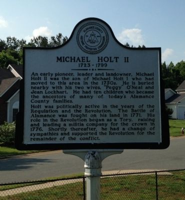
Michael Holt II
1723 - 1799
Photographed by Patrick G. Jordan, May 26, 2014
1. Michael Holt II Marker
Holt was politically active in the years of the Regulation and the Revolution. The Battle of Alamance was fought on his land in 1771. His role in the Revolution began as a Tory, raising and leading a militia company for the crown in 1776. Shortly thereafter, he had a change of sympathies and supported the Revolution for the remainder of the conflict.
Erected by Alamance County Historic Properties Commission.
Topics. This historical marker is listed in these topic lists: Cemeteries & Burial Sites • War, US Revolutionary. A significant historical year for this entry is 1771.
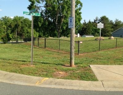
Location. 36° 3.348′ N, 79° 25.391′ W. Marker is in Graham, North Carolina, in Alamance County. It is at the intersection of Hanford Hills Road and Monticello Court, on the left when traveling south on Hanford Hills Road. Marker is inside a chain link fence.
this page online

Regionally, this marker is in the Piedmont and specifically in Piedmont Triad. It is also in the American South and specifically in the Upper South. Globally, it is in North America, the Western Hemisphere, the Western World, and the Anglosphere. Historically, it finds itself in what was once the territory of the Mississippian Culture, one of the original Thirteen Colonies, one of the Confederate States of America, and the Antebellum South.
Other nearby markers. At least 8 other markers are within 2 miles of this marker, measured as the crow flies: A different marker also named Pyle's Defeat (approx. 0.7 miles away); Graham College (approx. 1.4 miles away); Alamance County War Memorial (approx. 1.4 miles away); Kirk-Holden War (approx. 1½ miles away); Captain James W. White House (approx. 1½ miles away); "Elmhurst" (approx. 1½ miles away); National Bank of Alamance (approx. 1.6 miles away); Graham's First Bank (approx. 1.6 miles away). Touch for a list and map of all markers
Photographed by Patrick G. Jordan, May 26, 2014
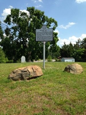
2. Michael Holt II Marker
Another marker is no longer nearby. Pyle's Defeat (was approx. 0.7 miles away but has been replaced with another marker now near it).
Photographed by Patrick G. Jordan, May 26, 2014
3. Michael Holt II Marker
Photographed by Patrick G. Jordan, May 26, 2014
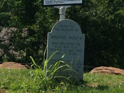
4. Sacred to the memory of Michael Holt II
Who was born the 6 of May 1723
Died the 20 July 1799
Aged 76 years
Remember men as you pass by. As you are now so once was I. As I am now so you must be. Prepare for death and follow me.
Died the 20 July 1799
Aged 76 years
Remember men as you pass by. As you are now so once was I. As I am now so you must be. Prepare for death and follow me.
Photographed by Patrick G. Jordan, May 26, 2014
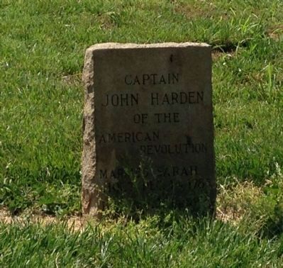
5. Captain John Harden of the American Revolution
Married Sarah Holt
Dec. 14, 1783
Dec. 14, 1783
Credits. This page was last revised on May 11, 2023. It was originally submitted on May 26, 2014, by Patrick G. Jordan of Graham, North Carolina. This page has been viewed 2,557 times since then and 166 times this year. Last updated on May 11, 2023, by Michael Buckner of Durham, North Carolina. Photos: 1, 2, 3, 4, 5. submitted on May 26, 2014, by Patrick G. Jordan of Graham, North Carolina. • Bernard Fisher was the editor who published this page.
