Chapel Hill in Orange County, North Carolina — The American South (South Atlantic)
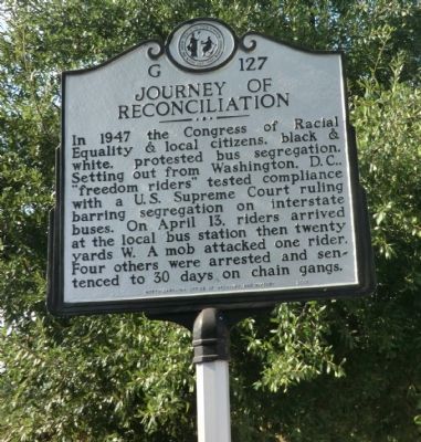
Journey of Reconciliation
Erected 2008 by North Carolina Office of Archives and History. (Marker Number G-127.)
Topics and series. This historical marker is listed in these topic lists: African Americans • Civil Rights • Roads & Vehicles. In addition, it is included in the North Carolina Division of Archives and History series list. A significant historical month for this entry is April 1947.
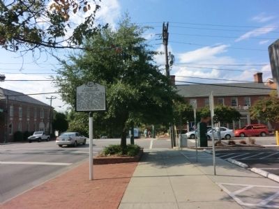
Location. 35° 54.838′ N, 79° 3.368′ W. Marker is in Chapel Hill, North Carolina, in Orange County. Marker is at the intersection of North Columbia Street (State Highway 86) and East Rosemary Street, on the right when traveling north on North Columbia Street. Touch for map. Marker is at or near this postal address: 121 N Columbia St, Chapel Hill NC 27514, United States of America. Touch for directions.
Other nearby markers. At least 8 other markers are within walking distance of this marker. Kuralt Building (about 400 feet away, measured in a direct line); University Florist (about 400 feet away); Carolina Coffee Shop (about 600 feet away); Old Sawpit Site (about 600 feet away); Strowd Building (about 700 feet away); University of N.C. at Chapel Hill (approx. 0.2 miles away); Astronaut Training (approx. 0.3 miles away); Old East (approx. 0.3 miles away). Touch for a list and map of all markers in Chapel Hill.
Credits. This page was last revised on May 11, 2023. It was originally submitted on November 4, 2013, by Don Morfe of Baltimore, Maryland. This page has been viewed 659 times since then and 36 times this year. Last updated on May 11, 2023, by Michael Buckner of Durham, North Carolina. Photos: 1, 2. submitted on November 4, 2013, by Don Morfe of Baltimore, Maryland. • Bernard Fisher was the editor who published this page.

