Near Charlotte in Atascosa County, Texas — The American South (West South Central)
Kings Highway Camino Real — Old San Antonio Road
Marker #97
| — | El Camino Real de los Tejas National Historic Trail | — |

Photographed by WayBetterFinder, December 28, 2015
1. Kings Highway Camino Real — Old San Antonio Road Marker
Erected 1918 by Daughters of The American Revolution and The State of Texas A.D. 1918. (Marker Number 97.)
Topics and series. This historical marker is listed in this topic list: Roads & Vehicles. In addition, it is included in the Daughters of the American Revolution (DAR) series list.
Location. 28° 46.963′ N, 98° 44.412′ W. Marker is near Charlotte, Texas, in Atascosa County. It is on County Route 347 one mile south of County Route 346, on the left when traveling south. Touch for map. Marker is in this post office area: Charlotte TX 78011, United States of America. Touch for directions.

Regionally, this marker is in the Hill Country and in the San Antonio Metropolitan Area. Globally, it is in North America, a Gulf of Mexico state, the Western Hemisphere, the Western World, and the Anglosphere. Historically, it finds itself in what was once New Spain, the Republic of Texas, and one of the Confederate States of America.
this page online
Other nearby markers. At least 8 other markers are within 15 miles of this marker, measured as the crow flies: A different marker also named Kings Highway Camino Real — Old San Antonio Road (approx. 4.8 miles away); Chilipitin Cemetery (approx. 6.3 miles away); a different marker also named Kings Highway Camino Real — Old San Antonio Road (approx. 12.7 miles away); a different marker also named Kings Highway Camino Real — Old San Antonio Road (approx. 14.7 miles away); Jourdanton Independent School District (approx. 14.9 miles away); First Baptist Church of Jourdanton (approx. 15 miles away); Martin Abstract Company (approx. 15.1 miles away); Jourdanton United Methodist Church (approx. 15.1 miles away). Touch for a list and map of all markers in Charlotte.
Regarding Kings Highway Camino Real — Old San Antonio Road. “During the Spanish colonial period in North America, numerous “royal roads”—or caminos reales—tied far-flung regions of the empire to Mexico City. One particular collection of indigenous trails and trade routes became known as El Camino Real de los Tejas, the primary overland route for the Spanish colonization of what
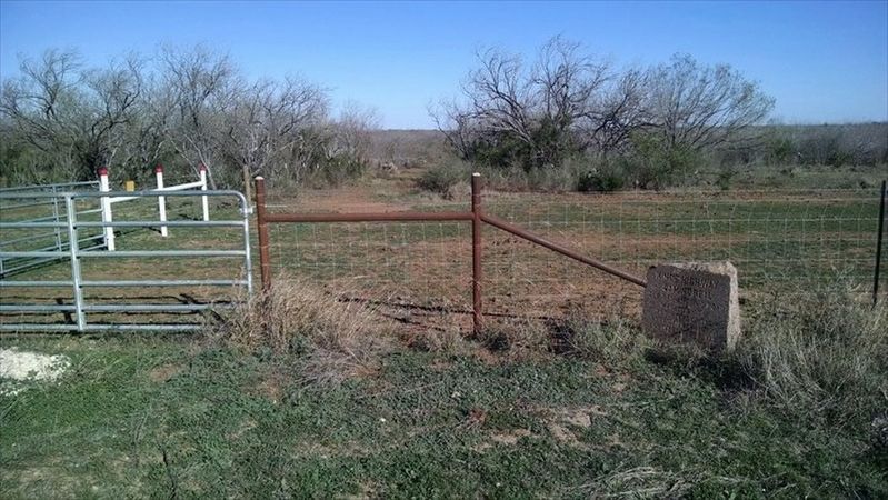
Photographed by WayBetterFinder, December 28, 2015
2. Kings Highway Camino Real — Old San Antonio Road Marker
El Camino Real de los Tejas served as a political, economic, and cultural link between Mexico City and Los Adaes (and all points in between). Settlers, missionaries, soldiers, servants, and indigenous allies followed various roads and trails along the 2,500 miles of this route to populate the settlements, missions, and presidios of eastern Texas and northwestern Louisiana. Linking a variety of cultural and linguistic groups, the royal road served as an agent for cultural diffusion, biological exchange, and communication and as a conduit for exploration, trade, migration, settlement, and livestock drives. Spanish, Mexican, French, American, Black, and American Indian travelers along El Camino Real de los Tejas created a mix of traditions, laws, and cultures that is reflected in the people, landscapes, place names, languages, music, and arts of Texas and Louisiana today.” (NPS)
In 1915 the Texas legislature appropriated $5,000 to survey and mark the route. The Daughters of the American Revolution and other organizations sponsored and endorsed the project, and professional surveyor V. N. Zivley was commissioned to make the study. From 1915-18, the State of Texas and the Daughters of the American Revolution together placed 123 pink granite markers about every five miles along the King’s Highway, also known as Camino Real or Old San Antonio Road
The El Camino Real de los Tejas National Historic Trail is a national historic trail covering the U.S. section of El Camino Real de Los Tejas, a thoroughfare from the 18th-century Spanish colonial era in Spanish Texas, instrumental in the settlement, development, and history of Texas. The National Park Service designated El Camino Real de los Tejas National Historic Trail as a unit in the National Trails System in 2004. (Wiki)
Credits. This page was last revised on May 12, 2023. It was originally submitted on May 11, 2023, by Carolyn Sanders of Plano, Texas. This page has been viewed 274 times since then and 44 times this year. Photos: 1, 2. submitted on May 11, 2023, by Carolyn Sanders of Plano, Texas. • James Hulse was the editor who published this page.
