College Hill in Providence in Providence County, Rhode Island — The American Northeast (New England)
Prospect Terrace
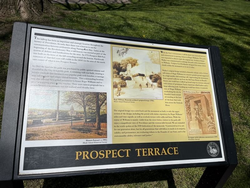
This hilltop has been an important and strategic location throughout the history of Providence. In early days there was a beacon to use for communication between settlements along Narragansett Bay. Later, at the beginning of the Revolutionary War, a tall beacon was erected as part of the system of defense and fortifications of the area. In 1775 Prospect Hill fort was built on the brow of the hill extending around the beacon. Earthwork remnants of that fort were still visible in the 1850's in the area of the north east corner of what is now Prospect Terrace.
,br> In 1863 the land for the park was purchased by public spirited citizens and donated to the City as a public park. A retaining wall was built, creating a terrace overlook that became a very popular park with benches, a carriage way, tall flagpole and ornate central fountain. This commanding location was also selected for a grand monument to honor Roger Williams and to serve as a resting place for his remains. There were various proposal but a commemorative monument was not realized until decades later.
With the City's tercentenary in 1936 there was renewed interest and commitment to paying tribute to Roger Williams. The park was expanded to almost triple the original size. Architect Ralph Walker was commissioned to redesign the park with a monument to Williams. Sculptor Leo Friedlander designed the statue which stands within the monument as we see it today.
Walker's original design included a dramatic scheme with a 14 foot tall statue of Roger Williams in a massive granite portal supported by a high marble clad retaining wall. Approaching the monument from a grand walkway up from the Old State House on Benefit Street, one could have walked up broad steps to a terrace adorned with statues of prominent Native American tribal leaders and a large reflecting pool. Looking up would have been a wonderful view of Roger Williams overlooking the city he founded, hand extended standing at the bow of the boat that took him across the Seekonk River.
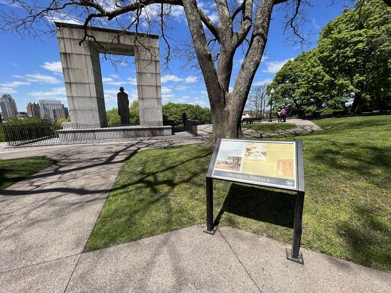
The original design was scaled back and the monument as built, is only the upper section of the design, including the portal with statue, repository for Roger Williams' ashes and time capsule, as well as overlook terrace with walks and lawn. While the statue of Williams is mainly visible from the street below, visitors to the park still enjoy a magnificent view of Providence and the western hills beyond. We are reminded in the words spoken at the 1939 dedication of the memorial, "Constructed as it is, not for our generation alone, but for all generations that will follow, it stands in its majesty, solidity and permanence, an everlasting tribute to the Founder of our State, and to
Erected by City of Providence, Rhode Island.
Topics. This historical marker is listed in these topic lists: Architecture • Arts, Letters, Music • Colonial Era • Communications • Forts and Castles • Parks & Recreational Areas • Settlements & Settlers • War, US Revolutionary. A significant historical year for this entry is 1775.
Location. 41° 49.793′ N, 71° 24.43′ W. Marker is in Providence, Rhode Island, in Providence County. It is in College Hill. Marker is on Congdon Street north of Cushing Street, on the left when traveling north. Touch for map. Marker is at or near this postal address: 62 Congdon St, Providence RI 02906, United States of America. Touch for directions.
Other nearby markers. At least 8 other markers are within walking distance of this marker. A different marker also named Prospect Terrace (a few steps from this marker); Isaac Hale (within shouting distance of this marker); Sissieretta Jones (about 300 feet away, measured in a direct line); College Hill Historic District (about 500 feet away); Court and State House (about 500 feet away); State Arsenal 20th Century Wars Memorial (about 600 feet away); Providence Marine Corps of Artillery (about 600 feet away); The Boys of Adams' Battery "G" (about 600 feet away). Touch for a list and map of all markers in Providence.
Credits. This page was last revised on May 12, 2023. It was originally submitted on May 12, 2023, by Devry Becker Jones of Washington, District of Columbia. This page has been viewed 74 times since then and 22 times this year. Photos: 1, 2. submitted on May 12, 2023, by Devry Becker Jones of Washington, District of Columbia.

