Statesville in Iredell County, North Carolina — The American South (South Atlantic)
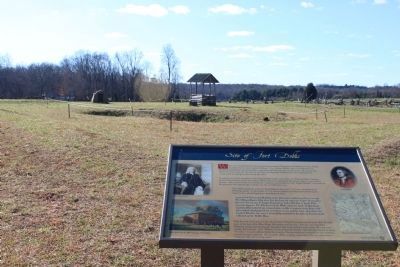
Site of Fort Dobbs
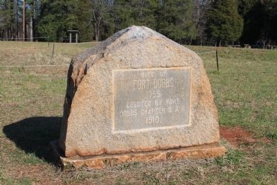
Site of Fort Dobbs
1755.
Erected by Fort Dobbs Chapter D.A.R.
1910.
Erected 1910 by Fort Dobbs Chapter Daughters of the American Revolution (DAR).
Topics and series. This historical marker is listed in these topic lists: Forts and Castles • War, French and Indian. In addition, it is included in the Daughters of the American Revolution series list. A significant historical year for this entry is 1755.
Location. 35° 49.295′ N, 80° 53.845′ W. Marker is in Statesville, North Carolina, in Iredell County. Marker can be reached from Fort Dobbs Road. Touch for map. Marker is in this post office area: Statesville NC 28625, United States of America. Touch for directions.
Other nearby markers. At least 8 other markers are within 3 miles of this marker, measured as the crow flies. They found the fire very hot … February 27, 1760 (within shouting distance of this marker); Anglo-Cherokee War (1759 - 1761) (within shouting distance of this marker); The Natural Landscape of Fort Dobbs (within shouting distance of this marker); a different marker also named Site of Fort Dobbs (within shouting distance of this marker); Preserving the Past (within shouting distance of this marker); Hugh Waddell (within shouting distance of this marker); Fort Dobbs (approx. 1.3 miles away); Iredell County Korea & Vietnam War Memorial (approx. 2.4 miles away). Touch for a list and map of all markers in Statesville.
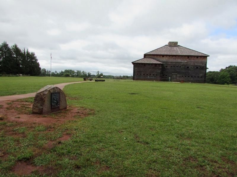
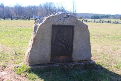
Regarding Site of Fort Dobbs. Now over 100 years old, this stone marker itself is now considered historic. Here is the text from the supplemental modern marker:
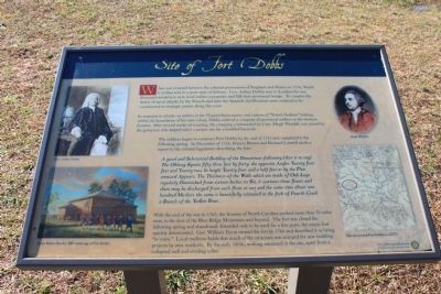
When war erupted between the colonial possessions of England and France in 1754, North Carolina was in a poor state of defense. Gov. Arthur Dobbs sent to London for one thousand muskets to arm local militia companies and full-time provincial troops. To counter the threat of naval attacks by the French and later the Spanish, fortifications were ordered to be constructed at strategic points along the coast.
In response to attacks on settlers in the Virginia backcountry and rumors of "French Indians" lurking within the boundaries of his own colony, Dobbs ordered a company of provincial soldiers to the western frontier. After several weeks of scouting, the company, commanded by Capt. Hugh Waddell, was joined by the governor, who helped select a proper site for a fortified barracks.
The soldiers began to construct Fort Dobbs by the end of 1755 and completed it the following spring.
In December of 1756, Francis Brown and Richard Caswell made a report to the colonial legislature describing the fort:
A good and Substantial Building of the Dimentions following (that is to say) The Oblong Square fifty three feet by forty. The opposite Angles Twenty four feet and Twenty-two. In height Twenty four and a half feet as by the Plan annexed Appears. The thickness of the Walls which are made of Oak Logs regularly Diminished from sixteen Inches to Six, it contains three floors and there may be discharged from each floor at one and the same time about one hundred Muskets the same is beautifully scituated in the fork of Fourth Creek a branch of the Yadkin River.
With the end of the war in 1763, the frontier of North Carolina pushed more than 70 miles west, to the foot of the Blue Ridge Mountains and beyond. The fort was closed the following spring and abandoned. Intended only to be used for a few years, the empty fort quickly deteriorated. Gov. Wiliam Tryon viewed the fort in 1766 and described it as being "in ruins." Local tradition holds that much of the structure was stripped for new building projects by area residents. By the early 1800s, nothing remained at the site apart from a collapsed well and eroding cellar.
Credits. This page was last revised on May 18, 2023. It was originally submitted on December 28, 2011, by Jamie Cox of Melbourne, Florida. This page has been viewed 770 times since then and 18 times this year. Last updated on May 18, 2023, by Jamie Cox of Melbourne, Florida. Photos: 1. submitted on December 28, 2011, by Jamie Cox of Melbourne, Florida. 2. submitted on May 26, 2022, by Bill Coughlin of Woodland Park, New Jersey. 3, 4, 5. submitted on December 28, 2011, by Jamie Cox of Melbourne, Florida. • J. Makali Bruton was the editor who published this page.
