Falling Waters in Washington County, Maryland — The American Northeast (Mid-Atlantic)
Battle of Falling Waters
Union Cavalry Charges Confederate Rear Guard
| — | Gettysburg Campaign | — |

Photographed by Larry Gertner, May 11, 2023
1. Battle of Falling Waters wayside
On July 14, 1863, fighting erupted here at about 11 A.M. between Confederate Gen. Henry Heth’s Army of Northern Virginia rear guard and advance units of Gen. George G. Meade’s Army of the Potomac. Both armies had been horribly bloodied by the battle of Gettysburg, which had ended on June 3, and Robert E. Lee’s army was nearing the end of a harrowing ten-day retreat from Pennsylvania. Heth’s men were trying to hold off Federal cavalry until the Confederate artillery and wagon train could cross the rain-swollen Potomac River into Virginia.
The previous night, the13th, most of Lee’s infantry crossed the river on a pontoon bridge one and a half miles west of here. Could Heth’s men, exhausted and short of supplies like the rest of their army, hold the line?
Heth’s line was formed on the ridge in front of you and extended to your left across present-day Falling Waters Road for a mile. His men were preparing breakfast when two companies of Union Gen. H. Judson Kilpatrick’s cavalry division came pounding up the road toward you. Confederates desperately swung axes and fence rails to fend off the onslaught. Kilpatrick, supported
this page online
Erected by Civil War Trails.
Topics and series. This historical marker is listed in this topic list: War, US Civil. In addition, it is included in the Maryland Civil War Trails series list. A significant historical date for this entry is June 3, 1863.
Location. 39° 33.197′ N, 77° 51.169′ W. Marker is in Falling Waters, Maryland, in Washington County. It is on Falling Waters Road west of Beagle Club Road, on the right when traveling west. Touch for map. Marker is at or near this postal address: near 14926 Falling Waters Rd, Williamsport MD 21795, United States of America. Touch for directions.

Regionally, this marker is in Western Maryland. It is also in the American Mid-Atlantic, in Appalachia, and specifically in Northern Appalachia. Globally, it is in North America, the Western Hemisphere, the Western World, and the Anglosphere. Historically, it finds itself in what was once one of the original

Photographed by Larry Gertner, May 11, 2023
2. Battle of Falling Waters wayside
On 3.5 acres of preserved land
Other nearby markers. At least 8 other markers are within 3 miles of this marker, measured as the crow flies: Battle of Falling Waters (MD) Preservation Project (a few steps from this marker); Falling Waters (approx. 1.7 miles away); a different marker also named Falling Waters (approx. 1.7 miles away); Battles of Falling Waters (approx. 1.9 miles away in West Virginia); Battle of Hoke's Run (approx. 2.2 miles away in West Virginia); Rose Hill (approx. 2.7 miles away); a different marker also named Battle of Falling Waters (approx. 2.9 miles away in West Virginia); a different marker also named Battle of Falling Waters (approx. 3 miles away in West Virginia). Touch for a list and map of all markers in Falling Waters.
Other markers no longer nearby. 1862 Antietam Campaign (was approx. 2.3 miles away in West Virginia but has been permanently removed); a different marker also named Battle of Falling Waters (was approx. 2.8 miles away in West Virginia but has been permanently removed).
Photographed by Larry Gertner, May 11, 2023
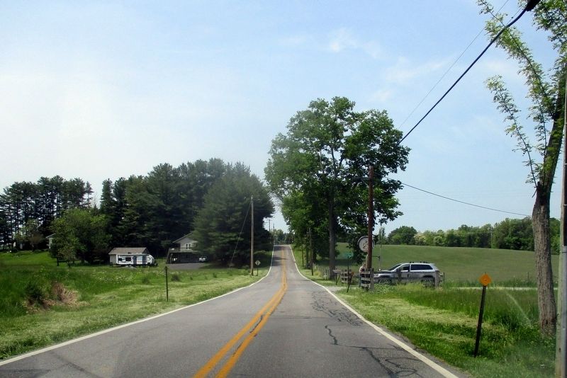
3. Towards the wayside
Companies B & F of the 6th Michigan Cavalry charged up this road towards the ridge beyond.

Photographed by Larry Gertner, May 11, 2023
4. Battle of Falling Waters - Heth's line
The view across from the wayside. General Pettigrew received his mortal wound somewhere between the Donnally House (left) and a now-missing barn.
Photographed by Wayside Art, May 19, 2023
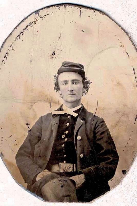
5. Captain James Harvey Kidd of the 6th Michigan Cavalry
was wounded in the foot at this battle. Helped to a nearby house, he remembered “that shells from the enemy batteries hurtled around” and worried that “one would come crashing through the building.”
Courtesy Bentley Library
University of Michigan
(Ancillary wayside text)
Courtesy Bentley Library
University of Michigan
(Ancillary wayside text)
Photographed by Wayside Art, May 19, 2023
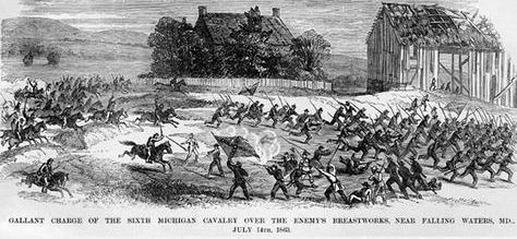
6. Charge of the 6th Michigan Cavalry at Falling Waters
The regiment fought a portion of the battle dismounted, and used its Spencer repeating rifles to deadly effect.
Courtesy Library of Congress
(Ancillary wayside text)
Courtesy Library of Congress
(Ancillary wayside text)
Credits. This page was last revised on May 19, 2023. It was originally submitted on May 19, 2023, by Larry Gertner of New York, New York. This page has been viewed 1,153 times since then and 136 times this year. Photos: 1, 2, 3, 4, 5, 6. submitted on May 19, 2023, by Larry Gertner of New York, New York.
