Lansing in Fayette County, West Virginia — The American South (Appalachia)
The Bridge
— New River Gorge National Park and Preserve —
Inscription.
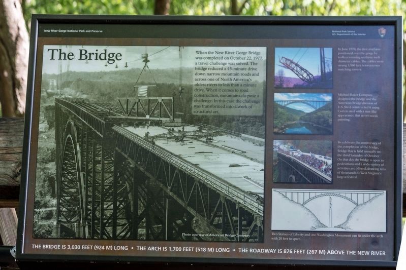
When the New River Gorge Bridge
was completed on October 22, 1977,
a travel challenge was solved. The
bridge reduced a 45-minute drive
down narrow mountain roads and
across one of North America's
oldest rivers to less than a minute
drive. When it comes to road
construction, mountains do pose a
challenge. In this case the challenge
was transformed into a work of
structural art.
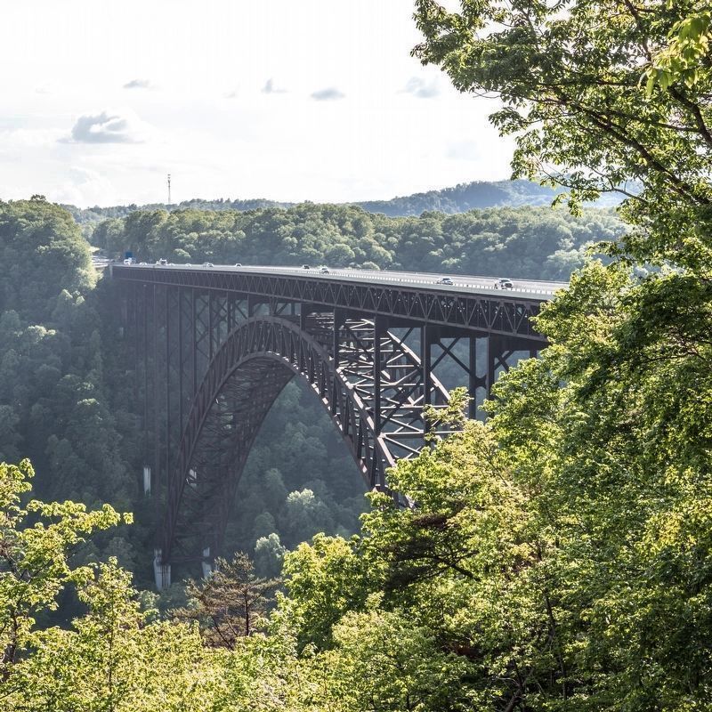
The roadway is 876 feet (267 m) above the New River • The bridge is 3,030 feet (924 m) long • The arch is 1,700 feet (518 m) long.
(captions)
In June 1974, the first steel was positioned over the gorge by trolleys running on three-inch diameter cables. The cables were strung 3,500 feet between two matching towers.
Michael Baker Company designed the bridge and the American Bridge division of U.S. Steel constructed it using Corten steel with a rust-like appearance that never needs painting.
To celebrate the anniversary of the completion of the bridge, Bridge Day is held annually on the third Saturday of October. On that day the bridge is open to pedestrians and a wide variety of activities are offered, drawing tens of thousands to West Virginia's largest festival.
Two Statues of Liberty and one Washington Monument can fit under the arch with 20 feet to spare.
Erected by the National Park Service, U.S. Department of the Interior.
Topics. This historical marker is listed in these topic lists: Architecture • Bridges & Viaducts • Roads & Vehicles. A significant historical month for this entry is June 1974.
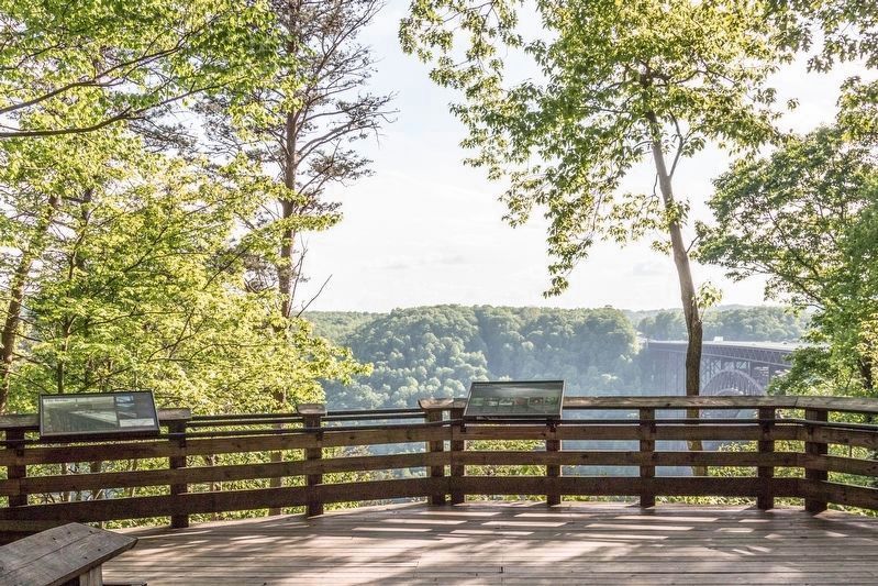
Location. 38° 4.207′ N, 81° 4.661′ W. Marker is in Lansing, West Virginia, in Fayette County. Marker can be reached from Visitor Center Road east of Fayette Mine Road (Road 85/9), on the right when traveling south. It is at the first overlook on the Canyon Rim Boardwalk that starts at the Canyon Rim Visitor Center. It is a level walk to this overlook, which is wheelchair accessible, then steps begin down to another overlook. Touch for map. Marker is at or near this postal address: 162 Visitor Center Rd, Lansing WV 25862, United States of America. Touch for directions.
Other nearby markers. At least 8 other markers are within walking distance of this marker. A different marker also named The Bridge (within shouting distance of this marker);
Growth of an Era (within shouting distance of this marker); Layers of History (about 300 feet away, measured in a direct line); New River Gorge Bridge (about 300 feet away); Spanning the Gorge (about 300 feet away); Smoke, Coke, Coal, and Kaymoor (about 500 feet away); New River Gorge Scenic Drives (about 500 feet away); The Deceptive Forest (about 500 feet away). Touch for a list and map of all markers in Lansing.
More about this marker. There is a duplicate of this interpretive panel at the overlook at the bottom of the steps.
Also see . . . Wikipedia entry. Excerpt:
The roadway of the New River Gorge Bridge is 876 feet (267 m) above the New River, making the bridge one of the highest vehicular bridges in the world; it is the third highest in the(Submitted on May 19, 2023.)United States. When completed in 1977, it was the world's highest bridge carrying a regular roadway, a title it held until the 2001 opening of the Liuguanghe Bridge in China.
Because of its height, the bridge has attracted daredevils since its construction. It is now the centerpiece of the annual “Bridge Day,” during which hundreds of people, with appropriate equipment, are permitted to climb on or jump from the bridge. In 2005, the structure gained additional attention when the US Mint issued the West Virginia state quarter with the bridge depicted on one side. In 2013, the bridge was listed on the National Register of Historic Places.
Additional commentary.
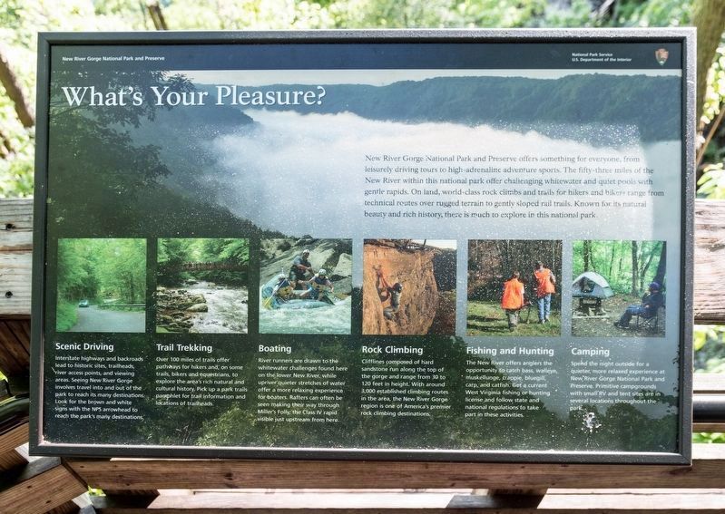
1. What’s Your Pleasure?
Transcription of the captions on Photo No. 4.
Scenic Driving. Interstate highways and backroads lead to historic sites, trailheads, river access points, and viewing areas. Seeing New River Gorge involves travel into and out of the park to reach
Photographed By J. J. Prats, May 14, 2023
4. What’s Your Pleasure?
This is the other interpretive panel at this overlook. It reads,
“New River Gorge National Park and Preserve offers something for everyone, from leisurely driving tours to high-adrenaline adventure sports. The fifty-three miles of the New River within this national park offer challenging whitewater and quiet pools with gentle rapids. On land, world-class rock climbs and trails for hikers and bikers range from technical routes over rugged terrain to gently sloped rail trails. Known for its natural beauty and rich history, there is much to explore in this national park.”
Captions below the six photographs are transcribed in Commentary No. 1.
Trail Trekking. Over 100 miles of trails-offer pathways for hikers and, on some trails, bikers and equestrians, to explore the area’s rich natural and cultural history. Pick up a park trails pamphlet for trail information and locations of trailheads.
Boating. River runners are drawn to the whitewater challenges found here on the lower New River, while upriver quieter stretches of water offer a more relaxing experience for boaters. Rafters can often be seen making their way through Miller’s Folly, the Class IV rapid visible just upstream from here.
Rock Climbing. Clifflines composed of hard sandstone run along the top of the gorge and range from 30 to 120 feet in height. With around 3,000 established climbing routes in the area, the New River Gorge region is one of America’s premier rock climbing destinations.
Fishing and Hunting. The New River offers anglers the opportunity to catch bass, muskellunge, crappie, bluegill, carp, and catfish. Get a current
Photographed By J. J. Prats, May 14, 2023
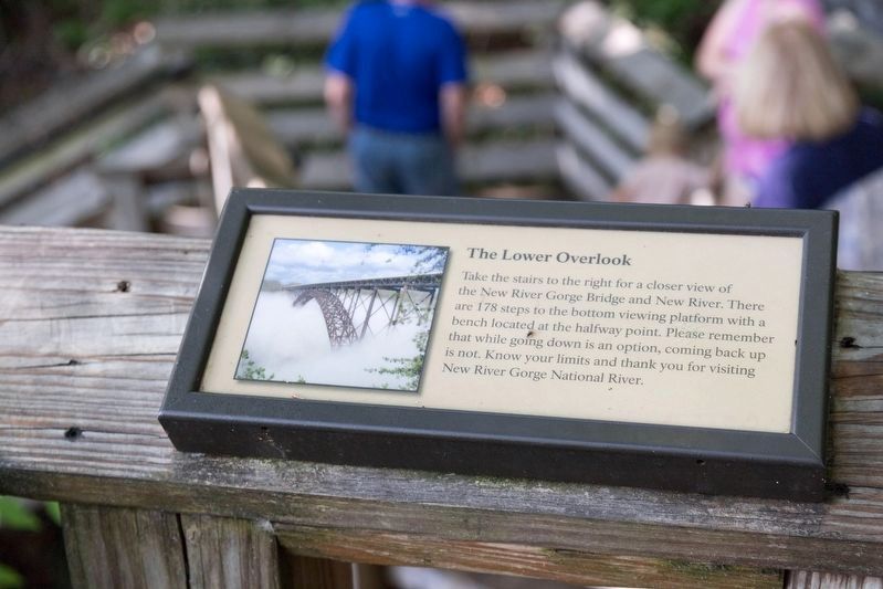
5. The Lower Overlook
“Take the stairs to the right for a closer view of the New River Gorge Bridge and New River. There are 178 steps to the bottom viewing platform with a bench located at the halfway point. Please remember that while going down is an option, coming back up is not. Know your limits and thank you for visiting New River Gorge National River.”
Camping.Spend the night outside for a quieter, more relaxed experience at New River Gorge National Park and Preserve. Primitive campgrounds, with small RV and tent sites are in several locations throughout the park.
— Submitted May 19, 2023.
Credits. This page was last revised on May 19, 2023. It was originally submitted on May 19, 2023, by J. J. Prats of Powell, Ohio. This page has been viewed 71 times since then and 17 times this year. Photos: 1, 2, 3, 4, 5. submitted on May 19, 2023, by J. J. Prats of Powell, Ohio.
