Mount Holly in Westmoreland County, Virginia — The American South (Mid-Atlantic)
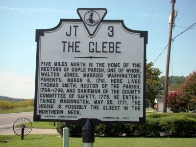
The Glebe
Photographed by J. J. Prats, August 30, 2009
1. The Glebe Marker
Erected 1947 by Virginia Conservation Commission. (Marker Number JT-3.)
Topics and series. This historical marker is listed in these topic lists: Colonial Era • Religion & Religious Structures. In addition, it is included in the Virginia Department of Historic Resources (DHR) series list. A significant historical date for this entry is March 6, 1867.
Location. 38° 5.478′ N, 76° 43.11′ W. Marker is in Mount Holly, Virginia, in Westmoreland County. It is at the intersection of Cople Highway (Virginia Route 202) and Mount Holly Road (County Route 621), on the left when traveling east on Cople Highway. Touch for map. Marker is in this post office area: Montross VA 22520, United States of America. Touch for directions.

Regionally, this marker is on Virginia’s Northern Neck. It is also
this page online
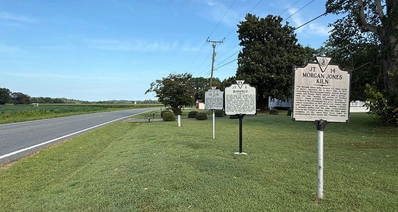
Other nearby markers. At least 8 other markers are within 4 miles of this marker, measured as the crow flies: Morgan Jones Kiln (here, next to this marker); a different marker also named Bushfield (a few steps from this marker); Nominy Church (approx. 0.8 miles away); The War of 1812 / British Landing at Nomini Ferry (approx. 0.8 miles away); Nomini Hall (approx. 2.3 miles away); Nomini Baptist Church (approx. 3.4 miles away); Armstead Tasker Johnson School (approx. 3.6 miles away); Lee Hall (approx. 3.7 miles away). Touch for a list and map of all markers in Mount Holly.
Another marker is no longer nearby. Bushfield (was here, next to this marker but has been replaced
Photographed by Devry Becker Jones (CC0), August 30, 2026
2. Three Virginia Department of Historic Resources Markers on Display
Also see . . .
1. The History of Cople Parish. “In colonial days, it was the established church, serving the whole community in both spiritual and temporal matters. Among its vestry and leading parishioners were Richard Henry Lee (who drafted the resolution for Independence and was one of the signers of the Declaration); Bushrod Washington (Justice of the US Supreme Court, nephew of George Washington), President Washington’s chief heir; George Eskridge (holder of numerous colonial offices and guardian of George Washington’s mother, Mary Ball who grew up in the parish); and Robert ‘Counsillor’ Carter. Fithian’s Diary, written by a Carter family tutor, describes our Colonial heyday. ” (Submitted on September 12, 2009.)
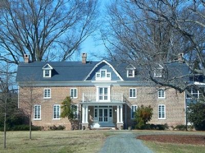
2. Glebe Farm, Westmoreland County. (Submitted on July 10, 2012, by Linda Walcroft of Woodstock, Virginia.)
Photographed by J. J. Prats, August 30, 2009
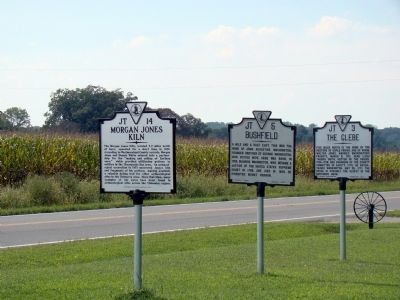
3. Three Markers
This is a context photo from before the Bushfield marker was replaced.
Photographed by Linda Walcroft
4. The Glebe
Credits. This page was last revised on August 30, 2026. It was originally submitted on September 12, 2009, by J. J. Prats of Powell, Ohio. This page has been viewed 3,230 times since then and 136 times this year. Photos: 1. submitted on September 12, 2009, by J. J. Prats of Powell, Ohio. 2. submitted on August 30, 2026, by Devry Becker Jones of Washington, District of Columbia. 3. submitted on September 12, 2009, by J. J. Prats of Powell, Ohio. 4. submitted on July 10, 2012, by Linda Walcroft of Woodstock, Virginia.
