Salters in Williamsburg County, South Carolina — The American South (South Atlantic)
Union Presbyterian Church
Photographed by Dave W, May 20, 2023
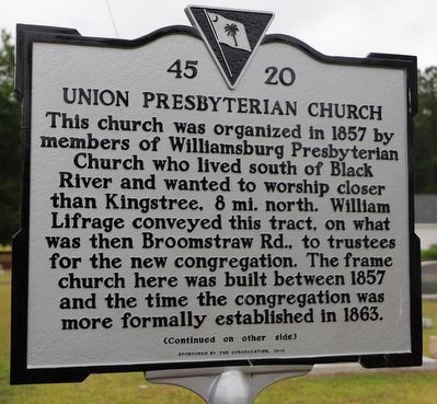
1. Union Presbyterian Church Marker
This church was organized in 1857 by members of Williamsburg Presbyterian Church who lived south of Black River and wanted to worship closer than Kingstree, 8 mi. north. William Lifrage conveyed this tract, on what was then Broomstraw Rd., to trustees for the new congregation. The frame church here was built between 1857 and the time the congregation was more formally established in 1863.
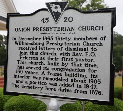
In December 1863 thirty members of Williamsburg Presbyterian Church received letters of dismissal to join this church, with Rev. E.O. Frierson as their first pastor. This church, built by that time, has served its congregation for 150 years. A frame building, its interior was remodeled about 1905 and a portico was added in 1947. The cemetery here dates from 1876.
Erected 2013 by South Carolina Department of Archives and History; sponsored by The Congregation. (Marker Number 45-20.)
Topics. This historical marker is listed in these topic lists: Cemeteries & Burial Sites • Religion & Religious Structures. A significant historical month for this entry is December 1863.
Location. 33° 34.045′ N, 79° 49.981′ W. Marker is in Salters, South
this page online

Regionally, this marker is in South Carolina’s Pee Dee. It is also in the American South and specifically in the Deep South. Globally, it is in North America, the Western Hemisphere, the Western World, and the Anglosphere. Historically, it finds itself in what was once the territory of the Mississippian Culture, one of the original Thirteen Colonies, one of the Confederate States of America, and the Antebellum South.
Other nearby markers. At least 8 other markers are within 7 miles of this marker, measured as the crow flies: Burrows's Service Station / Cooper's Country Store (approx. 1.1 miles away); Battle Of Lower Bridge (approx. 1.7 miles away); Lower Bridge: Take the Low Ground! (approx. 1.7 miles away); Union School (approx. 4.1 miles away); McClary Cemetery (approx. 5½ miles away); Dr. Martin Luther King, Jr. (approx. 6.6 miles away); Thurgood Marshall, J.D. (approx. 6.6 miles away); The Honorable Carol Connor
Photographed by Dave W, May 20, 2023
2. Union Presbyterian Church Marker Reverse
Photographed by Dave W, May 20, 2023
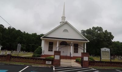
3. Union Presbyterian Church and Marker
Credits. This page was last revised on May 25, 2026. It was originally submitted on May 21, 2023, by Dave W of Co, Colorado. This page has been viewed 515 times since then and 54 times this year. Photos: 1, 2, 3. submitted on May 21, 2023, by Dave W of Co, Colorado. • J. Makali Bruton was the editor who published this page.
