Mount Holly in Westmoreland County, Virginia — The American South (Mid-Atlantic)
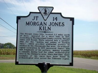
Morgan Jones Kiln
Erected 2008 by Department of Historic Resources. (Marker Number JT-14.)
Topics and series. This historical marker is listed in these topic lists: Colonial Era • Industry & Commerce. In addition, it is included in the Virginia Department of Historic Resources (DHR) series list. A significant historical year for this entry is 1677.
Location. 38° 5.478′ N, 76° 43.11′ W. Marker is in Mount Holly, Virginia, in Westmoreland County. Marker is at the intersection of Cople Highway (Virginia Route 202) and Mount Holly Road (County Route 621), on the left when traveling east on Cople Highway. Touch for map. Marker is in this post office area: Montross VA 22520, United States of America. Touch for directions.
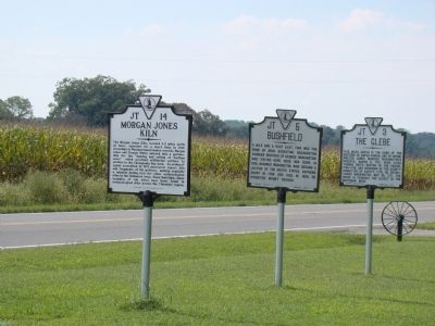
Other nearby markers. At least 8 other markers are within 4 miles of this marker, measured as the crow flies. The Glebe (here, next to this marker); Bushfield (here, next to this marker); Nominy Church (approx. 0.8 miles away); The War of 1812 / British Landing at Nomini Ferry (approx. 0.8 miles away); Nomini Hall (approx. 2.3 miles away); Nomini Baptist Church (approx. 3.4 miles away); Armstead Tasker Johnson School (approx. 3.6 miles away); Lee Hall (approx. 3.7 miles away). Touch for a list and map of all markers in Mount Holly.
Also see . . . Community celebrates acknowledgement of important 17th Century kiln. Article in The Journal of Westmoreland County. “The kiln uncovered in 1973 was described by Dr. [William] Kelso as being cross-shaped, with a large doughnut hole at the junction of the two arms of its cross. Photographs and drawings associated with the excavation are on display at the Westmoreland County Museum, along with pottery created on the site.” Virginia Sherman: “As the Lords of Trade in London did not permit any manufacturing in the Virginia colony, the White-Jones venture was illegal: the colonists were expected to furnish the raw materials to England and then buy back English manufactured goods.” (Submitted on September 12, 2009.)
Credits. This page was last revised on July 14, 2021. It was originally submitted on September 12, 2009, by J. J. Prats of Powell, Ohio. This page has been viewed 1,075 times since then and 40 times this year. Photos: 1, 2. submitted on September 12, 2009, by J. J. Prats of Powell, Ohio.

