Florence in Florence County, South Carolina — The American South (South Atlantic)
Florence High School
⎯⎯⎯
McClenaghan High School
Photographed by Dave W, May 21, 2023
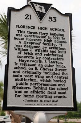
1. Florence High School side of marker
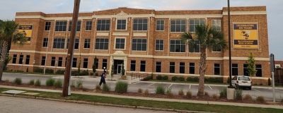
Florence High School. This three-story building was constructed in 1921 to house Florence High School. A fireproof facility, it was designed by architect William J. Wilkins and built of brick and reinforced concrete by contractors Haynsworth & Lawton. It replaced an older brick school on E. Cheves Street and originally included the main west wing and central auditorium, which hosted public performances and speakers. Behind the school was an athletic field used for home sporting events.
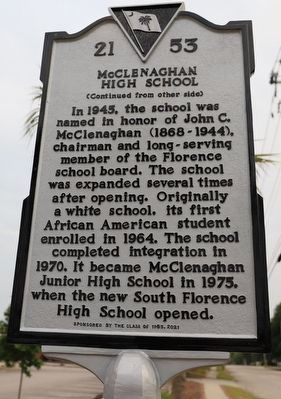
McClenaghan High School. In 1945, the school was named in honor of John C. McClenaghan (1868-1944), chairman and long-serving member of the Florence school board. The school was expanded several times after opening. Originally a white school, its first African American student enrolled in 1964. The school completed integration in 1970. It became McClenaghan Junior High School in 1975, when the new South Florence High School opened.
Erected 2021 by South Carolina State Historic Preservation Office, sponsored by The Class of 1955. (Marker Number 21-53.)
Topics and series. This historical marker is listed in these topic lists: African Americans • Architecture • Civil Rights • Education. In addition, it is included in the South Carolina Historical Markers series list. A significant historical year for this entry is 1921.
Location. 34° 11.393′ N, 79° 45.921′ W. Marker is in Florence, South Carolina, in Florence County. It is on South Dargan Street (State Road 21-354) south of East Elm Street (State Road 21-175), on the right when traveling north. Touch for map. Marker is at or near this postal address: 500 S Dargan St, Florence SC 29506, United States of America. Touch for directions.

Regionally, this marker is in South Carolina’s Pee Dee. It is also in the American South and specifically in the
this page online
Other nearby markers. At least 8 other markers are within walking distance of this marker: F.H. McLeod House (approx. ¼ mile away); Wilson School / Wilson High School (approx. ¼ mile away); Downtown Arts Corridor (approx. 0.4 miles away); Florence Civic Improvement Society Memorial (approx. 0.4 miles away); McLeod Medical Center (approx. 0.4 miles away); Propellers, CSS Peedee (approx. 0.4 miles away); Swept yards (approx. 0.4 miles away); The Lorax: Unless (approx. 0.4 miles away). Touch for a list and map of all markers in Florence.
Photographed by Dave W, May 21, 2023
2. McClenaghan High School side of marker
Photographed by Dave W, May 21, 2023
3. Florence High School / McClenaghan High School Marker
Credits. This page was last revised on January 19, 2026. It was originally submitted on May 22, 2023, by Dave W of Co, Colorado. This page has been viewed 3,020 times since then and 277 times this year. Photos: 1, 2, 3. submitted on May 22, 2023, by Dave W of Co, Colorado. • Devry Becker Jones was the editor who published this page.
