Mount Pleasant in Charleston County, South Carolina — The American South (South Atlantic)
The Cooper River Bridge / Silas N. Pearman Bridge
(side 1)
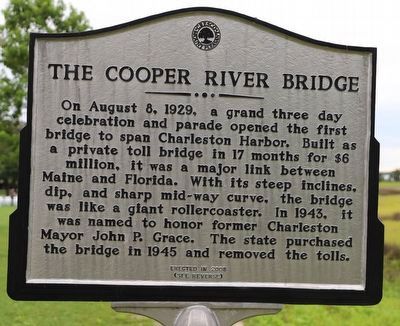
On August 8, 1929, a grand three day celebration and parade opened the first bridge to span Charleston Harbor. Built as a private toll bridge in 17 months for $6 million, it was a major link between Maine and Florida. With its steep inclines, dip, and sharp mid-way curve, the bridge was like a giant rollercoaster. In 1943, it was named to honor former Charleston Mayor John P. Grace. The state purchased the bridge in 1945 and removed the tolls.
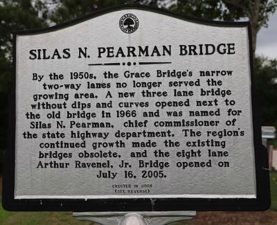
By the 1950s, the Grace Bridge's narrow two-way lanes no longer served the growing area. A new three lane bridge without dips and curves opened next to the old bridge in 1966 and was named for Silas N. Pearman, chief commissioner of the state highway department. The region's continued growth made the existing bridges obsolete, and the eight lane Arthur Ravenel, Jr. Bridge opened on July 16, 2005.
Erected 2008 by CRESCO / Mount Pleasant.
Topics. This historical marker is listed in these topic lists: Bridges & Viaducts • Roads & Vehicles • Waterways & Vessels.
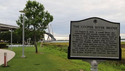
Location. 32° 48.132′ N, 79° 54.144′ W. Marker is in Mount Pleasant, South Carolina, in Charleston County. Marker is on Harry M Hallman Jr Boulevard west of Cooper River Drive, on the right when traveling west. Located in Mount Pleasant Memorial Waterfront Park. Touch for map. Marker is at or near this postal address: 99 Harry M Hallman Jr Blvd, Mount Pleasant SC 29464, United States of America. Touch for directions.
Other nearby markers. At least 8 other markers are within walking distance of this marker. Harry M. Hallman, Jr. (about 300 feet away, measured in a direct line); Old Sunken Hull / BG James Estcourt Sawyer (approx. 0.2 miles away); Arthur Ravenel, Jr. Bridge (approx. ¼ mile away); Patriots Point Naval & Maritime Museum/The Medal of Honor Museum (approx. 0.4 miles away); Milton's Ferry Tavern (approx. 0.4 miles away); Channel 2 & Suzie Q (approx. 0.4 miles away); One Hand Sanders / Prince's Ferry (approx. half a mile away); USS Yorktown (CV~10) (approx. half a mile away). Touch for a list and map of all markers in Mount Pleasant.
Also see . . . History of the previous bridges that led to the Arthur Ravenel Jr. Bridge.
When the Arthur Ravenel Jr. Bridge opened on July 16, 2005, it became the longest cable-stayed bridge of its time in North America and the tallest structure in South Carolina.(Submitted on May 22, 2023, by Dave W of Co, Colorado.)
Credits. This page was last revised on June 5, 2023. It was originally submitted on May 22, 2023, by Dave W of Co, Colorado. This page has been viewed 80 times since then and 29 times this year. Photos: 1, 2, 3. submitted on May 22, 2023, by Dave W of Co, Colorado. • Bernard Fisher was the editor who published this page.


