Mount Pleasant in Charleston County, South Carolina — The American South (South Atlantic)
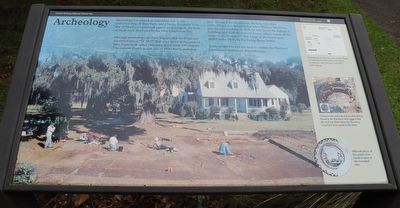
Archeology
Archeology has played an important role in our understanding of Snee Farm and Charles Pinckney. Very few of Pinckney’s personal paper exist today, as the bulk of them were destroyed by the 1861 Charleston fire.
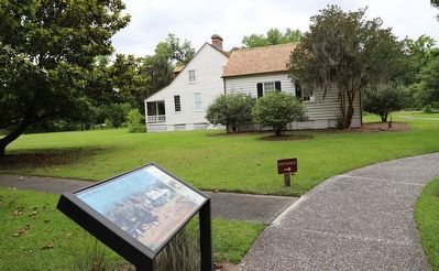
Through archeology, we have learned that the Pinckney-era structures (1754-1817) that once stood in this part of Snee Farm were razed sometime in the early 19th century. The current theory is that one or more hurricanes have damaged the farmhouse, kitchen, and other outbuildings. It is believed that when William Matthews purchased Snee Farm in 1828, he tore down the damaged buildings and built the present house, which stands on the same site as Pinckney’s. The wings of the house were added in the 1930s by the Ewing-Stone family.
Today modern bricks are used to outline the Pinckney kitchen and farmhouse dependencies.
Erected by National Park Service / United States Department of the Interior.
Topics. This historical marker is listed in these topic lists: Anthropology & Archaeology • Settlements & Settlers. A significant historical year for this entry is 1861.
Location. 32° 50.774′ N, 79° 49.46′ W. Marker is in Mount Pleasant, South Carolina, in Charleston County. Marker is on Long Point Road. Touch for map. Marker is at or near this postal address: 1240 Long Point Rd, Mount Pleasant SC 29464, United States of America. Touch for directions.
Other nearby markers. At least 8 other markers are within walking distance of this marker. Charles Pinckney - Statesman (within shouting distance of this marker); Charles Pinckney (within shouting distance of this marker); a different marker also named Charles Pinckney (within shouting distance of this marker); Snee Farm (within shouting distance of this marker); Indigo and Its Beginnings in South Carolina (within shouting distance of this marker); Snee Farm Historic Structures (within shouting distance of this marker); Rice Trunk (about 500 feet away, measured in a direct line); Slave Community (about 700 feet away). Touch for a list and map of all markers in Mount Pleasant.
Credits. This page was last revised on June 5, 2023. It was originally submitted on May 24, 2023, by Dave W of Co, Colorado. This page has been viewed 78 times since then and 10 times this year. Photos: 1, 2. submitted on May 24, 2023, by Dave W of Co, Colorado. • Bill Pfingsten was the editor who published this page.

