Bellingham in Whatcom County, Washington — The American West (Northwest)
Old Telegraph Road
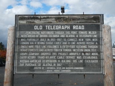
Photographed by Barry Swackhamer, October 29, 2012
1. Old Telegraph Road Marker
Erected by Historical Site and Markers Commission, [Washington] State Parks Commission.
Topics. This historical marker is listed in these topic lists: Communications • Roads & Vehicles. A significant historical year for this entry is 1867.
Location. 48° 47.069′ N, 122° 29.146′ W. Marker is in Bellingham, Washington, in Whatcom County. It is at the intersection of Telegraph Road and Guide Meridian Road on Telegraph Road. Touch for map. Marker is at or near this postal address: 100 Telegraph Road, Bellingham WA 98226, United States of America. Touch for directions.

Regionally,
this page online
Other nearby markers. At least 8 other markers are within 3 miles of this marker, measured as the crow flies: Washington State's Oldest Brick Building (approx. 2.1 miles away); Metasequoia glyptostroboides (Dawn Redwood) (approx. 2.1 miles away); Performance Theater in Bellingham (approx. 2.3 miles away); Downtown was the hub of commercial activity (approx. 2.3 miles away); Bellingham grew up along its streetcar lines (approx. 2.4 miles away); Bellingham bloomed during its Tulip Festival in the 1920s (approx. 2.4 miles away); Bellingham Public Market Had Everything Under One Roof! (approx. 2.4 miles away); The Great Water Fight (approx. 2.4 miles away). Touch for a list and map of all markers in Bellingham.
Other markers no longer nearby. Pickett Bridge (was approx.
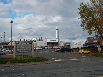
Photographed by Barry Swackhamer, October 29, 2012
2. Old Telegraph Road Marker
Credits. This page was last revised on May 26, 2023. It was originally submitted on November 3, 2012, by Barry Swackhamer of Brentwood, California. This page has been viewed 1,506 times since then and 96 times this year. Last updated on May 26, 2023, by Ann S. of Bellingham, Washington. Photos: 1, 2. submitted on November 3, 2012, by Barry Swackhamer of Brentwood, California. • J. Makali Bruton was the editor who published this page.
