Mullins in Marion County, South Carolina — The American South (South Atlantic)
Tobacco Culture
Photographed by Dave W, May 25, 2023
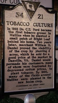
1. Tobacco Culture Marker, Side One
In 1892 Dr. C.T. Ford became the first tobacco grower in Mullins when he planted a small patch of Bright Leaf behind his home. Two years later, merchant William H. Daniel proved the viability of the crop by planting 8 acres, which he sold for a good price at the market in Danville, VA. Daniel would persuade his customers, many of whom were frustrated by depressed cotton prices, to plant tobacco. By 1895, many of the fields around Mullins were planted in the new boom crop.
(Continued on other side)
{Side 2}
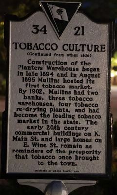
(Continued from other side)
Construction of the Planters’ Warehouse began in late 1894 and in August 1895 Mullins hosted its first tobacco market. By 1902, Mullins had two banks, three tobacco warehouses, four tobacco re-drying plants, and had become the leading tobacco market in the state. The early 20th century commercial buildings on N. Main St. and large homes on E. Wine St. remain as reminders of the prosperity that tobacco once brought to the town.
Erected 2018 by Marion County. (Marker Number 34-21.)
Topics. This historical marker is listed in these topic lists: Agriculture • Industry & Commerce. A significant historical year for this entry is 1892.
Location. 34° 12.335′ N, 79° 15.254′ W. Marker is in Mullins, South Carolina, in Marion County. It is on North Main Street, on the left when traveling west. Touch for map. Marker is at or near this postal address: 100 N Main Street, Mullins SC 29574, United States of America. Touch for directions.

Regionally, this marker is in the Pee Dee. It is also in the American South and specifically in the Deep South. Globally, it is in North America, the Western Hemisphere, the Western World, and the Anglosphere. Historically, it finds itself in what was once the territory of the Mississippian Culture, one of the original Thirteen Colonies,
this page online
Other nearby markers. At least 8 other markers are within 9 miles of this marker, measured as the crow flies: Mullins Depot / Mullins (a few steps from this marker); Mt. Olive Baptist Church (approx. 0.4 miles away); Palmetto High School (approx. 0.7 miles away); Camp Victor Blue (approx. 6.6 miles away); Drowning Creek (approx. 6.7 miles away); Bluefields (approx. 8.3 miles away); Marion Depot (approx. 8.4 miles away); Francis Marion (approx. 8½ miles away). Touch for a list and map of all markers in Mullins.
Another marker is no longer nearby. Christ Prayer Chapel (was approx. 0.3 miles away but has been confirmed missing).
Photographed by Dave W, May 25, 2023
2. Tobacco Culture Marker, Side Two
Photographed by Dave W, May 25, 2023
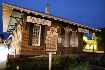
3. Tobacco Culture Marker
Credits. This page was last revised on January 13, 2025. It was originally submitted on May 26, 2023, by Dave W of Co, Colorado. This page has been viewed 1,249 times since then and 38 times this year. Photos: 1, 2, 3. submitted on May 26, 2023, by Dave W of Co, Colorado. • Andrew Ruppenstein was the editor who published this page.
