Near Findlay in Hancock County, Ohio — The American Midwest (Great Lakes)
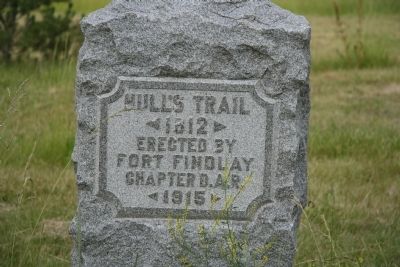
Hull's Trail
1812
Erected By
Fort Findlay
Chapter D.A.R.
1915
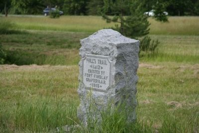
Erected 1915 by Fort Findlay Chapter D.A.R.
Topics and series. This historical marker is listed in these topic lists: Native Americans • Roads & Vehicles • War of 1812. In addition, it is included in the Daughters of the American Revolution series list. A significant historical year for this entry is 1812.
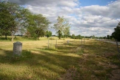
Location. 40° 59.45′ N, 83° 39.08′ W. Marker is near Findlay, Ohio, in Hancock County. Marker is at the intersection of U.S. 68 and Ohio Route 15, on the right when traveling north on U.S. 68. Touch for map. Marker is in this post office area: Findlay OH 45840, United States of America. Touch for directions.
Other nearby markers. At least 8 other markers are within 3 miles of this marker, measured as the crow flies. Ohio's First Road Side Park (within shouting distance of this marker); Mason Chapel African Methodist Episcopal Church (approx. 2.8 miles away); George P. Jones Home (approx. 3 miles away); Beneath the Surface (approx. 3.1 miles away); Moving to Markets (approx. 3.1 miles away); Marathon & Speedway (approx. 3.1 miles away); Marketing Petroleum (approx. 3.1 miles away); Refineries Multiply (approx. 3.1 miles away). Touch for a list and map of all markers in Findlay.
Related markers. Click here for a list of markers that are related to this marker. To better understand the relationship, study each marker in the order shown.
Also see . . . Hull's Road. This is a link to information provided by Ohio History Central, an online encyclopedia of Ohio History. (Submitted on August 13, 2010, by Dale K. Benington of Toledo, Ohio.)
Credits. This page was last revised on June 16, 2016. It was originally submitted on September 13, 2009, by Dale K. Benington of Toledo, Ohio. This page has been viewed 1,422 times since then and 30 times this year. Photos: 1, 2, 3. submitted on September 13, 2009, by Dale K. Benington of Toledo, Ohio. • Craig Swain was the editor who published this page.


