Summerville in Dorchester County, South Carolina — The American South (South Atlantic)
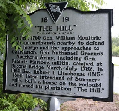
Bacon's Bridge / "The Hill"
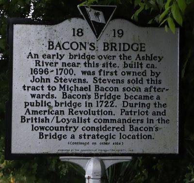
(side 1) An early bridge over the Ashley River near this site, built ca. 1696-1700, was first owned by John Stevens. Stevens sold this tract to Michael Bacon soon afterwards. Bacon’s Bridge became a public bridge in 1722. During the American Revolution, Patriot and British/Loyalist commanders in the lowcountry considered Bacon’s Bridge a strategic location.
Erected 2015 by Summerville Preservation Society. (Marker Number 18-19.)
Topics. This historical marker is listed in these topic lists: Bridges & Viaducts • Colonial Era • Settlements & Settlers • War, US Revolutionary • Waterways & Vessels. A significant historical year for this entry is 1700.
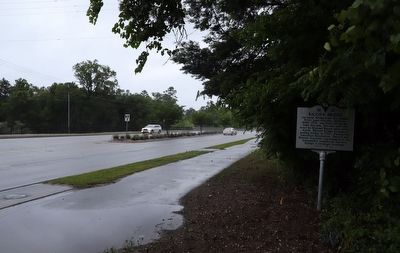
Location. 32° 57.559′ N, 80° 12.055′ W. Marker is in Summerville, South Carolina, in Dorchester County. Marker is on Bacon's Bridge Road (South Carolina Route 165) south of Renken Road, on the right when traveling south. Touch for map. Marker is at or near this postal address: 2820 Bacons Bridge Rd, Summerville SC 29485, United States of America. Touch for directions.
Other nearby markers. At least 8 other markers are within 2 miles of this marker, measured as the crow flies. Old White Meeting House and Cemetery (approx. 0.6 miles away); Newington Plantation (approx. 1.7 miles away); Old Dorchester (approx. 1.8 miles away); Dorchester Free School (approx. 1.9 miles away); The Bell Tower of St. George's (approx. 1.9 miles away); Parish Church of St. George, Dorchester (approx. 1.9 miles away); Colonial Dorchester (approx. 1.9 miles away); a different marker also named Colonial Dorchester (approx. 2 miles away). Touch for a list and map of all markers in Summerville.
Credits. This page was last revised on June 6, 2023. It was originally submitted on May 28, 2023, by Dave W of Co, Colorado. This page has been viewed 322 times since then and 191 times this year. Photos: 1, 2, 3. submitted on May 28, 2023, by Dave W of Co, Colorado. • Bernard Fisher was the editor who published this page.


