Red Wing in Goodhue County, Minnesota — The American Midwest (Upper Plains)
Anderson Center and Outdoor Sculpture Garden
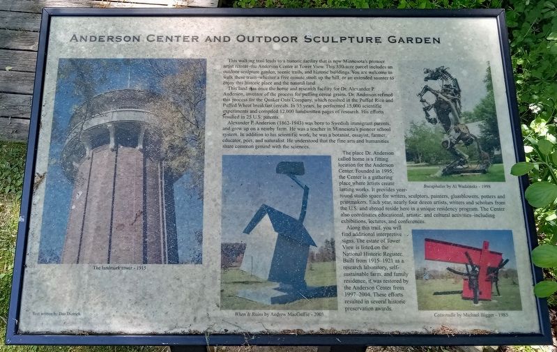
This walking trail leads to a historic facility that is now Minnesota's premier artist retreat–the Anderson Center at Tower View. This 330-acre parcel includes an outdoor sculpture garden, scenic trails, and historic buildings. You are welcome to walk these trails—whether a five minute stroll up the hill, or an extended saunter to enjoy this historic place and the natural land.
This land was once the home and research facility for Dr. Alexander P. Anderson, inventor of the process for puffing cereal grains. Dr. Anderson refined this process for the Quaker Oats Company, which resulted in the Puffed Rice and Puffed Wheat breakfast cereals. In 35 years, he performed 15,000 scientific experiments and compiled 12,000 handwritten pages of research. His efforts resulted in 25 U.S. patents.
Alexander P. Anderson (1862-1943) was born to Swedish immigrant parents, and grew up on a nearby farm. He was a teacher in Minnesota's pioneer school system. In addition to this scientific work, he was a botanist, essayist, farmer, educator, poet, and naturalist. He understood that the fine arts and humanities share common ground with the sciences.
The place Dr. Anderson called home is a fitting location for the Anderson Center. Founded in 1995, the Center is a gathering place where artists create lasting works. It provides year-round studio space for writers, sculptors, painters, glassblowers, potters and printmakers. Each year, nearly four dozen artists, writers and scholars from the U.S. and abroad reside here in a unique residency program. The Center also coordinates educational, artistic, and cultural activities–including exhibitions, lectures, and conferences.
Along this trail, you will find additional interpretive signs. The estate of Tower View is listed on the National Historic Register. Built from 1915–1921 as a research laboratory, self-sustainable farm, and family residence, it was restored by the Anderson Center from 1997–2004. These efforts resulted in several historic preservation awards.
Captions:
The landmark tower - 1915
When It Rains by Andrew MacGuffie - 2003
Bucaphalus by Al Wadzinski - 1998
Catscradle by Michael Bigger - 1985
Text written by Dan Dietrich
Topics. This historical marker is listed in these topic lists: Agriculture • Arts, Letters, Music • Industry & Commerce • Science & Medicine. A significant historical year for this entry is 1915.
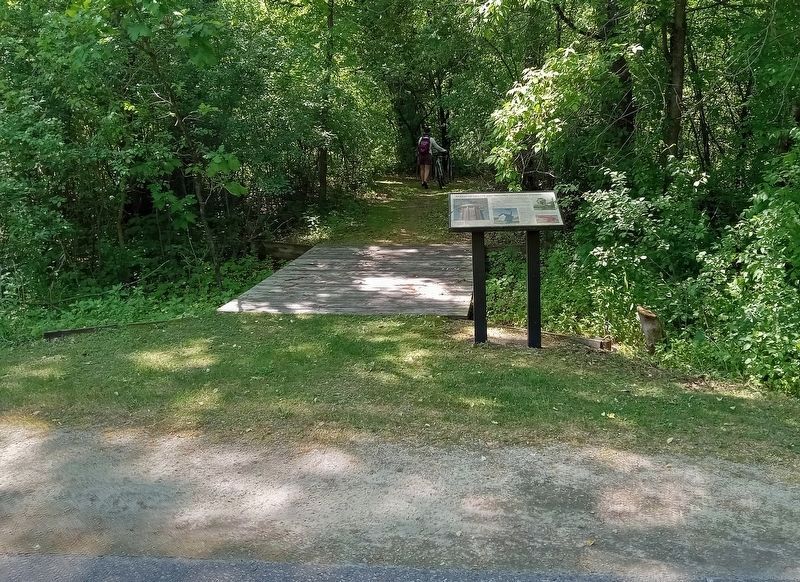
Location. 44° 34.415′ N, 92° 38.386′ W. Marker is in Red Wing, Minnesota, in Goodhue County. Marker is on Cannon Valley Trail east of Cannon Bottom Road, on the right
when traveling east. The marker is along the paved bike trail, at a marked side trail leading south to the Anderson Center Sculpture Garden. It is a short walk from the trail parking at the end of Cannon Bottom Road. Touch for map. Marker is at or near this postal address: 161 Tower View Drive, Red Wing MN 55066, United States of America. Touch for directions.
Other nearby markers. At least 8 other markers are within 5 miles of this marker, measured as the crow flies. Our Native Forests (about 500 feet away, measured in a direct line); Military Roads (about 700 feet away); Early Inhabitants (about 700 feet away); Oak Trees in the Tallgrass Prairie (approx. 0.2 miles away); Restoring the Land (approx. 0.2 miles away); Red Wing Archaeological Preserve (approx. 0.6 miles away); The Belle Creek Watershed (approx. 3.8 miles away); Cannon Valley Trail Archaeology (approx. 5 miles away). Touch for a list and map of all markers in Red Wing.
Credits. This page was last revised on May 29, 2023. It was originally submitted on May 28, 2023, by McGhiever of Minneapolis, Minnesota. This page has been viewed 80 times since then and 15 times this year. Photos: 1, 2. submitted on May 28, 2023, by McGhiever of Minneapolis, Minnesota. • J. Makali Bruton was the editor who published this page.

